Property Record
234 E Emory Rd, Powell, TN 37849


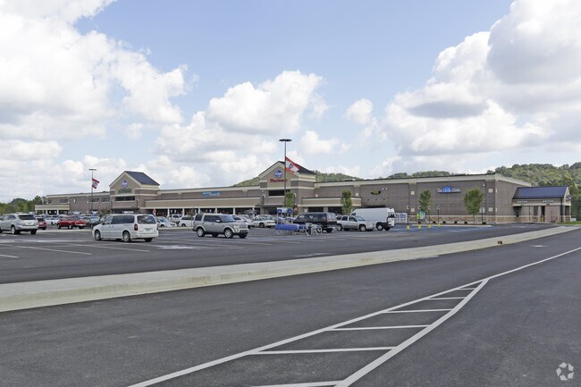
Property Detail
234 E Emory Rd
Knoxville, TN
SUBDIVISIONNAME POWELL KROGERS FINAL PLAT LOWLOT PT1 HI GHLOT LOWBLOCK HIGHBLOCK DIMENSIONS
057-00703
KNOX
Supermarket
Tennessee
AE The base floodplain where base flood elevations are provided. AE Zones are now used on new format FIRMs instead of A1-A30 Zones.
1
2025
12.92 AC
2025
North/Emory Road
006102
Knoxville
122,198 SF
NEARBY LISTINGS FOR SALE OR LEASE
DEMOGRAPHICS near 234 E Emory Rd
1 mile
3 mile
5 mile
2025 Total Population
4,743
35,598
103,124
2030 Population
4,918
37,067
107,359
Pop Growth 2025-2030
+ 3.69%
+ 4.13%
+ 4.11%
Average Age
41
40
40
2025 Total Households
2,018
14,305
42,872
HH Growth 2025-2030
+ 3.57%
+ 4.08%
+ 4.07%
Median Household Inc
$65,827
$78,310
$64,108
Avg Household Size
2.30
2.40
2.30
2025 Avg HH Vehicles
2.00
2.00
2.00
Median Home Value
$304,167
$310,579
$287,916
Median Year Built
1995
1991
1983
Nearby Places
Map Layers
Map Styles
 Street
 Aerial
Transit
 Traffic
 Biking
Places
Listings with unknown addresses are not visible on the map
- Restaurants
- Banks
- Shops
- Fitness
- Groceries
PUBLIC TRANSPORTATION
AIRPORT
McGhee Tyson
Drive
Walk
Distance
McGhee Tyson
41 min
23.9 mi
SALE & LEASE HISTORY
LISTING DATE
SALE/LEASE

Oct 09, 2018
For Sale
Nearby Properties
Address
Land Use
TOTAL SIZE
Lot Size
Zoning
Address
Land Use
TOTAL SIZE
Lot Size
Zoning
44,435 SF
34.87 AC
Address
Land Use
TOTAL SIZE
Lot Size
Zoning
4,922 SF
46.42 AC
Address
Land Use
TOTAL SIZE
Lot Size
Zoning
3,697 SF
16.71 AC
Address
Land Use
TOTAL SIZE
Lot Size
Zoning
111,570 SF
7.15 AC
Address
Land Use
TOTAL SIZE
Lot Size
Zoning
3,046 SF
13.43 AC
Address
Land Use
TOTAL SIZE
Lot Size
Zoning
80,708 SF
0.04 AC
Address
Land Use
TOTAL SIZE
Lot Size
Zoning
3,294 SF
10.07 AC
Address
Land Use
TOTAL SIZE
Lot Size
Zoning
70,506 SF
0.04 AC
Address
Land Use
TOTAL SIZE
Lot Size
Zoning
14,601 SF
15.03 AC
Address
Land Use
TOTAL SIZE
Lot Size
Zoning
9,924 SF
10.20 AC
Address
Land Use
TOTAL SIZE
Lot Size
Zoning
50,857 SF
37.82 AC
Address
Land Use
TOTAL SIZE
Lot Size
Zoning
34,022 SF
3.85 AC
Address
Land Use
TOTAL SIZE
Lot Size
Zoning
14,270 SF
46.96 AC
Address
Land Use
TOTAL SIZE
Lot Size
Zoning
172,462 SF
22.86 AC
Address
Land Use
TOTAL SIZE
Lot Size
Zoning
90,717 SF
31.69 AC
Address
Land Use
TOTAL SIZE
Lot Size
Zoning
133,171 SF
11.96 AC
Address
Land Use
TOTAL SIZE
Lot Size
Zoning
25,302 SF
10.67 AC
Address
Land Use
TOTAL SIZE
Lot Size
Zoning
62,732 SF
5.90 AC
Address
Land Use
TOTAL SIZE
Lot Size
Zoning
7,712 SF
7.30 AC
Address
Land Use
TOTAL SIZE
Lot Size
Zoning
53,961 SF
2.32 AC
Address
Land Use
TOTAL SIZE
Lot Size
Zoning
16,000 SF
8.97 AC
Address
Land Use
TOTAL SIZE
Lot Size
Zoning
23,306 SF
10.08 AC
Address
Land Use
TOTAL SIZE
Lot Size
Zoning
109,500 SF
10.03 AC
Address
Land Use
TOTAL SIZE
Lot Size
Zoning
48,957 SF
2.76 AC
Address
Land Use
TOTAL SIZE
Lot Size
Zoning
57,900 SF
9.97 AC
Address
Land Use
TOTAL SIZE
Lot Size
Zoning
18,212 SF
3.06 AC
Address
Land Use
TOTAL SIZE
Lot Size
Zoning
92,010 SF
1.44 AC
Address
Land Use
TOTAL SIZE
Lot Size
Zoning
58,972 SF
4.94 AC
Address
Land Use
TOTAL SIZE
Lot Size
Zoning
37,688 SF
5.81 AC
The World's #1 Commercial Real Estate Marketplace
Connect with us
© 2026 CoStar Group
The information above has been obtained from sources believed reliable. While we do not doubt its accuracy we have not verified it and make no guarantee, warranty or representation about it. It is your responsibility to independently confirm its accuracy and completeness. Any projections, opinions, assumptions, or estimates used are for example only and do not represent the current or future performance of the property. The value of this transaction to you depends on tax and other factors which should be evaluated by your tax, financial, and legal advisors. You and your advisors should conduct a careful, independent investigation of the property to determine to your satisfaction the suitability of the property for your needs.