Property Record
234 Wickaboag Valley Rd, West Brookfield, MA 01585
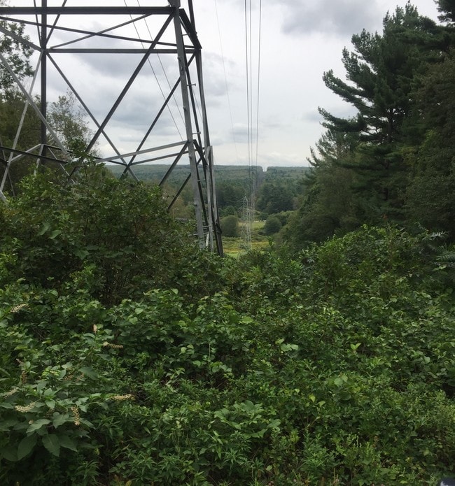
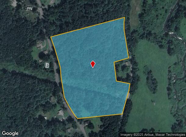
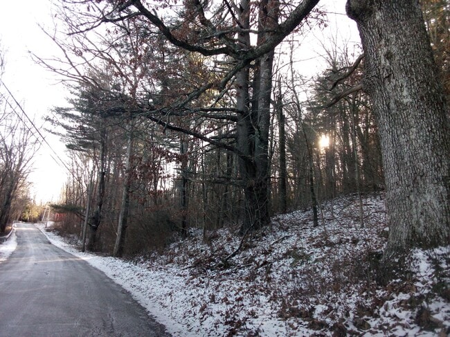
This Property Is For Sale
NEARBY LISTINGS FOR SALE OR LEASE
-
-
View all West Brookfield listings for sale on LoopNet.com
Property Detail
234 Wickaboag Valley Rd
Residentialacreage
Worcester
ARE
Massachusetts
25027C0543E
12 AC
2025
Outlying Worcester
2025
Boston
724100
Worcester, MA-CT
1,664 SF
WBFD-000020-000040
DEMOGRAPHICS near 234 Wickaboag Valley Rd
1 Mile
3 Mile
5 Mile
2024 Total Population
410
4,060
18,998
2029 Population
420
4,128
19,215
Pop Growth 2024-2029
+ 2.44%
+ 1.67%
+ 1.14%
Average Age
45
47
43
2024 Total Households
158
1,627
7,933
HH Growth 2024-2029
+ 2.53%
+ 1.66%
+ 1.22%
Median Household Inc
$130,769
$91,071
$65,337
Avg Household Size
2.60
2.40
2.30
2024 Avg HH Vehicles
2.00
2.00
2.00
Median Home Value
$306,863
$305,928
$274,460
Median Year Built
1976
1961
1955
Nearby Places
- Restaurants
- Banks
- Shops
- Fitness
- Groceries
PUBLIC TRANSPORTATION
AIRPORT
Worcester Regional
DRIVE
WALK
Distance
Worcester Regional
45 min
21.8 mi
Freight Ports
Port of Boston
DRIVE
WALK
Distance
Port of Boston
102 min
69.1 mi
Nearby Properties
Address
Land Use
TOTAL SIZE
Lot Size
Zoning
Address
Land Use
TOTAL SIZE
Lot Size
Zoning
76,000 SF
20.83 AC
RR
Address
Land Use
TOTAL SIZE
Lot Size
Zoning
23,918 SF
4.97 AC
CD
Address
Land Use
TOTAL SIZE
Lot Size
Zoning
18,744 SF
5.80 AC
GD
Address
Land Use
TOTAL SIZE
Lot Size
Zoning
1,989 SF
4.06 AC
GD
Address
Land Use
TOTAL SIZE
Lot Size
Zoning
42,853 SF
0.64 AC
GD
Address
Land Use
TOTAL SIZE
Lot Size
Zoning
31,152 SF
24 AC
HC
Address
Land Use
TOTAL SIZE
Lot Size
Zoning
700 SF
7 AC
CD
Address
Land Use
TOTAL SIZE
Lot Size
Zoning
17,378 SF
0.37 AC
GD
Address
Land Use
TOTAL SIZE
Lot Size
Zoning
3,161 SF
1 AC
GD
Address
Land Use
TOTAL SIZE
Lot Size
Zoning
57,094 SF
4.68 AC
GD
Address
Land Use
TOTAL SIZE
Lot Size
Zoning
9,836 SF
105.68 AC
RR
Address
Land Use
TOTAL SIZE
Lot Size
Zoning
9,836 SF
0.73 AC
GD
Address
Land Use
TOTAL SIZE
Lot Size
Zoning
305.48 AC
RR
Address
Land Use
TOTAL SIZE
Lot Size
Zoning
33.06 AC
RR
Address
Land Use
TOTAL SIZE
Lot Size
Zoning
0.21 AC
GD
Address
Land Use
TOTAL SIZE
Lot Size
Zoning
4,196 SF
3.20 AC
RR
Address
Land Use
TOTAL SIZE
Lot Size
Zoning
41,400 SF
3.65 AC
GD
Address
Land Use
TOTAL SIZE
Lot Size
Zoning
2,240 SF
40.22 AC
RR
Address
Land Use
TOTAL SIZE
Lot Size
Zoning
1,201 SF
0.50 AC
NR
Address
Land Use
TOTAL SIZE
Lot Size
Zoning
6,780 SF
7.40 AC
GD
Address
Land Use
TOTAL SIZE
Lot Size
Zoning
0.17 AC
RR
Address
Land Use
TOTAL SIZE
Lot Size
Zoning
8,371 SF
0.55 AC
CD
Address
Land Use
TOTAL SIZE
Lot Size
Zoning
4,568 SF
2.25 AC
GD
Address
Land Use
TOTAL SIZE
Lot Size
Zoning
3,450 SF
0.40 AC
GD
Address
Land Use
TOTAL SIZE
Lot Size
Zoning
3,936 SF
0.35 AC
CD
Address
Land Use
TOTAL SIZE
Lot Size
Zoning
10,148 SF
2.81 AC
GD
Address
Land Use
TOTAL SIZE
Lot Size
Zoning
146.50 AC
RR
Address
Land Use
TOTAL SIZE
Lot Size
Zoning
2,040 SF
17.47 AC
RR
Address
Land Use
TOTAL SIZE
Lot Size
Zoning
5,195 SF
0.97 AC
CD
Address
Land Use
TOTAL SIZE
Lot Size
Zoning
5,355 SF
0.89 AC
CD
The World's #1 Commercial Real Estate Marketplace
Connect with us
© 2025 CoStar Group
The information above has been obtained from sources believed reliable. While we do not doubt its accuracy we have not verified it and make no guarantee, warranty or representation about it. It is your responsibility to independently confirm its accuracy and completeness. Any projections, opinions, assumptions, or estimates used are for example only and do not represent the current or future performance of the property. The value of this transaction to you depends on tax and other factors which should be evaluated by your tax, financial, and legal advisors. You and your advisors should conduct a careful, independent investigation of the property to determine to your satisfaction the suitability of the property for your needs.