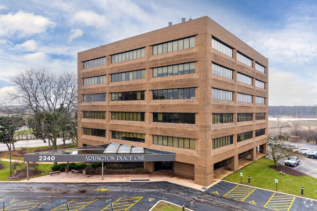
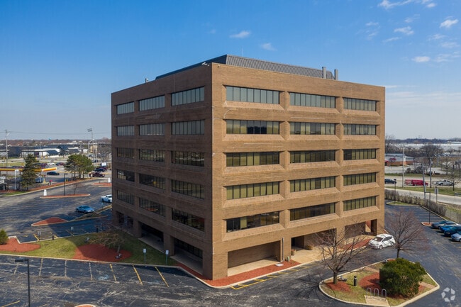
Property Record
2340 S Arlington Heights Rd, Arlington Heights, IL 60005
Current Lease Availabilities
NEARBY LISTINGS FOR SALE OR LEASE
Property Detail
2340 S Arlington Heights Rd
Chicago-Naperville-Elgin, IL-IN
Teutsch Sub
08-16-400-031-0000
CARL M (TEUTSCH) SUB OF PT OF SE SEC 16-41-11
Commercialbuilding
Cook
X
Illinois
17031C0211J
2
2023
2.40 AC
2025
Schaumburg Area
805107
Chicago
70,875 SF
DEMOGRAPHICS near 2340 S Arlington Heights Rd
1 Mile
3 Mile
5 Mile
2024 Total Population
8,848
103,182
254,899
2029 Population
8,535
100,048
247,093
Pop Growth 2024-2029
(3.54%)
(3.04%)
(3.06%)
Average Age
40
41
42
2024 Total Households
3,798
41,432
101,122
HH Growth 2024-2029
(3.84%)
(3.37%)
(3.37%)
Median Household Inc
$68,379
$83,599
$91,153
Avg Household Size
2.30
2.40
2.40
2024 Avg HH Vehicles
2.00
2.00
2.00
Median Home Value
$328,361
$326,836
$328,852
Median Year Built
1974
1969
1972
Nearby Places
Map Layers
Map Styles
 Street
 Aerial
- Restaurants
- Banks
- Shops
- Fitness
- Groceries
PUBLIC TRANSPORTATION
COMMUTER RAIL
Arlington Heights Station (Union Pacific Northwest Line - Northeast Illinois Regional Commuter Railroad (Metra))
DRIVE
WALK
Distance
Arlington Heights Station (Union Pacific Northwest Line - Northeast Illinois Regional Commuter Railroad (Metra))
8 min
3.2 mi
Mount Prospect Station (Union Pacific Northwest Line - Northeast Illinois Regional Commuter Railroad (Metra))
DRIVE
WALK
Distance
Mount Prospect Station (Union Pacific Northwest Line - Northeast Illinois Regional Commuter Railroad (Metra))
9 min
4.2 mi
AIRPORT
Chicago O'Hare International
DRIVE
WALK
Distance
Chicago O'Hare International
15 min
10.1 mi
Chicago Midway International
DRIVE
WALK
Distance
Chicago Midway International
44 min
29.4 mi
Nearby Properties
Address
Land Use
TOTAL SIZE
Lot Size
Zoning
Address
Land Use
TOTAL SIZE
Lot Size
Zoning
53,760 SF
5.36 AC
Address
Land Use
TOTAL SIZE
Lot Size
Zoning
410,822 SF
14.26 AC
Address
Land Use
TOTAL SIZE
Lot Size
Zoning
32.56 AC
Address
Land Use
TOTAL SIZE
Lot Size
Zoning
782,746 SF
12.44 AC
Address
Land Use
TOTAL SIZE
Lot Size
Zoning
58,373 SF
11.22 AC
Address
Land Use
TOTAL SIZE
Lot Size
Zoning
12.66 AC
Address
Land Use
TOTAL SIZE
Lot Size
Zoning
Address
Land Use
TOTAL SIZE
Lot Size
Zoning
74,664 SF
3.19 AC
Address
Land Use
TOTAL SIZE
Lot Size
Zoning
165,128 SF
Address
Land Use
TOTAL SIZE
Lot Size
Zoning
510,788 SF
39.93 AC
Address
Land Use
TOTAL SIZE
Lot Size
Zoning
Address
Land Use
TOTAL SIZE
Lot Size
Zoning
112,000 SF
Address
Land Use
TOTAL SIZE
Lot Size
Zoning
748,059 SF
7.36 AC
Address
Land Use
TOTAL SIZE
Lot Size
Zoning
688,900 SF
20.91 AC
Address
Land Use
TOTAL SIZE
Lot Size
Zoning
533,629 SF
24.19 AC
Address
Land Use
TOTAL SIZE
Lot Size
Zoning
338,694 SF
12.18 AC
Address
Land Use
TOTAL SIZE
Lot Size
Zoning
365,253 SF
31.07 AC
Address
Land Use
TOTAL SIZE
Lot Size
Zoning
427,761 SF
30.41 AC
Address
Land Use
TOTAL SIZE
Lot Size
Zoning
544,744 SF
14.87 AC
Address
Land Use
TOTAL SIZE
Lot Size
Zoning
Address
Land Use
TOTAL SIZE
Lot Size
Zoning
332,283 SF
Address
Land Use
TOTAL SIZE
Lot Size
Zoning
24.55 AC
Address
Land Use
TOTAL SIZE
Lot Size
Zoning
642,049 SF
33.14 AC
Address
Land Use
TOTAL SIZE
Lot Size
Zoning
211,275 SF
21.67 AC
Address
Land Use
TOTAL SIZE
Lot Size
Zoning
325,470 SF
22.20 AC
Address
Land Use
TOTAL SIZE
Lot Size
Zoning
303,671 SF
10.94 AC
Address
Land Use
TOTAL SIZE
Lot Size
Zoning
17.21 AC
Address
Land Use
TOTAL SIZE
Lot Size
Zoning
Address
Land Use
TOTAL SIZE
Lot Size
Zoning
283,822 SF
9.56 AC
Address
Land Use
TOTAL SIZE
Lot Size
Zoning
290,000 SF
9.08 AC
The World's #1 Commercial Real Estate Marketplace
Connect with us
© 2026 CoStar Group
The information above has been obtained from sources believed reliable. While we do not doubt its accuracy we have not verified it and make no guarantee, warranty or representation about it. It is your responsibility to independently confirm its accuracy and completeness. Any projections, opinions, assumptions, or estimates used are for example only and do not represent the current or future performance of the property. The value of this transaction to you depends on tax and other factors which should be evaluated by your tax, financial, and legal advisors. You and your advisors should conduct a careful, independent investigation of the property to determine to your satisfaction the suitability of the property for your needs.