Property Record
2341 Highway 70, Manchester, NJ 08759


NEARBY LISTINGS FOR SALE OR LEASE
-
-
View all Manchester listings for sale on LoopNet.com
Property Detail
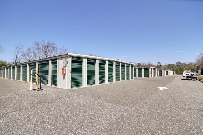
2341 Highway 70
Lakewood-New Brunswick, NJ
Major Sub
19-00060-10-00024
5.815 ACRES
Commercialnec
Ocean
X
New Jersey
34029C0169F
24
2024
5.82 AC
2025
Ocean County
720206
Northern New Jersey
40,580 SF
DEMOGRAPHICS near 2341 Highway 70
1 Mile
3 Mile
5 Mile
2024 Total Population
6,112
50,257
145,159
2029 Population
6,391
52,551
151,613
Pop Growth 2024-2029
+ 4.56%
+ 4.56%
+ 4.45%
Average Age
49
44
39
2024 Total Households
2,599
19,544
49,735
HH Growth 2024-2029
+ 3.66%
+ 3.52%
+ 3.92%
Median Household Inc
$77,957
$66,550
$57,883
Avg Household Size
2.20
2.40
2.70
2024 Avg HH Vehicles
2.00
2.00
2.00
Median Home Value
$331,715
$291,739
$273,151
Median Year Built
1994
1988
1984
Nearby Places
Map Layers
Map Styles
 Street
 Aerial
- Restaurants
- Banks
- Shops
- Fitness
- Groceries
Nearby Properties
Address
Land Use
TOTAL SIZE
Lot Size
Zoning
Address
Land Use
TOTAL SIZE
Lot Size
Zoning
1,065.50 AC
MI
Address
Land Use
TOTAL SIZE
Lot Size
Zoning
17,952 SF
103.18 AC
PRA
Address
Land Use
TOTAL SIZE
Lot Size
Zoning
75,558 SF
43.30 AC
R15
Address
Land Use
TOTAL SIZE
Lot Size
Zoning
9,730 SF
98.31 AC
RC
Address
Land Use
TOTAL SIZE
Lot Size
Zoning
12,383 SF
39.07 AC
HD-3
Address
Land Use
TOTAL SIZE
Lot Size
Zoning
52.06 AC
TC
Address
Land Use
TOTAL SIZE
Lot Size
Zoning
97,092 SF
15.97 AC
RHB
Address
Land Use
TOTAL SIZE
Lot Size
Zoning
61,142 SF
23.53 AC
R40
Address
Land Use
TOTAL SIZE
Lot Size
Zoning
1,512 SF
411.32 AC
RD9
Address
Land Use
TOTAL SIZE
Lot Size
Zoning
71.59 AC
R10
Address
Land Use
TOTAL SIZE
Lot Size
Zoning
148,718 SF
15.74 AC
RUR
Address
Land Use
TOTAL SIZE
Lot Size
Zoning
9.01 AC
M10A
Address
Land Use
TOTAL SIZE
Lot Size
Zoning
21,441 SF
54.88 AC
PORL
Address
Land Use
TOTAL SIZE
Lot Size
Zoning
164.93 AC
PED+
Address
Land Use
TOTAL SIZE
Lot Size
Zoning
11,744 SF
9.98 AC
M10A
Address
Land Use
TOTAL SIZE
Lot Size
Zoning
68,864 SF
8.65 AC
RHB
Address
Land Use
TOTAL SIZE
Lot Size
Zoning
13,220 SF
11.59 AC
HD7
Address
Land Use
TOTAL SIZE
Lot Size
Zoning
72,940 SF
49.84 AC
SPLT
Address
Land Use
TOTAL SIZE
Lot Size
Zoning
10.37 AC
M12A
Address
Land Use
TOTAL SIZE
Lot Size
Zoning
38,172 SF
7.36 AC
MF
Address
Land Use
TOTAL SIZE
Lot Size
Zoning
9,366 SF
12.60 AC
MF10
Address
Land Use
TOTAL SIZE
Lot Size
Zoning
1,952 SF
38.39 AC
RUR
Address
Land Use
TOTAL SIZE
Lot Size
Zoning
139,558 SF
6.66 AC
RHB
Address
Land Use
TOTAL SIZE
Lot Size
Zoning
48,688 SF
9.60 AC
TC
Address
Land Use
TOTAL SIZE
Lot Size
Zoning
20,778 SF
8.38 AC
B5
Address
Land Use
TOTAL SIZE
Lot Size
Zoning
8,400 SF
87.20 AC
SPLT
Address
Land Use
TOTAL SIZE
Lot Size
Zoning
13,200 SF
14.71 AC
M1
Address
Land Use
TOTAL SIZE
Lot Size
Zoning
78,980 SF
4.88 AC
R40
Address
Land Use
TOTAL SIZE
Lot Size
Zoning
1,538 SF
134.90 AC
R40B
Address
Land Use
TOTAL SIZE
Lot Size
Zoning
158 SF
23.51 AC
MP
The World's #1 Commercial Real Estate Marketplace
Connect with us
© 2026 CoStar Group
The information above has been obtained from sources believed reliable. While we do not doubt its accuracy we have not verified it and make no guarantee, warranty or representation about it. It is your responsibility to independently confirm its accuracy and completeness. Any projections, opinions, assumptions, or estimates used are for example only and do not represent the current or future performance of the property. The value of this transaction to you depends on tax and other factors which should be evaluated by your tax, financial, and legal advisors. You and your advisors should conduct a careful, independent investigation of the property to determine to your satisfaction the suitability of the property for your needs.