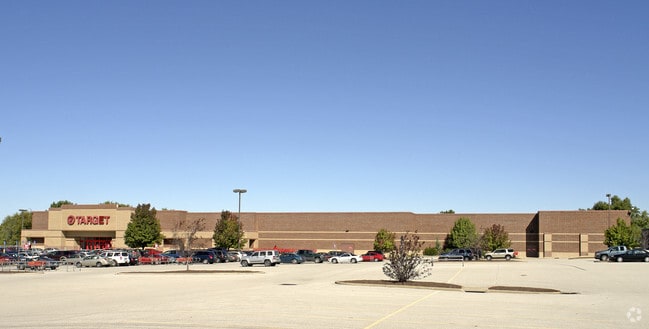
Property Record
2341 N Highway 67, Florissant, MO 63033


NEARBY LISTINGS FOR SALE OR LEASE
Property Detail
2341 N Highway 67
St. Louis, MO-IL
Pidgeon Park Florissant Plat 2 Lots 1A &
07J-34-0434
PIDGEON PARK FLORISSANT PLAT 2 LOTS 1A & 1B AMENDED LOT PT 1B
Departmentstore
St. Louis
X
Missouri
29183C0325G
1b
2024
10.10 AC
2025
North County
210925
St. Louis
121,945 SF
DEMOGRAPHICS near 2341 N Highway 67
1 Mile
3 Mile
5 Mile
2024 Total Population
14,470
96,936
171,251
2029 Population
14,216
94,868
168,728
Pop Growth 2024-2029
(1.76%)
(2.13%)
(1.47%)
Average Age
39
40
40
2024 Total Households
5,684
38,304
67,937
HH Growth 2024-2029
(1.76%)
(2.18%)
(1.55%)
Median Household Inc
$59,890
$63,157
$57,037
Avg Household Size
2.50
2.40
2.40
2024 Avg HH Vehicles
2.00
2.00
2.00
Median Home Value
$136,579
$147,531
$142,454
Median Year Built
1963
1966
1965
Nearby Places
Map Layers
Map Styles
 Street
 Aerial
- Restaurants
- Banks
- Shops
- Fitness
- Groceries
PUBLIC TRANSPORTATION
COMMUTER RAIL
UM St. Louis North (Lambert Airport Shiloh-Scott - St. Louis MetroLink (MetroLink))
DRIVE
WALK
Distance
UM St. Louis North (Lambert Airport Shiloh-Scott - St. Louis MetroLink (MetroLink))
17 min
7.4 mi
Lambert Airport East Terminal (Lambert Airport Shiloh-Scott - St. Louis MetroLink (MetroLink))
DRIVE
WALK
Distance
Lambert Airport East Terminal (Lambert Airport Shiloh-Scott - St. Louis MetroLink (MetroLink))
15 min
7.4 mi
AIRPORT
St Louis Lambert International
DRIVE
WALK
Distance
St Louis Lambert International
14 min
5.8 mi
Scott AFB/Midamerica St Louis
DRIVE
WALK
Distance
Scott AFB/Midamerica St Louis
62 min
39.1 mi
Nearby Properties
Address
Land Use
TOTAL SIZE
Lot Size
Zoning
Address
Land Use
TOTAL SIZE
Lot Size
Zoning
47,184 SF
71.66 AC
R4
Address
Land Use
TOTAL SIZE
Lot Size
Zoning
25,545 SF
82.84 AC
R1B
Address
Land Use
TOTAL SIZE
Lot Size
Zoning
71.29 AC
24R4
Address
Land Use
TOTAL SIZE
Lot Size
Zoning
35.96 AC
R2
Address
Land Use
TOTAL SIZE
Lot Size
Zoning
15.37 AC
R
Address
Land Use
TOTAL SIZE
Lot Size
Zoning
271,184 SF
13.67 AC
B3
Address
Land Use
TOTAL SIZE
Lot Size
Zoning
335,294 SF
33.83 AC
24MFD
Address
Land Use
TOTAL SIZE
Lot Size
Zoning
18,734 SF
38.83 AC
24R4
Address
Land Use
TOTAL SIZE
Lot Size
Zoning
93,136 SF
108.76 AC
Address
Land Use
TOTAL SIZE
Lot Size
Zoning
354,790 SF
22.46 AC
B6
Address
Land Use
TOTAL SIZE
Lot Size
Zoning
262,938 SF
11.32 AC
80H
Address
Land Use
TOTAL SIZE
Lot Size
Zoning
21.29 AC
24R4
Address
Land Use
TOTAL SIZE
Lot Size
Zoning
2,429 SF
79.10 AC
NU
Address
Land Use
TOTAL SIZE
Lot Size
Zoning
320,176 SF
9.83 AC
24MFD
Address
Land Use
TOTAL SIZE
Lot Size
Zoning
387,158 SF
34.19 AC
R6
Address
Land Use
TOTAL SIZE
Lot Size
Zoning
169,426 SF
26.38 AC
R1
Address
Land Use
TOTAL SIZE
Lot Size
Zoning
1,560 SF
12.84 AC
R4
Address
Land Use
TOTAL SIZE
Lot Size
Zoning
999 SF
21.20 AC
R
Address
Land Use
TOTAL SIZE
Lot Size
Zoning
78,460 SF
4.13 AC
G
Address
Land Use
TOTAL SIZE
Lot Size
Zoning
11.27 AC
24R4
Address
Land Use
TOTAL SIZE
Lot Size
Zoning
17.26 AC
24R4
Address
Land Use
TOTAL SIZE
Lot Size
Zoning
6.20 AC
24R4
Address
Land Use
TOTAL SIZE
Lot Size
Zoning
11.48 AC
24R4
Address
Land Use
TOTAL SIZE
Lot Size
Zoning
193,344 SF
14.37 AC
24MFD
Address
Land Use
TOTAL SIZE
Lot Size
Zoning
134,837 SF
11.43 AC
R4
Address
Land Use
TOTAL SIZE
Lot Size
Zoning
85,971 SF
5.63 AC
24R4
Address
Land Use
TOTAL SIZE
Lot Size
Zoning
222,813 SF
30.12 AC
B3
Address
Land Use
TOTAL SIZE
Lot Size
Zoning
90,796 SF
8.62 AC
B3
Address
Land Use
TOTAL SIZE
Lot Size
Zoning
25,394 SF
67.31 AC
M2
Address
Land Use
TOTAL SIZE
Lot Size
Zoning
4,908 SF
22.17 AC
80B
The World's #1 Commercial Real Estate Marketplace
Connect with us
© 2026 CoStar Group
The information above has been obtained from sources believed reliable. While we do not doubt its accuracy we have not verified it and make no guarantee, warranty or representation about it. It is your responsibility to independently confirm its accuracy and completeness. Any projections, opinions, assumptions, or estimates used are for example only and do not represent the current or future performance of the property. The value of this transaction to you depends on tax and other factors which should be evaluated by your tax, financial, and legal advisors. You and your advisors should conduct a careful, independent investigation of the property to determine to your satisfaction the suitability of the property for your needs.