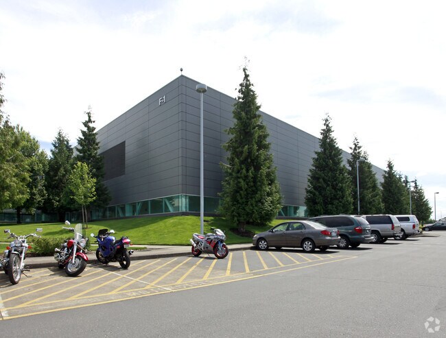
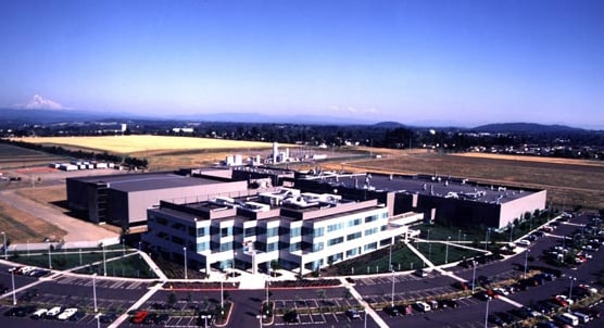
Property Record
23440 Ne Glisan St, Gresham, OR 97030


Property Detail
23440 Ne Glisan St
R322043
SECTION 34 1N 3E, TL 300 11.39 ACRES, ENTERPRISE ZONE, POTENTIAL ADDITIONAL TAX
Industrialgeneral
Multnomah
GI
Oregon
B and X Area of moderate flood hazard, usually the area between the limits of the 100-year and 500-year floods.
1-2
2025
11.39 AC
2025
East Columbia Corridor
010303
Portland
201,539 SF
Portland-Vancouver-Hillsboro, OR-WA
NEARBY LISTINGS FOR SALE OR LEASE
DEMOGRAPHICS near 23440 Ne Glisan St
1 mile
3 mile
5 mile
2025 Total Population
16,313
107,311
209,896
2030 Population
16,202
105,478
207,215
Pop Growth 2025-2030
(0.68%)
(1.71%)
(1.28%)
Average Age
39
39
40
2025 Total Households
5,958
38,690
74,769
HH Growth 2025-2030
(0.89%)
(1.99%)
(1.55%)
Median Household Inc
$66,343
$69,940
$73,881
Avg Household Size
2.60
2.70
2.70
2025 Avg HH Vehicles
2.00
2.00
2.00
Median Home Value
$424,815
$429,587
$452,015
Median Year Built
1985
1982
1982
Nearby Places
Map Layers
Map Styles
 Street
 Aerial
Transit
 Traffic
 Biking
Places
Listings with unknown addresses are not visible on the map
- Restaurants
- Banks
- Shops
- Fitness
- Groceries
PUBLIC TRANSPORTATION
AIRPORT
Portland International
Drive
Walk
Distance
Portland International
21 min
12.4 mi
Freight Ports
Port of Portland
Drive
Walk
Distance
Port of Portland
28 min
17.9 mi
Nearby Properties
Address
Land Use
TOTAL SIZE
Lot Size
Zoning
Address
Land Use
TOTAL SIZE
Lot Size
Zoning
21.39 AC
NULL
Address
Land Use
TOTAL SIZE
Lot Size
Zoning
3,800 SF
27.96 AC
LI
Address
Land Use
TOTAL SIZE
Lot Size
Zoning
40.81 AC
LDR-5
Address
Land Use
TOTAL SIZE
Lot Size
Zoning
Address
Land Use
TOTAL SIZE
Lot Size
Zoning
3.20 AC
DEM
Address
Land Use
TOTAL SIZE
Lot Size
Zoning
Address
Land Use
TOTAL SIZE
Lot Size
Zoning
64.20 AC
HI
Address
Land Use
TOTAL SIZE
Lot Size
Zoning
478,472 SF
77.86 AC
GI
Address
Land Use
TOTAL SIZE
Lot Size
Zoning
137.54 AC
GI
Address
Land Use
TOTAL SIZE
Lot Size
Zoning
260,995 SF
6.49 AC
RTC
Address
Land Use
TOTAL SIZE
Lot Size
Zoning
302,114 SF
31.69 AC
R-5
Address
Land Use
TOTAL SIZE
Lot Size
Zoning
109,231 SF
7.87 AC
HI
Address
Land Use
TOTAL SIZE
Lot Size
Zoning
75,850 SF
11.55 AC
LDR-5
Address
Land Use
TOTAL SIZE
Lot Size
Zoning
8.69 AC
NULL
Address
Land Use
TOTAL SIZE
Lot Size
Zoning
857,470 SF
73.72 AC
GI
Address
Land Use
TOTAL SIZE
Lot Size
Zoning
836,366 SF
38.86 AC
LI
Address
Land Use
TOTAL SIZE
Lot Size
Zoning
14,059 SF
12.83 AC
GI
Address
Land Use
TOTAL SIZE
Lot Size
Zoning
378,000 SF
18.91 AC
LI
Address
Land Use
TOTAL SIZE
Lot Size
Zoning
21.39 AC
HI
Address
Land Use
TOTAL SIZE
Lot Size
Zoning
197,834 SF
8.67 AC
R5
Address
Land Use
TOTAL SIZE
Lot Size
Zoning
237,815 SF
22.70 AC
TLDR
Address
Land Use
TOTAL SIZE
Lot Size
Zoning
191,466 SF
34.68 AC
R/CSP
Address
Land Use
TOTAL SIZE
Lot Size
Zoning
219,470 SF
9.77 AC
R_MF
Address
Land Use
TOTAL SIZE
Lot Size
Zoning
118,460 SF
28.10 AC
BP
Address
Land Use
TOTAL SIZE
Lot Size
Zoning
213,544 SF
6.64 AC
A2
Address
Land Use
TOTAL SIZE
Lot Size
Zoning
273,264 SF
11.39 AC
CMF
Address
Land Use
TOTAL SIZE
Lot Size
Zoning
85,380 SF
5.04 AC
TD
Address
Land Use
TOTAL SIZE
Lot Size
Zoning
156,393 SF
5.82 AC
GC
Address
Land Use
TOTAL SIZE
Lot Size
Zoning
254,580 SF
4.76 AC
TDHC
Address
Land Use
TOTAL SIZE
Lot Size
Zoning
304,649 SF
14.13 AC
GI
The World's #1 Commercial Real Estate Marketplace
Connect with us
© 2026 CoStar Group
The information above has been obtained from sources believed reliable. While we do not doubt its accuracy we have not verified it and make no guarantee, warranty or representation about it. It is your responsibility to independently confirm its accuracy and completeness. Any projections, opinions, assumptions, or estimates used are for example only and do not represent the current or future performance of the property. The value of this transaction to you depends on tax and other factors which should be evaluated by your tax, financial, and legal advisors. You and your advisors should conduct a careful, independent investigation of the property to determine to your satisfaction the suitability of the property for your needs.