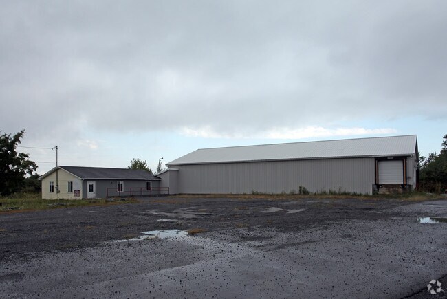
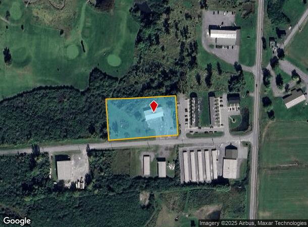
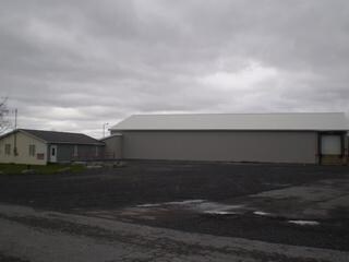
Property Record
23465 Graham Rd, Watertown, NY 13601
NEARBY LISTINGS FOR SALE OR LEASE
Property Detail
23465 Graham Rd
224889-074-010-0001-001-430
GRAHAM INDUSTRIAL PARK LOT 4
Storesoffices
Jefferson
ARE
New York
36045C0519G
1.430
2025
1.97 AC
2024
Jefferson County
060500
Syracuse
960 SF
Watertown-Fort Drum, NY
DEMOGRAPHICS near 23465 Graham Rd
1 Mile
3 Mile
5 Mile
2024 Total Population
292
10,479
46,867
2029 Population
281
10,244
45,791
Pop Growth 2024-2029
(3.77%)
(2.24%)
(2.30%)
Average Age
33
36
34
2024 Total Households
126
4,493
18,403
HH Growth 2024-2029
(3.97%)
(2.40%)
(2.51%)
Median Household Inc
$78,241
$53,507
$55,158
Avg Household Size
2.30
2.20
2.30
2024 Avg HH Vehicles
1.00
1.00
1.00
Median Home Value
$256,249
$134,241
$160,476
Median Year Built
1985
1962
1966
Nearby Places
- Restaurants
- Banks
- Shops
- Fitness
- Groceries
SALE & LEASE HISTORY
LISTING DATE
SALE/LEASE

Oct 25, 2019
For Sale
Nearby Properties
Address
Land Use
TOTAL SIZE
Lot Size
Zoning
Address
Land Use
TOTAL SIZE
Lot Size
Zoning
10,848 SF
89.80 AC
B
Address
Land Use
TOTAL SIZE
Lot Size
Zoning
18,042 SF
22.50 AC
PARK
Address
Land Use
TOTAL SIZE
Lot Size
Zoning
5,568 SF
95 AC
PC
Address
Land Use
TOTAL SIZE
Lot Size
Zoning
10,944 SF
82.39 AC
PD
Address
Land Use
TOTAL SIZE
Lot Size
Zoning
52,650 SF
6.50 AC
PC
Address
Land Use
TOTAL SIZE
Lot Size
Zoning
77,688 SF
53.15 AC
AR
Address
Land Use
TOTAL SIZE
Lot Size
Zoning
14,752 SF
32.36 AC
99
Address
Land Use
TOTAL SIZE
Lot Size
Zoning
27,296 SF
81.58 AC
99
Address
Land Use
TOTAL SIZE
Lot Size
Zoning
59,771 SF
9.68 AC
PARK
Address
Land Use
TOTAL SIZE
Lot Size
Zoning
10,559 SF
1.11 AC
99
Address
Land Use
TOTAL SIZE
Lot Size
Zoning
134,480 SF
21.36 AC
99
Address
Land Use
TOTAL SIZE
Lot Size
Zoning
7,500 SF
31.71 AC
PARK
Address
Land Use
TOTAL SIZE
Lot Size
Zoning
62,740 SF
11.49 AC
LI
Address
Land Use
TOTAL SIZE
Lot Size
Zoning
61.39 AC
INDUST
Address
Land Use
TOTAL SIZE
Lot Size
Zoning
11,112 SF
6.90 AC
PC
Address
Land Use
TOTAL SIZE
Lot Size
Zoning
40,400 SF
8.76 AC
99
Address
Land Use
TOTAL SIZE
Lot Size
Zoning
6,000 SF
5.62 AC
Address
Land Use
TOTAL SIZE
Lot Size
Zoning
62,700 SF
18.65 AC
IND
Address
Land Use
TOTAL SIZE
Lot Size
Zoning
82,372 SF
8.14 AC
R
Address
Land Use
TOTAL SIZE
Lot Size
Zoning
81,144 SF
3.62 AC
PC
Address
Land Use
TOTAL SIZE
Lot Size
Zoning
4,134 SF
1.20 AC
NMU
Address
Land Use
TOTAL SIZE
Lot Size
Zoning
216,407 SF
22.43 AC
INDUST
Address
Land Use
TOTAL SIZE
Lot Size
Zoning
3,710 SF
7.90 AC
PC
Address
Land Use
TOTAL SIZE
Lot Size
Zoning
2,400 SF
18.70 AC
99
Address
Land Use
TOTAL SIZE
Lot Size
Zoning
9,098 SF
16.55 AC
PC
Address
Land Use
TOTAL SIZE
Lot Size
Zoning
0.91 AC
AR
Address
Land Use
TOTAL SIZE
Lot Size
Zoning
660 SF
14.94 AC
PC
Address
Land Use
TOTAL SIZE
Lot Size
Zoning
22,400 SF
46.32 AC
Address
Land Use
TOTAL SIZE
Lot Size
Zoning
37,309 SF
9.89 AC
99
Address
Land Use
TOTAL SIZE
Lot Size
Zoning
20,740 SF
1.45 AC
NMU
The World's #1 Commercial Real Estate Marketplace
Connect with us
© 2025 CoStar Group
The information above has been obtained from sources believed reliable. While we do not doubt its accuracy we have not verified it and make no guarantee, warranty or representation about it. It is your responsibility to independently confirm its accuracy and completeness. Any projections, opinions, assumptions, or estimates used are for example only and do not represent the current or future performance of the property. The value of this transaction to you depends on tax and other factors which should be evaluated by your tax, financial, and legal advisors. You and your advisors should conduct a careful, independent investigation of the property to determine to your satisfaction the suitability of the property for your needs.