Property Record
23489 Mapes Rd, Menifee, CA 92585


Property Detail
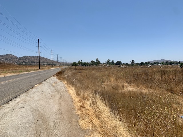
23489 Mapes Rd
327-260-021
49.47 ACRES M/L IN POR NW 1/4 OF SEC 12 T5S R3W FOR TOTAL DESCRIPTION SEE ASSESSORS MAPS
Agriculturalland
RIVERSIDE
A11
California
B and X Area of moderate flood hazard, usually the area between the limits of the 100-year and 500-year floods.
156
2024
49.47 AC
2025
South Riverside
042728
Inland Empire (California)
1,260 SF
Riverside-San Bernardino-Ontario, CA
NEARBY LISTINGS FOR SALE OR LEASE
DEMOGRAPHICS near 23489 Mapes Rd
1 mile
3 mile
5 mile
2025 Total Population
2,570
29,656
101,689
2030 Population
2,735
31,216
106,013
Pop Growth 2025-2030
+ 6.42%
+ 5.26%
+ 4.25%
Average Age
36
37
40
2025 Total Households
680
8,444
32,472
HH Growth 2025-2030
+ 6.32%
+ 5.01%
+ 3.70%
Median Household Inc
$82,753
$91,647
$76,616
Avg Household Size
3.60
3.30
3.00
2025 Avg HH Vehicles
3.00
3.00
2.00
Median Home Value
$499,056
$532,243
$485,003
Median Year Built
1988
2000
1995
Nearby Places
Map Layers
Map Styles
 Street
 Aerial
Layers
 Traffic
 Biking
Places
Listings with unknown addresses are not visible on the map
- Restaurants
- Banks
- Shops
- Fitness
- Groceries
PUBLIC TRANSPORTATION
COMMUTER RAIL
South Perris (Metrolink 91-Perris Valley Line - Metrolink Trains)
Drive
Walk
Distance
South Perris (Metrolink 91-Perris Valley Line - Metrolink Trains)
9 min
5.0 mi
Perris Downtown (Metrolink 91-Perris Valley Line - Metrolink Trains)
Drive
Walk
Distance
Perris Downtown (Metrolink 91-Perris Valley Line - Metrolink Trains)
13 min
7.7 mi
Freight Ports
Port of Long Beach
Drive
Walk
Distance
Port of Long Beach
103 min
75.6 mi
SALE & LEASE HISTORY
LISTING DATE
SALE/LEASE

Aug 25, 2020
For Sale
Nearby Properties
Address
Land Use
TOTAL SIZE
Lot Size
Zoning
Address
Land Use
TOTAL SIZE
Lot Size
Zoning
9.22 AC
CBOOK
Address
Land Use
TOTAL SIZE
Lot Size
Zoning
104,208 SF
10.96 AC
Address
Land Use
TOTAL SIZE
Lot Size
Zoning
13.95 AC
Address
Land Use
TOTAL SIZE
Lot Size
Zoning
97,942 SF
11 AC
Address
Land Use
TOTAL SIZE
Lot Size
Zoning
86,590 SF
10.97 AC
MM
Address
Land Use
TOTAL SIZE
Lot Size
Zoning
41,840 SF
8.92 AC
Address
Land Use
TOTAL SIZE
Lot Size
Zoning
24,889 SF
42.36 AC
Address
Land Use
TOTAL SIZE
Lot Size
Zoning
70,680 SF
4.59 AC
M-M
Address
Land Use
TOTAL SIZE
Lot Size
Zoning
68,986 SF
7.21 AC
CPS
Address
Land Use
TOTAL SIZE
Lot Size
Zoning
11,200 SF
11.05 AC
MM
Address
Land Use
TOTAL SIZE
Lot Size
Zoning
54,282 SF
3.87 AC
MSC
Address
Land Use
TOTAL SIZE
Lot Size
Zoning
3,275 SF
7.79 AC
Address
Land Use
TOTAL SIZE
Lot Size
Zoning
1,936 SF
4.06 AC
Address
Land Use
TOTAL SIZE
Lot Size
Zoning
4.43 AC
SPZONE
Address
Land Use
TOTAL SIZE
Lot Size
Zoning
45,640 SF
10.01 AC
MM
Address
Land Use
TOTAL SIZE
Lot Size
Zoning
4.80 AC
MSC
Address
Land Use
TOTAL SIZE
Lot Size
Zoning
18,898 SF
1.69 AC
RR
Address
Land Use
TOTAL SIZE
Lot Size
Zoning
4.86 AC
SPZONE
The World's #1 Commercial Real Estate Marketplace
Connect with us
© 2026 CoStar Group
The information above has been obtained from sources believed reliable. While we do not doubt its accuracy we have not verified it and make no guarantee, warranty or representation about it. It is your responsibility to independently confirm its accuracy and completeness. Any projections, opinions, assumptions, or estimates used are for example only and do not represent the current or future performance of the property. The value of this transaction to you depends on tax and other factors which should be evaluated by your tax, financial, and legal advisors. You and your advisors should conduct a careful, independent investigation of the property to determine to your satisfaction the suitability of the property for your needs.