Property Record
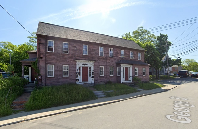
235 Central Ave, Dover, NH 03820


Property Detail
235 Central Ave
DOVR-023026
STRAFFORD
Apartment
New Hampshire
CBD-G
0.14 AC
B and X Area of moderate flood hazard, usually the area between the limits of the 100-year and 500-year floods.
Downtown Dover
2025
Boston
2025
Boston-Cambridge-Newton, MA-NH
081300
NEARBY LISTINGS FOR SALE OR LEASE
DEMOGRAPHICS near 235 Central Ave
1 mile
3 mile
5 mile
2025 Total Population
13,168
32,053
61,884
2030 Population
13,579
32,668
62,823
Pop Growth 2025-2030
+ 3.12%
+ 1.92%
+ 1.52%
Average Age
38
40
40
2025 Total Households
6,497
14,613
25,530
HH Growth 2025-2030
+ 3.31%
+ 2.10%
+ 1.67%
Median Household Inc
$80,181
$92,352
$93,508
Avg Household Size
2.00
2.10
2.30
2025 Avg HH Vehicles
2.00
2.00
2.00
Median Home Value
$473,297
$457,633
$433,293
Median Year Built
1962
1975
1973
Nearby Places
Map Layers
Map Styles
 Street
 Aerial
Layers
 Traffic
 Biking
Places
Listings with unknown addresses are not visible on the map
- Restaurants
- Banks
- Shops
- Fitness
- Groceries
PUBLIC TRANSPORTATION
COMMUTER RAIL
Drive
Walk
Distance
3 min
13 min
0.7 mi
Drive
Walk
Distance
13 min
6.4 mi
AIRPORT
Portsmouth International at Pease
Drive
Walk
Distance
Portsmouth International at Pease
18 min
9.8 mi
Manchester Boston Regional
Drive
Walk
Distance
Manchester Boston Regional
68 min
44.0 mi
Portland International Jetport
Drive
Walk
Distance
Portland International Jetport
68 min
46.9 mi
Freight Ports
Portland, ME
Drive
Walk
Distance
Portland, ME
69 min
49.5 mi
SALE & LEASE HISTORY
LISTING DATE
SALE/LEASE

Feb 12, 2025
For Sale
Nearby Properties
Address
Land Use
TOTAL SIZE
Lot Size
Zoning
Address
Land Use
TOTAL SIZE
Lot Size
Zoning
24.83 AC
R-20
Address
Land Use
TOTAL SIZE
Lot Size
Zoning
220.20 AC
IT
Address
Land Use
TOTAL SIZE
Lot Size
Zoning
1.26 AC
CBD-G
Address
Land Use
TOTAL SIZE
Lot Size
Zoning
20.03 AC
R-20
Address
Land Use
TOTAL SIZE
Lot Size
Zoning
7.84 AC
C
Address
Land Use
TOTAL SIZE
Lot Size
Zoning
3.66 AC
IT
Address
Land Use
TOTAL SIZE
Lot Size
Zoning
1.22 AC
CBD-G
Address
Land Use
TOTAL SIZE
Lot Size
Zoning
50.52 AC
RM-SU*
Address
Land Use
TOTAL SIZE
Lot Size
Zoning
18.65 AC
B
Address
Land Use
TOTAL SIZE
Lot Size
Zoning
3.40 AC
CBD-M
Address
Land Use
TOTAL SIZE
Lot Size
Zoning
11.80 AC
R-12*
Address
Land Use
TOTAL SIZE
Lot Size
Zoning
26.40 AC
IT*
Address
Land Use
TOTAL SIZE
Lot Size
Zoning
71.83 AC
R-40
Address
Land Use
TOTAL SIZE
Lot Size
Zoning
12.60 AC
IT
Address
Land Use
TOTAL SIZE
Lot Size
Zoning
3.35 AC
CBD-G
Address
Land Use
TOTAL SIZE
Lot Size
Zoning
7.92 AC
R-12
Address
Land Use
TOTAL SIZE
Lot Size
Zoning
0.22 AC
CBD-G
Address
Land Use
TOTAL SIZE
Lot Size
Zoning
4.15 AC
R-12
Address
Land Use
TOTAL SIZE
Lot Size
Zoning
11.08 AC
RM-U
Address
Land Use
TOTAL SIZE
Lot Size
Zoning
15.46 AC
C
Address
Land Use
TOTAL SIZE
Lot Size
Zoning
3.66 AC
C
Address
Land Use
TOTAL SIZE
Lot Size
Zoning
11.47 AC
IT
Address
Land Use
TOTAL SIZE
Lot Size
Zoning
197,921 SF
RC
Address
Land Use
TOTAL SIZE
Lot Size
Zoning
35.86 AC
R-40
Address
Land Use
TOTAL SIZE
Lot Size
Zoning
4.15 AC
RM-U
Address
Land Use
TOTAL SIZE
Lot Size
Zoning
15.46 AC
G
Address
Land Use
TOTAL SIZE
Lot Size
Zoning
9.29 AC
R-12*
Address
Land Use
TOTAL SIZE
Lot Size
Zoning
5 AC
C
Address
Land Use
TOTAL SIZE
Lot Size
Zoning
38.27 AC
RM-U
Address
Land Use
TOTAL SIZE
Lot Size
Zoning
8.96 AC
IT
The World's #1 Commercial Real Estate Marketplace
Connect with us
© 2026 CoStar Group
The information above has been obtained from sources believed reliable. While we do not doubt its accuracy we have not verified it and make no guarantee, warranty or representation about it. It is your responsibility to independently confirm its accuracy and completeness. Any projections, opinions, assumptions, or estimates used are for example only and do not represent the current or future performance of the property. The value of this transaction to you depends on tax and other factors which should be evaluated by your tax, financial, and legal advisors. You and your advisors should conduct a careful, independent investigation of the property to determine to your satisfaction the suitability of the property for your needs.