Property Record
235 Chatham Cottage Ln, State Road, NC 28676


NEARBY LISTINGS FOR SALE OR LEASE
-
-
View all State Road listings for sale on LoopNet.com
Property Detail
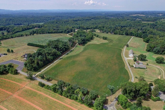
235 Chatham Cottage Ln
4953-03-00-9627
Klondike Rd/Chatham Farm
Clubslodgesprofessionalassociations
Surry
X
North Carolina
3710495300J
24.32 AC
2025
Hickory/Morganton
2025
Other Market Areas
930901
Mount Airy, NC
3,103 SF
DEMOGRAPHICS near 235 Chatham Cottage Ln
1 Mile
3 Mile
5 Mile
2024 Total Population
576
7,109
15,022
2029 Population
574
7,163
15,151
Pop Growth 2024-2029
(0.35%)
+ 0.76%
+ 0.86%
Average Age
43
44
44
2024 Total Households
237
3,041
6,443
HH Growth 2024-2029
(0.42%)
+ 0.79%
+ 0.87%
Median Household Inc
$50,357
$52,924
$50,299
Avg Household Size
2.40
2.30
2.30
2024 Avg HH Vehicles
2.00
2.00
2.00
Median Home Value
$139,506
$154,211
$146,220
Median Year Built
1972
1969
1970
Nearby Places
Map Layers
Map Styles
 Street
 Aerial
- Restaurants
- Banks
- Shops
- Fitness
- Groceries
SALE & LEASE HISTORY
LISTING DATE
SALE/LEASE

Sep 13, 2017
For Sale
Nearby Properties
Address
Land Use
TOTAL SIZE
Lot Size
Zoning
Address
Land Use
TOTAL SIZE
Lot Size
Zoning
155,096 SF
149.94 AC
MA
Address
Land Use
TOTAL SIZE
Lot Size
Zoning
217,774 SF
39.92 AC
HB
Address
Land Use
TOTAL SIZE
Lot Size
Zoning
415,005 SF
37.38 AC
M2
Address
Land Use
TOTAL SIZE
Lot Size
Zoning
6,050 SF
11.80 AC
MA
Address
Land Use
TOTAL SIZE
Lot Size
Zoning
57,895 SF
1.34 AC
B2
Address
Land Use
TOTAL SIZE
Lot Size
Zoning
69,411 SF
18.99 AC
MA
Address
Land Use
TOTAL SIZE
Lot Size
Zoning
117,278 SF
17.06 AC
B2
Address
Land Use
TOTAL SIZE
Lot Size
Zoning
46,128 SF
5.09 AC
MA
Address
Land Use
TOTAL SIZE
Lot Size
Zoning
404,100 SF
51.83 AC
M1
Address
Land Use
TOTAL SIZE
Lot Size
Zoning
23,062 SF
12.87 AC
LDR
Address
Land Use
TOTAL SIZE
Lot Size
Zoning
720 SF
13.71 AC
HDMF
Address
Land Use
TOTAL SIZE
Lot Size
Zoning
1,760 SF
8.17 AC
B2
Address
Land Use
TOTAL SIZE
Lot Size
Zoning
40,640 SF
8.87 AC
B2
Address
Land Use
TOTAL SIZE
Lot Size
Zoning
30,980 SF
5.75 AC
B2
Address
Land Use
TOTAL SIZE
Lot Size
Zoning
14,784 SF
2.17 AC
B2
Address
Land Use
TOTAL SIZE
Lot Size
Zoning
34,556 SF
7.29 AC
HB
Address
Land Use
TOTAL SIZE
Lot Size
Zoning
51,255 SF
19.15 AC
HB
Address
Land Use
TOTAL SIZE
Lot Size
Zoning
11,196 SF
14.02 AC
RA
Address
Land Use
TOTAL SIZE
Lot Size
Zoning
9,159 SF
6.61 AC
B2
Address
Land Use
TOTAL SIZE
Lot Size
Zoning
18,674 SF
10 AC
R8
Address
Land Use
TOTAL SIZE
Lot Size
Zoning
17,272 SF
6.62 AC
R20
Address
Land Use
TOTAL SIZE
Lot Size
Zoning
6,814 SF
4.54 AC
HB
Address
Land Use
TOTAL SIZE
Lot Size
Zoning
18,274 SF
2.13 AC
HB
Address
Land Use
TOTAL SIZE
Lot Size
Zoning
17,586 SF
27 AC
B2
Address
Land Use
TOTAL SIZE
Lot Size
Zoning
28,976 SF
28.02 AC
MDR
Address
Land Use
TOTAL SIZE
Lot Size
Zoning
22.30 AC
Address
Land Use
TOTAL SIZE
Lot Size
Zoning
7,282 SF
219.06 AC
RR
Address
Land Use
TOTAL SIZE
Lot Size
Zoning
14,490 SF
1.71 AC
HB
Address
Land Use
TOTAL SIZE
Lot Size
Zoning
6,559 SF
2.26 AC
B2
Address
Land Use
TOTAL SIZE
Lot Size
Zoning
12,640 SF
4.25 AC
R12
The World's #1 Commercial Real Estate Marketplace
Connect with us
© 2026 CoStar Group
The information above has been obtained from sources believed reliable. While we do not doubt its accuracy we have not verified it and make no guarantee, warranty or representation about it. It is your responsibility to independently confirm its accuracy and completeness. Any projections, opinions, assumptions, or estimates used are for example only and do not represent the current or future performance of the property. The value of this transaction to you depends on tax and other factors which should be evaluated by your tax, financial, and legal advisors. You and your advisors should conduct a careful, independent investigation of the property to determine to your satisfaction the suitability of the property for your needs.