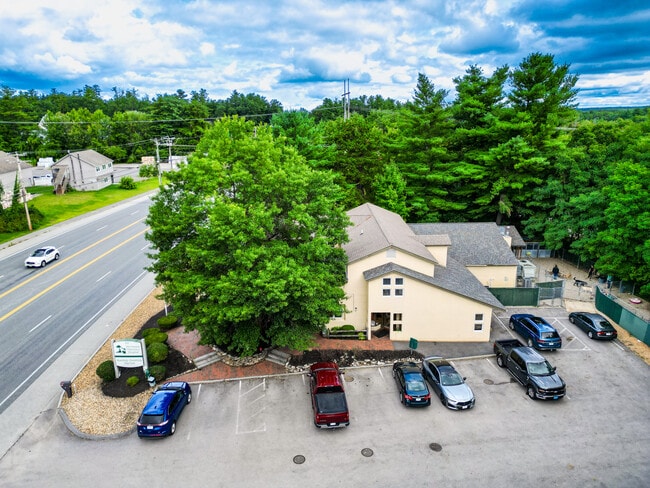
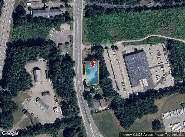
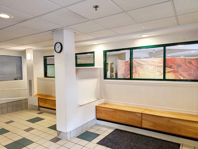
Property Record
235 Daniel Webster Hwy, Merrimack, NH 03054
Current Lease Availabilities
NEARBY LISTINGS FOR SALE OR LEASE
Property Detail
235 Daniel Webster Hwy
MRMK-000302D-000044
Hillsborough
Commercialbuilding
New Hampshire
X
44
33011C0503D
0.62 AC
2024
Hillsborough
2024
Boston
014102
Manchester-Nashua, NH
9,273 SF
DEMOGRAPHICS near 235 Daniel Webster Hwy
1 Mile
3 Mile
5 Mile
2024 Total Population
2,097
24,258
78,436
2029 Population
2,204
25,111
80,457
Pop Growth 2024-2029
+ 5.10%
+ 3.52%
+ 2.58%
Average Age
43
43
42
2024 Total Households
827
9,837
31,423
HH Growth 2024-2029
+ 5.20%
+ 3.65%
+ 2.60%
Median Household Inc
$129,405
$112,490
$104,514
Avg Household Size
2.50
2.40
2.40
2024 Avg HH Vehicles
2.00
2.00
2.00
Median Home Value
$425,225
$385,063
$380,916
Median Year Built
1991
1985
1980
Nearby Places
Map Layers
Map Styles
 Street
 Aerial
- Restaurants
- Banks
- Shops
- Fitness
- Groceries
PUBLIC TRANSPORTATION
AIRPORT
Manchester Boston Regional
DRIVE
WALK
Distance
Manchester Boston Regional
16 min
9.6 mi
Freight Ports
Port of Boston
DRIVE
WALK
Distance
Port of Boston
74 min
54.6 mi
Nearby Properties
Address
Land Use
TOTAL SIZE
Lot Size
Zoning
Address
Land Use
TOTAL SIZE
Lot Size
Zoning
29,295 SF
143.99 AC
INDUST
Address
Land Use
TOTAL SIZE
Lot Size
Zoning
202,546 SF
55 AC
RESIDE
Address
Land Use
TOTAL SIZE
Lot Size
Zoning
3,615 SF
21.02 AC
C2- GE
Address
Land Use
TOTAL SIZE
Lot Size
Zoning
6.28 AC
INDUST
Address
Land Use
TOTAL SIZE
Lot Size
Zoning
576,827 SF
446.22 AC
INDUST
Address
Land Use
TOTAL SIZE
Lot Size
Zoning
26.55 AC
INDUST
Address
Land Use
TOTAL SIZE
Lot Size
Zoning
621,927 SF
106.62 AC
INDUST
Address
Land Use
TOTAL SIZE
Lot Size
Zoning
15,975 SF
195.68 AC
INDUST
Address
Land Use
TOTAL SIZE
Lot Size
Zoning
66 AC
R18
Address
Land Use
TOTAL SIZE
Lot Size
Zoning
471,525 SF
40.78 AC
INDUST
Address
Land Use
TOTAL SIZE
Lot Size
Zoning
51,684 SF
36.58 AC
INDUST
Address
Land Use
TOTAL SIZE
Lot Size
Zoning
326,755 SF
43 AC
INDUST
Address
Land Use
TOTAL SIZE
Lot Size
Zoning
123,648 SF
135.87 AC
INDUST
Address
Land Use
TOTAL SIZE
Lot Size
Zoning
142,207 SF
4.72 AC
PI
Address
Land Use
TOTAL SIZE
Lot Size
Zoning
10.30 AC
RC
Address
Land Use
TOTAL SIZE
Lot Size
Zoning
9.01 AC
RC
Address
Land Use
TOTAL SIZE
Lot Size
Zoning
193,749 SF
54.34 AC
INDUST
Address
Land Use
TOTAL SIZE
Lot Size
Zoning
8.85 AC
RC
Address
Land Use
TOTAL SIZE
Lot Size
Zoning
8.38 AC
RC
Address
Land Use
TOTAL SIZE
Lot Size
Zoning
140,258 SF
8.02 AC
PI
Address
Land Use
TOTAL SIZE
Lot Size
Zoning
398,215 SF
65.88 AC
INDUST
Address
Land Use
TOTAL SIZE
Lot Size
Zoning
30,406 SF
16.74 AC
INDUST
Address
Land Use
TOTAL SIZE
Lot Size
Zoning
93,448 SF
10 AC
RC
Address
Land Use
TOTAL SIZE
Lot Size
Zoning
7.92 AC
RC
Address
Land Use
TOTAL SIZE
Lot Size
Zoning
101,479 SF
11.52 AC
INDUST
Address
Land Use
TOTAL SIZE
Lot Size
Zoning
24,495 SF
13.05 AC
RESIDE
Address
Land Use
TOTAL SIZE
Lot Size
Zoning
44,520 SF
8.51 AC
PI
Address
Land Use
TOTAL SIZE
Lot Size
Zoning
1.63 AC
RES
Address
Land Use
TOTAL SIZE
Lot Size
Zoning
38 AC
RES
Address
Land Use
TOTAL SIZE
Lot Size
Zoning
7.74 AC
RA
The World's #1 Commercial Real Estate Marketplace
Connect with us
© 2026 CoStar Group
The information above has been obtained from sources believed reliable. While we do not doubt its accuracy we have not verified it and make no guarantee, warranty or representation about it. It is your responsibility to independently confirm its accuracy and completeness. Any projections, opinions, assumptions, or estimates used are for example only and do not represent the current or future performance of the property. The value of this transaction to you depends on tax and other factors which should be evaluated by your tax, financial, and legal advisors. You and your advisors should conduct a careful, independent investigation of the property to determine to your satisfaction the suitability of the property for your needs.