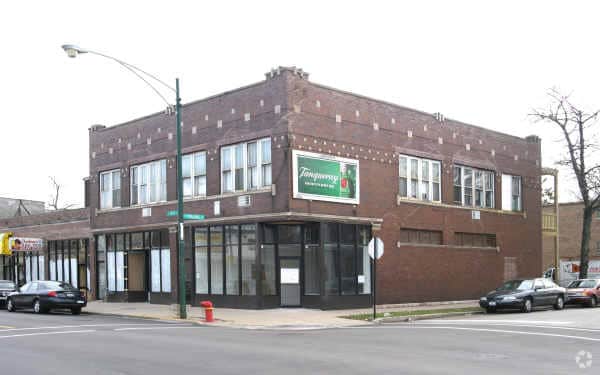
Property Record
235 E 115Th St, Chicago, IL 60628


NEARBY LISTINGS FOR SALE OR LEASE
Property Detail
235 E 115Th St
Chicago-Naperville-Elgin, IL-IN
Kensington
25-22-303-001-0000
J H (WINGARL) JRS RESUB OF LTS 34-38 OF BLK5 IN KENSI NGTON SUB OF S 2/3 ACS LYING W OF IC RR OF W 60ACS OF SE & LTS 1 & 4 OF
Miscresidentialimprovement
Cook
X
Illinois
17031C0661J
1,4
2023
0.12 AC
2025
South Chicago
530100
Chicago
6,424 SF
DEMOGRAPHICS near 235 E 115Th St
1 Mile
3 Mile
5 Mile
2024 Total Population
19,705
120,343
398,291
2029 Population
19,161
117,148
386,027
Pop Growth 2024-2029
(2.76%)
(2.65%)
(3.08%)
Average Age
40
41
41
2024 Total Households
7,664
45,604
153,413
HH Growth 2024-2029
(3.20%)
(3.02%)
(3.45%)
Median Household Inc
$36,175
$47,155
$50,393
Avg Household Size
2.50
2.50
2.50
2024 Avg HH Vehicles
1.00
1.00
1.00
Median Home Value
$116,336
$144,074
$165,877
Median Year Built
1947
1951
1951
Nearby Places
Map Layers
Map Styles
 Street
 Aerial
- Restaurants
- Banks
- Shops
- Fitness
- Groceries
PUBLIC TRANSPORTATION
TRANSIT/SUBWAY
Kensington Street Station (South Shore Line - Northern Indiana Commuter Transportation District (South Shore Line))
DRIVE
WALK
Distance
Kensington Street Station (South Shore Line - Northern Indiana Commuter Transportation District (South Shore Line))
1 min
5 min
0.3 mi
Pullman/111th Street Station (Metra Electric Line - Northeast Illinois Regional Commuter Railroad (Metra))
DRIVE
WALK
Distance
Pullman/111th Street Station (Metra Electric Line - Northeast Illinois Regional Commuter Railroad (Metra))
2 min
15 min
0.8 mi
COMMUTER RAIL
Kensington Street Station (South Shore Line - Northern Indiana Commuter Transportation District (South Shore Line))
DRIVE
WALK
Distance
Kensington Street Station (South Shore Line - Northern Indiana Commuter Transportation District (South Shore Line))
1 min
5 min
0.3 mi
Pullman/111th Street Station (Metra Electric Line - Northeast Illinois Regional Commuter Railroad (Metra))
DRIVE
WALK
Distance
Pullman/111th Street Station (Metra Electric Line - Northeast Illinois Regional Commuter Railroad (Metra))
2 min
15 min
0.8 mi
AIRPORT
Chicago Midway International
DRIVE
WALK
Distance
Chicago Midway International
26 min
14.5 mi
Chicago O'Hare International
DRIVE
WALK
Distance
Chicago O'Hare International
48 min
31.3 mi
SALE & LEASE HISTORY
LISTING DATE
SALE/LEASE

Jan 15, 2025
For Sale
Aug 06, 2020
For Sale
Nearby Properties
Address
Land Use
TOTAL SIZE
Lot Size
Zoning
Address
Land Use
TOTAL SIZE
Lot Size
Zoning
8 AC
PD 1168
Address
Land Use
TOTAL SIZE
Lot Size
Zoning
0.51 AC
PD 1168
Address
Land Use
TOTAL SIZE
Lot Size
Zoning
1.08 AC
PD 1168
Address
Land Use
TOTAL SIZE
Lot Size
Zoning
41,400 SF
13.35 AC
PD 1254
Address
Land Use
TOTAL SIZE
Lot Size
Zoning
11 AC
PD 1168
Address
Land Use
TOTAL SIZE
Lot Size
Zoning
307,335 SF
24.17 AC
PD 770
Address
Land Use
TOTAL SIZE
Lot Size
Zoning
67,348 SF
6.33 AC
PD 131
Address
Land Use
TOTAL SIZE
Lot Size
Zoning
88,008 SF
3.96 AC
Address
Land Use
TOTAL SIZE
Lot Size
Zoning
162,000 SF
20.94 AC
PD 1167
Address
Land Use
TOTAL SIZE
Lot Size
Zoning
83,005 SF
3.11 AC
Address
Land Use
TOTAL SIZE
Lot Size
Zoning
148,700 SF
Address
Land Use
TOTAL SIZE
Lot Size
Zoning
400,737 SF
PD 1167
Address
Land Use
TOTAL SIZE
Lot Size
Zoning
129,837 SF
10.44 AC
PD 770
Address
Land Use
TOTAL SIZE
Lot Size
Zoning
622,934 SF
34.41 AC
M2-3
Address
Land Use
TOTAL SIZE
Lot Size
Zoning
63,700 SF
0.74 AC
C1-1
Address
Land Use
TOTAL SIZE
Lot Size
Zoning
1 AC
RS-3
Address
Land Use
TOTAL SIZE
Lot Size
Zoning
73,947 SF
17.40 AC
PD 1167
Address
Land Use
TOTAL SIZE
Lot Size
Zoning
136,075 SF
13.65 AC
PD 1167
Address
Land Use
TOTAL SIZE
Lot Size
Zoning
542,852 SF
PMD 6,M2-1
Address
Land Use
TOTAL SIZE
Lot Size
Zoning
5,300 SF
36.84 AC
PMD 6
Address
Land Use
TOTAL SIZE
Lot Size
Zoning
155,765 SF
8.75 AC
PD 1167
Address
Land Use
TOTAL SIZE
Lot Size
Zoning
76,867 SF
3.44 AC
M1-1
Address
Land Use
TOTAL SIZE
Lot Size
Zoning
207,100 SF
9.84 AC
M2-2
Address
Land Use
TOTAL SIZE
Lot Size
Zoning
451,400 SF
26.59 AC
M3-3
Address
Land Use
TOTAL SIZE
Lot Size
Zoning
9.55 AC
M2-2
Address
Land Use
TOTAL SIZE
Lot Size
Zoning
72,219 SF
4.30 AC
M1-2
Address
Land Use
TOTAL SIZE
Lot Size
Zoning
84,400 SF
15.18 AC
M2-2,M1-1
Address
Land Use
TOTAL SIZE
Lot Size
Zoning
71,700 SF
6.24 AC
PD 485
Address
Land Use
TOTAL SIZE
Lot Size
Zoning
1.71 AC
PD 1168
Address
Land Use
TOTAL SIZE
Lot Size
Zoning
37,306 SF
8.38 AC
M3-3
The World's #1 Commercial Real Estate Marketplace
Connect with us
© 2026 CoStar Group
The information above has been obtained from sources believed reliable. While we do not doubt its accuracy we have not verified it and make no guarantee, warranty or representation about it. It is your responsibility to independently confirm its accuracy and completeness. Any projections, opinions, assumptions, or estimates used are for example only and do not represent the current or future performance of the property. The value of this transaction to you depends on tax and other factors which should be evaluated by your tax, financial, and legal advisors. You and your advisors should conduct a careful, independent investigation of the property to determine to your satisfaction the suitability of the property for your needs.