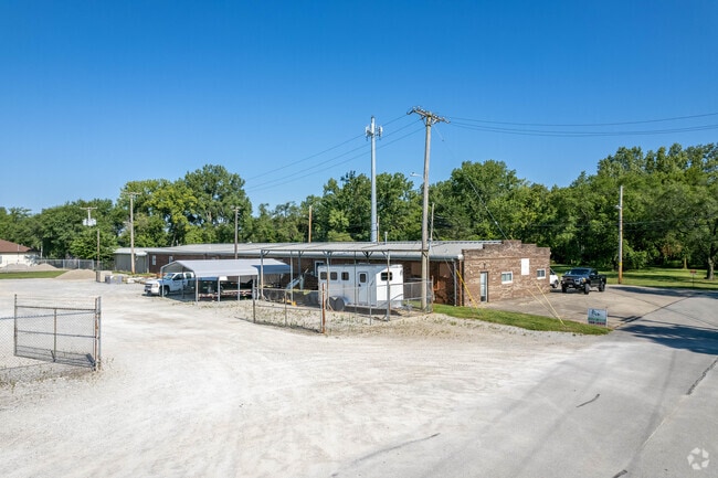
Property Record
235 Glaser St, Fairborn, OH 45324

Current Lease Availabilities
Property Detail
235 Glaser St
A02-0001-0021-0-0050-00
8-3-21 DP&L ESMNT REAR SPORTS ST 235 GLASER ST
Commercialnec
Greene
I1
Ohio
AE The base floodplain where base flood elevations are provided. AE Zones are now used on new format FIRMs instead of A1-A30 Zones.
0.46 AC
2025
East Dayton
2025
Cincinnati/Dayton
200300
Dayton, OH
6,940 SF
NEARBY LISTINGS FOR SALE OR LEASE
DEMOGRAPHICS near 235 Glaser St
1 mile
3 mile
5 mile
2025 Total Population
8,852
31,384
69,335
2030 Population
9,096
32,341
71,221
Pop Growth 2025-2030
+ 2.76%
+ 3.05%
+ 2.72%
Average Age
40
40
39
2025 Total Households
3,921
13,899
29,631
HH Growth 2025-2030
+ 2.96%
+ 3.22%
+ 2.94%
Median Household Inc
$54,373
$59,189
$68,767
Avg Household Size
2.20
2.20
2.20
2025 Avg HH Vehicles
2.00
2.00
2.00
Median Home Value
$153,257
$181,024
$210,783
Median Year Built
1954
1964
1976
Nearby Places
Map Layers
Map Styles
 Street
 Aerial
Layers
 Traffic
 Biking
Places
Listings with unknown addresses are not visible on the map
- Restaurants
- Banks
- Shops
- Fitness
- Groceries
PUBLIC TRANSPORTATION
AIRPORT
James M Cox Dayton International
Drive
Walk
Distance
James M Cox Dayton International
26 min
17.8 mi
Freight Ports
Port of Toledo
Drive
Walk
Distance
Port of Toledo
185 min
158.0 mi
Nearby Properties
Address
Land Use
TOTAL SIZE
Lot Size
Zoning
Address
Land Use
TOTAL SIZE
Lot Size
Zoning
Address
Land Use
TOTAL SIZE
Lot Size
Zoning
101,768 SF
22.02 AC
B1
Address
Land Use
TOTAL SIZE
Lot Size
Zoning
21,740 SF
16.48 AC
Address
Land Use
TOTAL SIZE
Lot Size
Zoning
271,232 SF
20.88 AC
PD2
Address
Land Use
TOTAL SIZE
Lot Size
Zoning
50,698 SF
9.43 AC
R2
Address
Land Use
TOTAL SIZE
Lot Size
Zoning
57,816 SF
9.15 AC
PD1
Address
Land Use
TOTAL SIZE
Lot Size
Zoning
45,204 SF
14.92 AC
PD1
Address
Land Use
TOTAL SIZE
Lot Size
Zoning
146,569 SF
11.81 AC
Address
Land Use
TOTAL SIZE
Lot Size
Zoning
46,802 SF
25.30 AC
R3
Address
Land Use
TOTAL SIZE
Lot Size
Zoning
4,494 SF
23.15 AC
R1
Address
Land Use
TOTAL SIZE
Lot Size
Zoning
163,780 SF
36.93 AC
PARK
Address
Land Use
TOTAL SIZE
Lot Size
Zoning
7,772 SF
8.52 AC
R3
Address
Land Use
TOTAL SIZE
Lot Size
Zoning
46,656 SF
10.35 AC
PD1
Address
Land Use
TOTAL SIZE
Lot Size
Zoning
159,880 SF
24.60 AC
I1
Address
Land Use
TOTAL SIZE
Lot Size
Zoning
74,238 SF
6.34 AC
PD-2
Address
Land Use
TOTAL SIZE
Lot Size
Zoning
261,152 SF
15.63 AC
B3
Address
Land Use
TOTAL SIZE
Lot Size
Zoning
46,005 SF
9.33 AC
PD4
Address
Land Use
TOTAL SIZE
Lot Size
Zoning
51,279 SF
2.58 AC
PD1
Address
Land Use
TOTAL SIZE
Lot Size
Zoning
24,512 SF
6.73 AC
PD1
Address
Land Use
TOTAL SIZE
Lot Size
Zoning
24,522 SF
8.46 AC
R3
Address
Land Use
TOTAL SIZE
Lot Size
Zoning
24,512 SF
5.75 AC
PD1
Address
Land Use
TOTAL SIZE
Lot Size
Zoning
38,324 SF
2.77 AC
R4
Address
Land Use
TOTAL SIZE
Lot Size
Zoning
3,456 SF
5.66 AC
PD1
Address
Land Use
TOTAL SIZE
Lot Size
Zoning
31,338 SF
0.25 AC
B2
Address
Land Use
TOTAL SIZE
Lot Size
Zoning
2,556 SF
338.34 AC
Address
Land Use
TOTAL SIZE
Lot Size
Zoning
79,032 SF
15.40 AC
IR
Address
Land Use
TOTAL SIZE
Lot Size
Zoning
11,176 SF
9.03 AC
Address
Land Use
TOTAL SIZE
Lot Size
Zoning
76,636 SF
7.40 AC
R4
Address
Land Use
TOTAL SIZE
Lot Size
Zoning
121,316 SF
20.43 AC
AG
Address
Land Use
TOTAL SIZE
Lot Size
Zoning
101,824 SF
6.13 AC
R4
The World's #1 Commercial Real Estate Marketplace
Connect with us
© 2026 CoStar Group
The information above has been obtained from sources believed reliable. While we do not doubt its accuracy we have not verified it and make no guarantee, warranty or representation about it. It is your responsibility to independently confirm its accuracy and completeness. Any projections, opinions, assumptions, or estimates used are for example only and do not represent the current or future performance of the property. The value of this transaction to you depends on tax and other factors which should be evaluated by your tax, financial, and legal advisors. You and your advisors should conduct a careful, independent investigation of the property to determine to your satisfaction the suitability of the property for your needs.