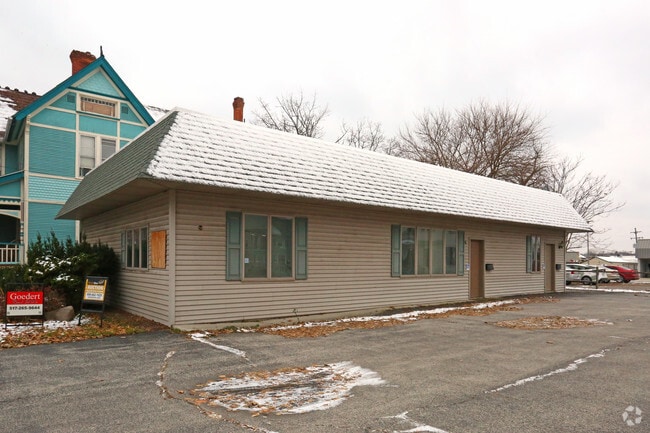
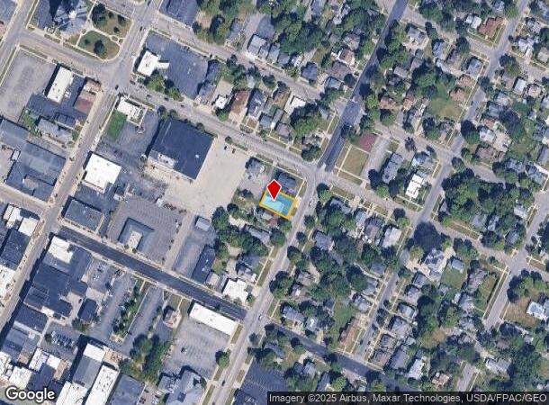
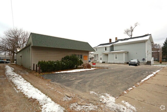
Property Record
235 N Broad St, Adrian, MI 49221
NEARBY LISTINGS FOR SALE OR LEASE
Property Detail
235 N Broad St
Adrian, MI
Original Plat
XA0-000-0119-00
E 100 FT OF LOT 114 ORIGINAL PLAT
Commercialnec
Lenawee
X
Michigan
26091C0193D
114
2024
0.15 AC
2025
Lenawee County
061302
Toledo
1,830 SF
DEMOGRAPHICS near 235 N Broad St
1 Mile
3 Mile
5 Mile
2024 Total Population
10,721
31,162
37,694
2029 Population
10,647
30,864
37,312
Pop Growth 2024-2029
(0.69%)
(0.96%)
(1.01%)
Average Age
38
40
40
2024 Total Households
4,197
11,449
13,723
HH Growth 2024-2029
(0.76%)
(1.02%)
(1.07%)
Median Household Inc
$29,370
$44,875
$49,605
Avg Household Size
2.30
2.30
2.40
2024 Avg HH Vehicles
1.00
2.00
2.00
Median Home Value
$80,154
$125,603
$140,103
Median Year Built
1949
1966
1970
Nearby Places
Map Layers
Map Styles
 Street
 Aerial
- Restaurants
- Banks
- Shops
- Fitness
- Groceries
PUBLIC TRANSPORTATION
AIRPORT
Eugene F Kranz Toledo Express
DRIVE
WALK
Distance
Eugene F Kranz Toledo Express
61 min
38.9 mi
Freight Ports
Port of Toledo
DRIVE
WALK
Distance
Port of Toledo
63 min
42.6 mi
SALE & LEASE HISTORY
LISTING DATE
SALE/LEASE

Jul 26, 2017
For Sale
Dec 04, 2018
For Sale
Nearby Properties
Address
Land Use
TOTAL SIZE
Lot Size
Zoning
Address
Land Use
TOTAL SIZE
Lot Size
Zoning
198,348 SF
28.50 AC
Address
Land Use
TOTAL SIZE
Lot Size
Zoning
297,470 SF
31.39 AC
I-2
Address
Land Use
TOTAL SIZE
Lot Size
Zoning
19,469 SF
27.08 AC
I-2
Address
Land Use
TOTAL SIZE
Lot Size
Zoning
21.68 AC
B-4
Address
Land Use
TOTAL SIZE
Lot Size
Zoning
Address
Land Use
TOTAL SIZE
Lot Size
Zoning
51,068 SF
7.07 AC
Address
Land Use
TOTAL SIZE
Lot Size
Zoning
122,669 SF
14.27 AC
B-4
Address
Land Use
TOTAL SIZE
Lot Size
Zoning
83,180 SF
3.14 AC
ERO
Address
Land Use
TOTAL SIZE
Lot Size
Zoning
27,436 SF
79.87 AC
CI
Address
Land Use
TOTAL SIZE
Lot Size
Zoning
119,884 SF
9.37 AC
RM-1
Address
Land Use
TOTAL SIZE
Lot Size
Zoning
101,287 SF
16.98 AC
B-4
Address
Land Use
TOTAL SIZE
Lot Size
Zoning
805,326 SF
50.38 AC
Address
Land Use
TOTAL SIZE
Lot Size
Zoning
136,850 SF
10.37 AC
RM-1
Address
Land Use
TOTAL SIZE
Lot Size
Zoning
35,880 SF
2.45 AC
Address
Land Use
TOTAL SIZE
Lot Size
Zoning
77,162 SF
22.82 AC
CI
Address
Land Use
TOTAL SIZE
Lot Size
Zoning
512,408 SF
33.83 AC
I-2
Address
Land Use
TOTAL SIZE
Lot Size
Zoning
53,333 SF
6.70 AC
B-4
Address
Land Use
TOTAL SIZE
Lot Size
Zoning
86,479 SF
4.79 AC
Address
Land Use
TOTAL SIZE
Lot Size
Zoning
33,858 SF
14.53 AC
OS-1
Address
Land Use
TOTAL SIZE
Lot Size
Zoning
49,676 SF
0.94 AC
RM-2
Address
Land Use
TOTAL SIZE
Lot Size
Zoning
29.25 AC
B-4
Address
Land Use
TOTAL SIZE
Lot Size
Zoning
42,682 SF
6.41 AC
B-2
Address
Land Use
TOTAL SIZE
Lot Size
Zoning
191,777 SF
6.15 AC
E-1
Address
Land Use
TOTAL SIZE
Lot Size
Zoning
35,534 SF
4.48 AC
Address
Land Use
TOTAL SIZE
Lot Size
Zoning
30,451 SF
7.99 AC
Address
Land Use
TOTAL SIZE
Lot Size
Zoning
73,636 SF
9.99 AC
RM-1
Address
Land Use
TOTAL SIZE
Lot Size
Zoning
86,971 SF
9.56 AC
RM-1
Address
Land Use
TOTAL SIZE
Lot Size
Zoning
17,751 SF
2.76 AC
B-2
Address
Land Use
TOTAL SIZE
Lot Size
Zoning
72,839 SF
7.05 AC
RM-1
Address
Land Use
TOTAL SIZE
Lot Size
Zoning
37.20 AC
The World's #1 Commercial Real Estate Marketplace
Connect with us
© 2025 CoStar Group
The information above has been obtained from sources believed reliable. While we do not doubt its accuracy we have not verified it and make no guarantee, warranty or representation about it. It is your responsibility to independently confirm its accuracy and completeness. Any projections, opinions, assumptions, or estimates used are for example only and do not represent the current or future performance of the property. The value of this transaction to you depends on tax and other factors which should be evaluated by your tax, financial, and legal advisors. You and your advisors should conduct a careful, independent investigation of the property to determine to your satisfaction the suitability of the property for your needs.