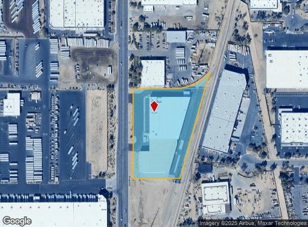
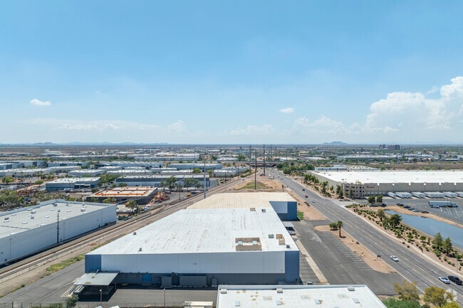
Property Record
235 S 56Th St, Chandler, AZ 85226
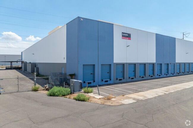
This Property Is For Sale
Current Lease Availabilities
NEARBY LISTINGS FOR SALE OR LEASE
Property Detail
235 S 56Th St
Phoenix
56Th & Frye
Phoenix-Mesa-Scottsdale, AZ
56TH & FRYE MCR 1536-31
301-85-835
Maricopa
Warehouse
Arizona
2025
10a
2025
5.26 AC
980400
Chandler
105,042 SF
DEMOGRAPHICS near 235 S 56Th St
1 Mile
3 Mile
5 Mile
2024 Total Population
3,392
70,064
159,113
2029 Population
3,650
75,311
171,029
Pop Growth 2024-2029
+ 7.61%
+ 7.49%
+ 7.49%
Average Age
37
39
39
2024 Total Households
1,600
28,128
63,991
HH Growth 2024-2029
+ 7.69%
+ 7.59%
+ 7.60%
Median Household Inc
$78,197
$97,648
$94,819
Avg Household Size
2.10
2.40
2.40
2024 Avg HH Vehicles
1.00
2.00
2.00
Median Home Value
$416,118
$419,530
$418,086
Median Year Built
1999
1992
1990
Nearby Places
Map Layers
Map Styles
 Street
 Aerial
- Restaurants
- Banks
- Shops
- Fitness
- Groceries
PUBLIC TRANSPORTATION
AIRPORT
Phoenix Sky Harbor International
DRIVE
WALK
Distance
Phoenix Sky Harbor International
19 min
12.4 mi
Phoenix-Mesa Gateway
DRIVE
WALK
Distance
Phoenix-Mesa Gateway
29 min
19.1 mi
Freight Ports
Port of San Diego
DRIVE
WALK
Distance
Port of San Diego
391 min
358.4 mi
Nearby Properties
Address
Land Use
TOTAL SIZE
Lot Size
Zoning
Address
Land Use
TOTAL SIZE
Lot Size
Zoning
47,945 SF
8.35 AC
C-C
Address
Land Use
TOTAL SIZE
Lot Size
Zoning
1,149,733 SF
70.56 AC
PAD
Address
Land Use
TOTAL SIZE
Lot Size
Zoning
14.98 AC
I-1
Address
Land Use
TOTAL SIZE
Lot Size
Zoning
656,241 SF
29.09 AC
PAD
Address
Land Use
TOTAL SIZE
Lot Size
Zoning
1,085,359 SF
74.95 AC
PAD
Address
Land Use
TOTAL SIZE
Lot Size
Zoning
390,410 SF
47.65 AC
R-35
Address
Land Use
TOTAL SIZE
Lot Size
Zoning
442,642 SF
35.15 AC
GID
Address
Land Use
TOTAL SIZE
Lot Size
Zoning
393,258 SF
49.79 AC
AG
Address
Land Use
TOTAL SIZE
Lot Size
Zoning
412,062 SF
21.84 AC
C-C
Address
Land Use
TOTAL SIZE
Lot Size
Zoning
713,461 SF
38.66 AC
I-1
Address
Land Use
TOTAL SIZE
Lot Size
Zoning
283,782 SF
25.29 AC
I-1
Address
Land Use
TOTAL SIZE
Lot Size
Zoning
409,148 SF
29.15 AC
I-1
Address
Land Use
TOTAL SIZE
Lot Size
Zoning
230,853 SF
23.41 AC
C-R
Address
Land Use
TOTAL SIZE
Lot Size
Zoning
244,900 SF
38.47 AC
PF
Address
Land Use
TOTAL SIZE
Lot Size
Zoning
300,965 SF
13.37 AC
PAD
Address
Land Use
TOTAL SIZE
Lot Size
Zoning
229,469 SF
23.78 AC
PAD
Address
Land Use
TOTAL SIZE
Lot Size
Zoning
240,814 SF
22.70 AC
C2
Address
Land Use
TOTAL SIZE
Lot Size
Zoning
422,759 SF
22.23 AC
M-H
Address
Land Use
TOTAL SIZE
Lot Size
Zoning
480,044 SF
20.47 AC
R-3A
Address
Land Use
TOTAL SIZE
Lot Size
Zoning
13,636 SF
32.62 AC
R-35
Address
Land Use
TOTAL SIZE
Lot Size
Zoning
306,300 SF
16.54 AC
PAD
Address
Land Use
TOTAL SIZE
Lot Size
Zoning
215,895 SF
17.49 AC
C-C
Address
Land Use
TOTAL SIZE
Lot Size
Zoning
177,459 SF
6.87 AC
PAD
Address
Land Use
TOTAL SIZE
Lot Size
Zoning
175,654 SF
12.13 AC
PAD
Address
Land Use
TOTAL SIZE
Lot Size
Zoning
225,117 SF
4.85 AC
PAD
Address
Land Use
TOTAL SIZE
Lot Size
Zoning
298,447 SF
16.30 AC
M-H
Address
Land Use
TOTAL SIZE
Lot Size
Zoning
108,932 SF
12 AC
I-1
Address
Land Use
TOTAL SIZE
Lot Size
Zoning
217,762 SF
7.69 AC
GID
Address
Land Use
TOTAL SIZE
Lot Size
Zoning
288,375 SF
14.47 AC
M-H
Address
Land Use
TOTAL SIZE
Lot Size
Zoning
131,171 SF
16.80 AC
PAD
The World's #1 Commercial Real Estate Marketplace
Connect with us
© 2025 CoStar Group
The information above has been obtained from sources believed reliable. While we do not doubt its accuracy we have not verified it and make no guarantee, warranty or representation about it. It is your responsibility to independently confirm its accuracy and completeness. Any projections, opinions, assumptions, or estimates used are for example only and do not represent the current or future performance of the property. The value of this transaction to you depends on tax and other factors which should be evaluated by your tax, financial, and legal advisors. You and your advisors should conduct a careful, independent investigation of the property to determine to your satisfaction the suitability of the property for your needs.