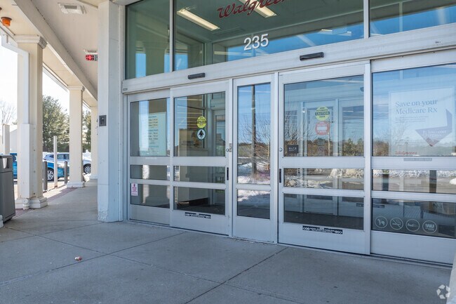
Property Record
235 S Main St, Middleton, MA 01949


Property Detail
235 S Main St
MIDD-000033-000000-000031B
Essex
Storebuilding
Massachusetts
M1
31 b
B and X Area of moderate flood hazard, usually the area between the limits of the 100-year and 500-year floods.
2.47 AC
2025
Danvers/Beverly
2025
Boston
212102
Boston-Cambridge-Newton, MA-NH
14,412 SF
NEARBY LISTINGS FOR SALE OR LEASE
DEMOGRAPHICS near 235 S Main St
1 mile
3 mile
5 mile
2025 Total Population
2,660
42,977
110,440
2030 Population
2,750
44,289
113,609
Pop Growth 2025-2030
+ 3.38%
+ 3.05%
+ 2.87%
Average Age
45
46
44
2025 Total Households
996
16,683
42,414
HH Growth 2025-2030
+ 3.31%
+ 3.20%
+ 2.87%
Median Household Inc
$135,237
$123,995
$120,703
Avg Household Size
2.60
2.40
2.50
2025 Avg HH Vehicles
2.00
2.00
2.00
Median Home Value
$739,831
$705,154
$730,943
Median Year Built
1988
1980
1970
Nearby Places
Map Layers
Map Styles
 Street
 Aerial
Layers
 Traffic
 Biking
Places
Listings with unknown addresses are not visible on the map
- Restaurants
- Banks
- Shops
- Fitness
- Groceries
PUBLIC TRANSPORTATION
COMMUTER RAIL
Salem (Newburyport/Rockport Line - Massachusetts Bay Transportation Authority Commuter Rail (Purple Line))
Drive
Walk
Distance
Salem (Newburyport/Rockport Line - Massachusetts Bay Transportation Authority Commuter Rail (Purple Line))
16 min
7.3 mi
North Beverly (Newburyport/Rockport Line - Massachusetts Bay Transportation Authority Commuter Rail (Purple Line))
Drive
Walk
Distance
North Beverly (Newburyport/Rockport Line - Massachusetts Bay Transportation Authority Commuter Rail (Purple Line))
14 min
7.5 mi
AIRPORT
General Edward Lawrence Logan International
Drive
Walk
Distance
General Edward Lawrence Logan International
31 min
18.1 mi
Manchester Boston Regional
Drive
Walk
Distance
Manchester Boston Regional
66 min
41.1 mi
Portsmouth International at Pease
Drive
Walk
Distance
Portsmouth International at Pease
55 min
41.5 mi
Freight Ports
Port of Boston
Drive
Walk
Distance
Port of Boston
34 min
21.1 mi
SALE & LEASE HISTORY
LISTING DATE
SALE/LEASE

Nov 20, 2024
For Sale
Jul 07, 2022
For Sale
Aug 11, 2022
For Sale
Nearby Properties
Address
Land Use
TOTAL SIZE
Lot Size
Zoning
Address
Land Use
TOTAL SIZE
Lot Size
Zoning
747,237 SF
36.70 AC
HW
Address
Land Use
TOTAL SIZE
Lot Size
Zoning
17 AC
R4
Address
Land Use
TOTAL SIZE
Lot Size
Zoning
198.74 AC
R3
Address
Land Use
TOTAL SIZE
Lot Size
Zoning
13.04 AC
HC
Address
Land Use
TOTAL SIZE
Lot Size
Zoning
49.85 AC
R1B
Address
Land Use
TOTAL SIZE
Lot Size
Zoning
101,389 SF
20 AC
I
Address
Land Use
TOTAL SIZE
Lot Size
Zoning
65.79 AC
I1
Address
Land Use
TOTAL SIZE
Lot Size
Zoning
40.20 AC
R1B
Address
Land Use
TOTAL SIZE
Lot Size
Zoning
206.65 AC
R1B
Address
Land Use
TOTAL SIZE
Lot Size
Zoning
54,302 SF
83.70 AC
R3
Address
Land Use
TOTAL SIZE
Lot Size
Zoning
93,789 SF
8.22 AC
HW
Address
Land Use
TOTAL SIZE
Lot Size
Zoning
111.24 AC
R3
Address
Land Use
TOTAL SIZE
Lot Size
Zoning
19.10 AC
R114
Address
Land Use
TOTAL SIZE
Lot Size
Zoning
15.32 AC
HC
Address
Land Use
TOTAL SIZE
Lot Size
Zoning
71.68 AC
R3
Address
Land Use
TOTAL SIZE
Lot Size
Zoning
12.57 AC
IH
Address
Land Use
TOTAL SIZE
Lot Size
Zoning
15.88 AC
BR
Address
Land Use
TOTAL SIZE
Lot Size
Zoning
24.54 AC
M1
Address
Land Use
TOTAL SIZE
Lot Size
Zoning
36,156 SF
754.25 AC
R1A
Address
Land Use
TOTAL SIZE
Lot Size
Zoning
81,746 SF
10.50 AC
R1A
Address
Land Use
TOTAL SIZE
Lot Size
Zoning
4.26 AC
R114
Address
Land Use
TOTAL SIZE
Lot Size
Zoning
24.87 AC
R3
Address
Land Use
TOTAL SIZE
Lot Size
Zoning
181,659 SF
11.57 AC
R114
Address
Land Use
TOTAL SIZE
Lot Size
Zoning
83,916 SF
15 AC
R3
Address
Land Use
TOTAL SIZE
Lot Size
Zoning
30.70 AC
R2
Address
Land Use
TOTAL SIZE
Lot Size
Zoning
175,699 SF
22.91 AC
R3
Address
Land Use
TOTAL SIZE
Lot Size
Zoning
115,348 SF
16.40 AC
HCD
Address
Land Use
TOTAL SIZE
Lot Size
Zoning
127,748 SF
13.64 AC
HC
Address
Land Use
TOTAL SIZE
Lot Size
Zoning
13.80 AC
BN2
Address
Land Use
TOTAL SIZE
Lot Size
Zoning
114,680 SF
13.73 AC
HC
The World's #1 Commercial Real Estate Marketplace
Connect with us
© 2026 CoStar Group
The information above has been obtained from sources believed reliable. While we do not doubt its accuracy we have not verified it and make no guarantee, warranty or representation about it. It is your responsibility to independently confirm its accuracy and completeness. Any projections, opinions, assumptions, or estimates used are for example only and do not represent the current or future performance of the property. The value of this transaction to you depends on tax and other factors which should be evaluated by your tax, financial, and legal advisors. You and your advisors should conduct a careful, independent investigation of the property to determine to your satisfaction the suitability of the property for your needs.