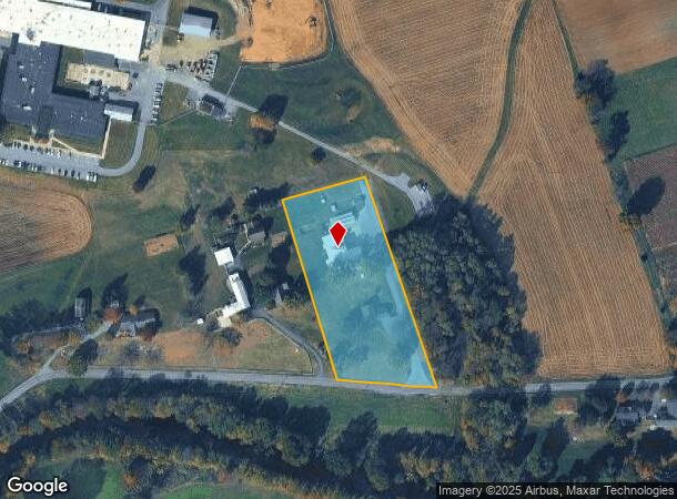
Property Record
235 Turtle Hill Rd, Ephrata, PA 17522


NEARBY LISTINGS FOR SALE OR LEASE
Property Detail
235 Turtle Hill Rd
Lancaster, PA
Turtle Hill Road Tr 779
210-60517-0-0000
235 TURTLE HILL RD
Shipyard
Lancaster
AE
Pennsylvania
42071C0189F
5a
2024
3.10 AC
2025
Lancaster County
013001
Philadelphia
13,222 SF
DEMOGRAPHICS near 235 Turtle Hill Rd
1 Mile
3 Mile
5 Mile
2024 Total Population
690
20,979
56,641
2029 Population
686
21,043
56,882
Pop Growth 2024-2029
(0.58%)
+ 0.31%
+ 0.43%
Average Age
39
40
40
2024 Total Households
234
7,971
21,089
HH Growth 2024-2029
(0.43%)
+ 0.41%
+ 0.49%
Median Household Inc
$99,768
$70,833
$73,903
Avg Household Size
2.90
2.60
2.60
2024 Avg HH Vehicles
2.00
2.00
2.00
Median Home Value
$253,092
$226,676
$250,451
Median Year Built
1986
1978
1976
Nearby Places
Map Layers
Map Styles
 Street
 Aerial
- Restaurants
- Banks
- Shops
- Fitness
- Groceries
SALE & LEASE HISTORY
LISTING DATE
SALE/LEASE

Mar 27, 2024
For Lease
Nearby Properties
Address
Land Use
TOTAL SIZE
Lot Size
Zoning
Address
Land Use
TOTAL SIZE
Lot Size
Zoning
154,041 SF
12.78 AC
Address
Land Use
TOTAL SIZE
Lot Size
Zoning
103,448 SF
79.90 AC
A
Address
Land Use
TOTAL SIZE
Lot Size
Zoning
122,512 SF
22.36 AC
I
Address
Land Use
TOTAL SIZE
Lot Size
Zoning
87,464 SF
7.30 AC
R-2
Address
Land Use
TOTAL SIZE
Lot Size
Zoning
88,413 SF
5.30 AC
RMD
Address
Land Use
TOTAL SIZE
Lot Size
Zoning
85,104 SF
24.20 AC
Address
Land Use
TOTAL SIZE
Lot Size
Zoning
123,018 SF
14.30 AC
HC
Address
Land Use
TOTAL SIZE
Lot Size
Zoning
73,648 SF
10.20 AC
R-1
Address
Land Use
TOTAL SIZE
Lot Size
Zoning
92,217 SF
11.50 AC
C
Address
Land Use
TOTAL SIZE
Lot Size
Zoning
55,896 SF
3.49 AC
Address
Land Use
TOTAL SIZE
Lot Size
Zoning
51,954 SF
11.80 AC
R-1
Address
Land Use
TOTAL SIZE
Lot Size
Zoning
81,044 SF
4.67 AC
Address
Land Use
TOTAL SIZE
Lot Size
Zoning
104,828 SF
5.94 AC
I
Address
Land Use
TOTAL SIZE
Lot Size
Zoning
64,500 SF
19.60 AC
RLD
Address
Land Use
TOTAL SIZE
Lot Size
Zoning
220,374 SF
20.62 AC
I
Address
Land Use
TOTAL SIZE
Lot Size
Zoning
16,054 SF
4.50 AC
HC
Address
Land Use
TOTAL SIZE
Lot Size
Zoning
14.50 AC
I
Address
Land Use
TOTAL SIZE
Lot Size
Zoning
51,064 SF
1.28 AC
Address
Land Use
TOTAL SIZE
Lot Size
Zoning
20,116 SF
3.50 AC
HC
Address
Land Use
TOTAL SIZE
Lot Size
Zoning
17,176 SF
3.95 AC
CC
Address
Land Use
TOTAL SIZE
Lot Size
Zoning
34,394 SF
1.82 AC
Address
Land Use
TOTAL SIZE
Lot Size
Zoning
44,625 SF
9.61 AC
C-2
Address
Land Use
TOTAL SIZE
Lot Size
Zoning
46,339 SF
39 AC
RMD
Address
Land Use
TOTAL SIZE
Lot Size
Zoning
26,072 SF
6.35 AC
C-2
Address
Land Use
TOTAL SIZE
Lot Size
Zoning
43,155 SF
2 AC
C-1
Address
Land Use
TOTAL SIZE
Lot Size
Zoning
66,735 SF
3.50 AC
C-2
Address
Land Use
TOTAL SIZE
Lot Size
Zoning
68,412 SF
8.04 AC
C-2
Address
Land Use
TOTAL SIZE
Lot Size
Zoning
19,940 SF
2.44 AC
C2
Address
Land Use
TOTAL SIZE
Lot Size
Zoning
36,121 SF
2.60 AC
Address
Land Use
TOTAL SIZE
Lot Size
Zoning
16,710 SF
1.57 AC
C-2
The World's #1 Commercial Real Estate Marketplace
Connect with us
© 2025 CoStar Group
The information above has been obtained from sources believed reliable. While we do not doubt its accuracy we have not verified it and make no guarantee, warranty or representation about it. It is your responsibility to independently confirm its accuracy and completeness. Any projections, opinions, assumptions, or estimates used are for example only and do not represent the current or future performance of the property. The value of this transaction to you depends on tax and other factors which should be evaluated by your tax, financial, and legal advisors. You and your advisors should conduct a careful, independent investigation of the property to determine to your satisfaction the suitability of the property for your needs.