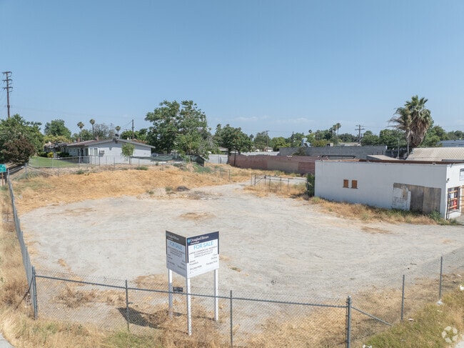
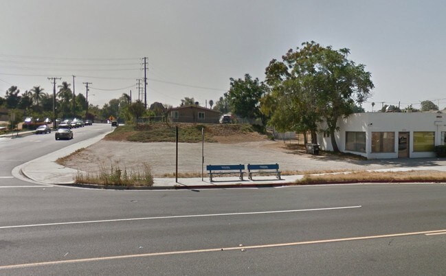
Property Record
2342 Main St, Riverside, CA 92501

NEARBY LISTINGS FOR SALE OR LEASE
Property Detail
2342 Main St
Riverside-San Bernardino-Ontario, CA
E N Smiths Sub
209-115-001
.25 ACRES M/L IN POR LOT 19 MB 005/179 E N SMITHS SUB
Commercialacreage
Riverside
X
California
06065C0726H
19
2024
0.25 AC
2025
Riverside
030103
Inland Empire (California)
DEMOGRAPHICS near 2342 Main St
1 mile
3 mile
5 mile
2024 Total Population
15,745
97,484
224,580
2029 Population
16,633
102,346
235,061
Pop Growth 2024-2029
+ 5.64%
+ 4.99%
+ 4.67%
Average Age
35
34
35
2024 Total Households
4,993
28,582
67,597
HH Growth 2024-2029
+ 5.51%
+ 4.72%
+ 4.37%
Median Household Inc
$76,248
$67,568
$76,209
Avg Household Size
3.00
3.00
3.10
2024 Avg HH Vehicles
2.00
2.00
2.00
Median Home Value
$403,980
$433,610
$455,007
Median Year Built
1962
1970
1973
Nearby Places
Map Layers
Map Styles
 Street
 Aerial
Transit
 Traffic
 Biking
Places
Listings with unknown addresses are not visible on the map
- Restaurants
- Banks
- Shops
- Fitness
- Groceries
PUBLIC TRANSPORTATION
COMMUTER RAIL
Riverside-Downtown (91 Line - Southern California Regional Rail Authority (Metrolink), Inland Empire-Orange County Line - Southern California Regional Rail Authority (Metrolink), Riverside Line - Southern California Regional Rail Authority (Metrolink))
Drive
Walk
Distance
Riverside-Downtown (91 Line - Southern California Regional Rail Authority (Metrolink), Inland Empire-Orange County Line - Southern California Regional Rail Authority (Metrolink), Riverside Line - Southern California Regional Rail Authority (Metrolink))
6 min
2.2 mi
Drive
Walk
Distance
5 min
2.6 mi
AIRPORT
Ontario International
Drive
Walk
Distance
Ontario International
20 min
15.2 mi
John Wayne/Orange County
Drive
Walk
Distance
John Wayne/Orange County
53 min
43.9 mi
Freight Ports
Port of Long Beach
Drive
Walk
Distance
Port of Long Beach
76 min
58.0 mi
SALE & LEASE HISTORY
LISTING DATE
SALE/LEASE

Oct 26, 2016
For Sale
Nearby Properties
Address
Land Use
TOTAL SIZE
Lot Size
Zoning
Address
Land Use
TOTAL SIZE
Lot Size
Zoning
1,186,950 SF
54.77 AC
Address
Land Use
TOTAL SIZE
Lot Size
Zoning
1,025,132 SF
46.44 AC
Address
Land Use
TOTAL SIZE
Lot Size
Zoning
1,000,177 SF
46 AC
Address
Land Use
TOTAL SIZE
Lot Size
Zoning
798,304 SF
42.64 AC
AMSP
Address
Land Use
TOTAL SIZE
Lot Size
Zoning
247,416 SF
10.17 AC
Address
Land Use
TOTAL SIZE
Lot Size
Zoning
1,009,120 SF
35.22 AC
Address
Land Use
TOTAL SIZE
Lot Size
Zoning
494,575 SF
25.33 AC
MP
Address
Land Use
TOTAL SIZE
Lot Size
Zoning
505,152 SF
28.88 AC
Address
Land Use
TOTAL SIZE
Lot Size
Zoning
599,735 SF
33.25 AC
AMSP
Address
Land Use
TOTAL SIZE
Lot Size
Zoning
369,842 SF
16.35 AC
Address
Land Use
TOTAL SIZE
Lot Size
Zoning
350,278 SF
1.21 AC
Address
Land Use
TOTAL SIZE
Lot Size
Zoning
447,190 SF
21.08 AC
Address
Land Use
TOTAL SIZE
Lot Size
Zoning
26,879 SF
16.27 AC
R3
Address
Land Use
TOTAL SIZE
Lot Size
Zoning
217,036 SF
1.66 AC
C2
Address
Land Use
TOTAL SIZE
Lot Size
Zoning
156,241 SF
2.55 AC
Address
Land Use
TOTAL SIZE
Lot Size
Zoning
55.22 AC
AMSP
Address
Land Use
TOTAL SIZE
Lot Size
Zoning
139,454 SF
0.97 AC
DSP
Address
Land Use
TOTAL SIZE
Lot Size
Zoning
750,700 SF
32.81 AC
AMSP
Address
Land Use
TOTAL SIZE
Lot Size
Zoning
36,010 SF
11.76 AC
R3
Address
Land Use
TOTAL SIZE
Lot Size
Zoning
210,004 SF
11.68 AC
Address
Land Use
TOTAL SIZE
Lot Size
Zoning
87,600 SF
0.39 AC
Address
Land Use
TOTAL SIZE
Lot Size
Zoning
244,495 SF
17.53 AC
MH
Address
Land Use
TOTAL SIZE
Lot Size
Zoning
134,944 SF
2.52 AC
Address
Land Use
TOTAL SIZE
Lot Size
Zoning
415,990 SF
5.16 AC
Address
Land Use
TOTAL SIZE
Lot Size
Zoning
307,163 SF
16.65 AC
Address
Land Use
TOTAL SIZE
Lot Size
Zoning
122,023 SF
6.83 AC
The World's #1 Commercial Real Estate Marketplace
Connect with us
© 2026 CoStar Group
The information above has been obtained from sources believed reliable. While we do not doubt its accuracy we have not verified it and make no guarantee, warranty or representation about it. It is your responsibility to independently confirm its accuracy and completeness. Any projections, opinions, assumptions, or estimates used are for example only and do not represent the current or future performance of the property. The value of this transaction to you depends on tax and other factors which should be evaluated by your tax, financial, and legal advisors. You and your advisors should conduct a careful, independent investigation of the property to determine to your satisfaction the suitability of the property for your needs.