Property Record
2350 Nw 71St Pl, Gainesville, FL 32653


NEARBY LISTINGS FOR SALE OR LEASE
Property Detail
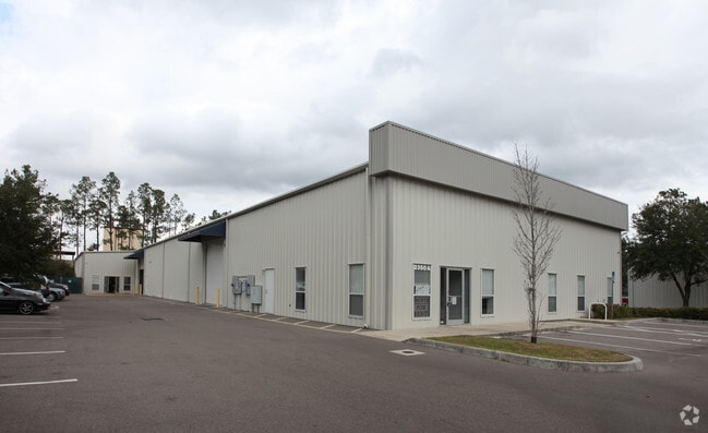
2350 Nw 71St Pl
Gainesville, FL
Minor S/D
07879-060-005
MINOR SUBDIVISION BK 2 PG 60 LOT 5 OR 4076/1058
Warehouse
Alachua
A
Florida
12001C0305E
5
2023
1.18 AC
2025
Gainesville
001802
Other Market Areas
11,730 SF
DEMOGRAPHICS near 2350 Nw 71St Pl
1 Mile
3 Mile
5 Mile
2024 Total Population
2,917
31,351
77,931
2029 Population
3,072
33,013
81,904
Pop Growth 2024-2029
+ 5.31%
+ 5.30%
+ 5.10%
Average Age
39
41
39
2024 Total Households
1,234
13,856
34,509
HH Growth 2024-2029
+ 5.35%
+ 5.46%
+ 5.17%
Median Household Inc
$50,682
$69,227
$62,061
Avg Household Size
2.30
2.20
2.20
2024 Avg HH Vehicles
2.00
2.00
2.00
Median Home Value
$162,665
$211,516
$229,577
Median Year Built
1978
1985
1980
Nearby Places
Map Layers
Map Styles
 Street
 Aerial
- Restaurants
- Banks
- Shops
- Fitness
- Groceries
PUBLIC TRANSPORTATION
AIRPORT
Gainesville Regional
DRIVE
WALK
Distance
Gainesville Regional
17 min
7.0 mi
SALE & LEASE HISTORY
LISTING DATE
SALE/LEASE

Jul 31, 2023
For Lease
Aug 19, 2021
For Lease
Nearby Properties
Address
Land Use
TOTAL SIZE
Lot Size
Zoning
Address
Land Use
TOTAL SIZE
Lot Size
Zoning
395,561 SF
19.11 AC
PD
Address
Land Use
TOTAL SIZE
Lot Size
Zoning
60,480 SF
117.68 AC
PS
Address
Land Use
TOTAL SIZE
Lot Size
Zoning
385,880 SF
21.51 AC
PD
Address
Land Use
TOTAL SIZE
Lot Size
Zoning
233,458 SF
16.30 AC
PD
Address
Land Use
TOTAL SIZE
Lot Size
Zoning
206,923 SF
15.32 AC
ED
Address
Land Use
TOTAL SIZE
Lot Size
Zoning
188,858 SF
15 AC
ED
Address
Land Use
TOTAL SIZE
Lot Size
Zoning
74,722 SF
9.71 AC
PD
Address
Land Use
TOTAL SIZE
Lot Size
Zoning
152,739 SF
15.30 AC
RMF6
Address
Land Use
TOTAL SIZE
Lot Size
Zoning
69,139 SF
2.18 AC
I1
Address
Land Use
TOTAL SIZE
Lot Size
Zoning
34.32 AC
PS
Address
Land Use
TOTAL SIZE
Lot Size
Zoning
80,995 SF
9.59 AC
MU1
Address
Land Use
TOTAL SIZE
Lot Size
Zoning
136,094 SF
16.11 AC
ED
Address
Land Use
TOTAL SIZE
Lot Size
Zoning
129,624 SF
11.27 AC
RMF7
Address
Land Use
TOTAL SIZE
Lot Size
Zoning
58,472 SF
14.89 AC
ED
Address
Land Use
TOTAL SIZE
Lot Size
Zoning
103,590 SF
12.68 AC
R-2
Address
Land Use
TOTAL SIZE
Lot Size
Zoning
109,946 SF
24.56 AC
I2
Address
Land Use
TOTAL SIZE
Lot Size
Zoning
138,032 SF
32 AC
MH
Address
Land Use
TOTAL SIZE
Lot Size
Zoning
93,250 SF
2.20 AC
BA
Address
Land Use
TOTAL SIZE
Lot Size
Zoning
125,867 SF
13.43 AC
RMF6
Address
Land Use
TOTAL SIZE
Lot Size
Zoning
97,016 SF
6.76 AC
RMF7
Address
Land Use
TOTAL SIZE
Lot Size
Zoning
145,289 SF
9.66 AC
MU2
Address
Land Use
TOTAL SIZE
Lot Size
Zoning
77,330 SF
5 AC
BI
Address
Land Use
TOTAL SIZE
Lot Size
Zoning
79,550 SF
3.07 AC
CI
Address
Land Use
TOTAL SIZE
Lot Size
Zoning
71,712 SF
13.71 AC
RMF7
Address
Land Use
TOTAL SIZE
Lot Size
Zoning
81,359 SF
67.46 AC
RMF6
Address
Land Use
TOTAL SIZE
Lot Size
Zoning
16,784 SF
31.50 AC
PS
Address
Land Use
TOTAL SIZE
Lot Size
Zoning
1,512 SF
52.41 AC
MH
Address
Land Use
TOTAL SIZE
Lot Size
Zoning
100,179 SF
15.07 AC
BUS
Address
Land Use
TOTAL SIZE
Lot Size
Zoning
54,540 SF
14.49 AC
I1
Address
Land Use
TOTAL SIZE
Lot Size
Zoning
188,880 SF
1.65 AC
I2
The World's #1 Commercial Real Estate Marketplace
Connect with us
© 2025 CoStar Group
The information above has been obtained from sources believed reliable. While we do not doubt its accuracy we have not verified it and make no guarantee, warranty or representation about it. It is your responsibility to independently confirm its accuracy and completeness. Any projections, opinions, assumptions, or estimates used are for example only and do not represent the current or future performance of the property. The value of this transaction to you depends on tax and other factors which should be evaluated by your tax, financial, and legal advisors. You and your advisors should conduct a careful, independent investigation of the property to determine to your satisfaction the suitability of the property for your needs.