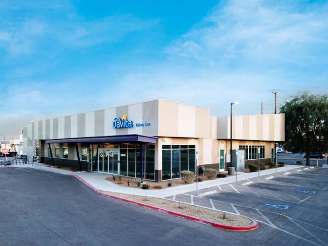
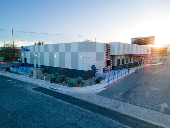
Property Record
2350 Stockton Ave, Las Vegas, NV 89104
NEARBY LISTINGS FOR SALE OR LEASE
Property Detail
2350 Stockton Ave
Las Vegas-Henderson-Paradise, NV
Parcel Map File 123 Page 044
162-02-802-004
PARCEL MAP FILE 123 PAGE 44 LOT 1
Commercialnec
Clark
X
Nevada
32003C2190F
1
2025
0.88 AC
2025
Central East Las Vegas
001402
Las Vegas
8,995 SF
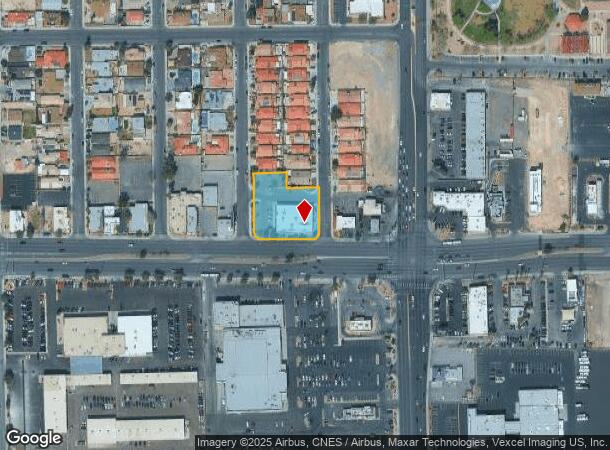
DEMOGRAPHICS near 2350 Stockton Ave
1 Mile
3 Mile
5 Mile
2024 Total Population
24,686
203,790
538,090
2029 Population
26,572
218,579
577,262
Pop Growth 2024-2029
+ 7.64%
+ 7.26%
+ 7.28%
Average Age
38
39
38
2024 Total Households
8,771
82,718
198,792
HH Growth 2024-2029
+ 7.66%
+ 7.31%
+ 7.41%
Median Household Inc
$44,312
$36,728
$40,696
Avg Household Size
2.70
2.40
2.60
2024 Avg HH Vehicles
2.00
1.00
1.00
Median Home Value
$267,836
$260,141
$259,624
Median Year Built
1971
1978
1982
Nearby Places
Map Layers
Map Styles
 Street
 Aerial
- Restaurants
- Banks
- Shops
- Fitness
- Groceries
PUBLIC TRANSPORTATION
AIRPORT
Harry Reid International
DRIVE
WALK
Distance
Harry Reid International
12 min
6.3 mi
Boulder City Municipal
DRIVE
WALK
Distance
Boulder City Municipal
31 min
23.1 mi
Freight Ports
Port of Long Beach
DRIVE
WALK
Distance
Port of Long Beach
318 min
284.2 mi
SALE & LEASE HISTORY
LISTING DATE
SALE/LEASE

Mar 04, 2025
For Sale
Nearby Properties
Address
Land Use
TOTAL SIZE
Lot Size
Zoning
Address
Land Use
TOTAL SIZE
Lot Size
Zoning
3,391,505 SF
68.55 AC
Address
Land Use
TOTAL SIZE
Lot Size
Zoning
1,044,724 SF
56.56 AC
Address
Land Use
TOTAL SIZE
Lot Size
Zoning
1,172,527 SF
19.67 AC
H1
Address
Land Use
TOTAL SIZE
Lot Size
Zoning
8,805 SF
45.63 AC
Address
Land Use
TOTAL SIZE
Lot Size
Zoning
74,148 SF
18.51 AC
Address
Land Use
TOTAL SIZE
Lot Size
Zoning
315,865 SF
19.85 AC
Address
Land Use
TOTAL SIZE
Lot Size
Zoning
79,707 SF
2.76 AC
Address
Land Use
TOTAL SIZE
Lot Size
Zoning
39,972 SF
3.04 AC
CV
Address
Land Use
TOTAL SIZE
Lot Size
Zoning
162,214 SF
4.32 AC
Address
Land Use
TOTAL SIZE
Lot Size
Zoning
497,331 SF
24.44 AC
Address
Land Use
TOTAL SIZE
Lot Size
Zoning
524,471 SF
59.01 AC
Address
Land Use
TOTAL SIZE
Lot Size
Zoning
162,501 SF
5.77 AC
C2
Address
Land Use
TOTAL SIZE
Lot Size
Zoning
34,354 SF
33.06 AC
Address
Land Use
TOTAL SIZE
Lot Size
Zoning
1,617,320 SF
7.21 AC
PD
Address
Land Use
TOTAL SIZE
Lot Size
Zoning
48.58 AC
PF
Address
Land Use
TOTAL SIZE
Lot Size
Zoning
2.79 AC
CV
Address
Land Use
TOTAL SIZE
Lot Size
Zoning
138.07 AC
PF
Address
Land Use
TOTAL SIZE
Lot Size
Zoning
20,924 SF
17.50 AC
H1
Address
Land Use
TOTAL SIZE
Lot Size
Zoning
24,965 SF
25.75 AC
Address
Land Use
TOTAL SIZE
Lot Size
Zoning
281,120 SF
21.38 AC
Address
Land Use
TOTAL SIZE
Lot Size
Zoning
1,283,663 SF
8.56 AC
PD
Address
Land Use
TOTAL SIZE
Lot Size
Zoning
5.96 AC
C2
Address
Land Use
TOTAL SIZE
Lot Size
Zoning
44,418 SF
5.08 AC
PD
Address
Land Use
TOTAL SIZE
Lot Size
Zoning
573,491 SF
38.94 AC
Address
Land Use
TOTAL SIZE
Lot Size
Zoning
814,789 SF
13.75 AC
C1
Address
Land Use
TOTAL SIZE
Lot Size
Zoning
345,133 SF
27.01 AC
H1
Address
Land Use
TOTAL SIZE
Lot Size
Zoning
9.01 AC
PF
Address
Land Use
TOTAL SIZE
Lot Size
Zoning
20.21 AC
H1
Address
Land Use
TOTAL SIZE
Lot Size
Zoning
123,990 SF
2.18 AC
C2
The World's #1 Commercial Real Estate Marketplace
Connect with us
© 2025 CoStar Group
The information above has been obtained from sources believed reliable. While we do not doubt its accuracy we have not verified it and make no guarantee, warranty or representation about it. It is your responsibility to independently confirm its accuracy and completeness. Any projections, opinions, assumptions, or estimates used are for example only and do not represent the current or future performance of the property. The value of this transaction to you depends on tax and other factors which should be evaluated by your tax, financial, and legal advisors. You and your advisors should conduct a careful, independent investigation of the property to determine to your satisfaction the suitability of the property for your needs.