Property Record
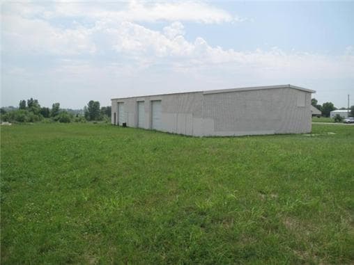
23505 S State Route 291, Harrisonville, MO 64701


NEARBY LISTINGS FOR SALE OR LEASE
Property Detail
23505 S State Route 291
1748100
N809.69 OF NW NW E OF HWY 291
Warehouse
Cass
X
Missouri
29037C0200F
6.82 AC
2023
Cass County
2025
Kansas City
060800
Kansas City, MO-KS
1,350 SF
DEMOGRAPHICS near 23505 S State Route 291
1 Mile
3 Mile
5 Mile
2024 Total Population
143
5,262
14,471
2029 Population
152
5,586
15,325
Pop Growth 2024-2029
+ 6.29%
+ 6.16%
+ 5.90%
Average Age
46
40
41
2024 Total Households
58
2,105
5,561
HH Growth 2024-2029
+ 5.17%
+ 6.27%
+ 6.02%
Median Household Inc
$69,999
$63,241
$67,160
Avg Household Size
2.30
2.40
2.50
2024 Avg HH Vehicles
2.00
2.00
2.00
Median Home Value
$371,428
$231,157
$243,216
Median Year Built
1996
1978
1979
Nearby Places
Map Layers
Map Styles
 Street
 Aerial
- Restaurants
- Banks
- Shops
- Fitness
- Groceries
Nearby Properties
Address
Land Use
TOTAL SIZE
Lot Size
Zoning
Address
Land Use
TOTAL SIZE
Lot Size
Zoning
197,883 SF
30 AC
Address
Land Use
TOTAL SIZE
Lot Size
Zoning
411,232 SF
26.77 AC
Address
Land Use
TOTAL SIZE
Lot Size
Zoning
157,628 SF
5.06 AC
Address
Land Use
TOTAL SIZE
Lot Size
Zoning
1,126,810 SF
17.17 AC
Address
Land Use
TOTAL SIZE
Lot Size
Zoning
15,840 SF
20 AC
Address
Land Use
TOTAL SIZE
Lot Size
Zoning
105,500 SF
4.29 AC
Address
Land Use
TOTAL SIZE
Lot Size
Zoning
65,356 SF
6.21 AC
Address
Land Use
TOTAL SIZE
Lot Size
Zoning
40,784 SF
0.45 AC
Address
Land Use
TOTAL SIZE
Lot Size
Zoning
3,040 SF
5 AC
Address
Land Use
TOTAL SIZE
Lot Size
Zoning
408,200 SF
10 AC
Address
Land Use
TOTAL SIZE
Lot Size
Zoning
45,480 SF
6.46 AC
Address
Land Use
TOTAL SIZE
Lot Size
Zoning
62,008 SF
4.97 AC
Address
Land Use
TOTAL SIZE
Lot Size
Zoning
88,957 SF
9.93 AC
Address
Land Use
TOTAL SIZE
Lot Size
Zoning
21,310 SF
3.40 AC
Address
Land Use
TOTAL SIZE
Lot Size
Zoning
20,600 SF
3.90 AC
Address
Land Use
TOTAL SIZE
Lot Size
Zoning
48.57 AC
Address
Land Use
TOTAL SIZE
Lot Size
Zoning
7,540 SF
0.82 AC
Address
Land Use
TOTAL SIZE
Lot Size
Zoning
84,525 SF
4.84 AC
Address
Land Use
TOTAL SIZE
Lot Size
Zoning
357,064 SF
6.88 AC
Address
Land Use
TOTAL SIZE
Lot Size
Zoning
5,355 SF
2.05 AC
Address
Land Use
TOTAL SIZE
Lot Size
Zoning
4,711 SF
1.97 AC
Address
Land Use
TOTAL SIZE
Lot Size
Zoning
82,692 SF
2.05 AC
Address
Land Use
TOTAL SIZE
Lot Size
Zoning
8,894 SF
0.22 AC
Address
Land Use
TOTAL SIZE
Lot Size
Zoning
14,736 SF
1.87 AC
Address
Land Use
TOTAL SIZE
Lot Size
Zoning
4,636 SF
2.19 AC
Address
Land Use
TOTAL SIZE
Lot Size
Zoning
13,146 SF
1.80 AC
Address
Land Use
TOTAL SIZE
Lot Size
Zoning
23,546 SF
1.84 AC
Address
Land Use
TOTAL SIZE
Lot Size
Zoning
35,678 SF
6 AC
Address
Land Use
TOTAL SIZE
Lot Size
Zoning
13,875 SF
4.71 AC
Address
Land Use
TOTAL SIZE
Lot Size
Zoning
11,910 SF
0.77 AC
The World's #1 Commercial Real Estate Marketplace
Connect with us
© 2025 CoStar Group
The information above has been obtained from sources believed reliable. While we do not doubt its accuracy we have not verified it and make no guarantee, warranty or representation about it. It is your responsibility to independently confirm its accuracy and completeness. Any projections, opinions, assumptions, or estimates used are for example only and do not represent the current or future performance of the property. The value of this transaction to you depends on tax and other factors which should be evaluated by your tax, financial, and legal advisors. You and your advisors should conduct a careful, independent investigation of the property to determine to your satisfaction the suitability of the property for your needs.