Property Record
23525 N 63Rd Dr, Glendale, AZ 85310

This Property Is For Sale
Current Lease Availabilities
Property Detail
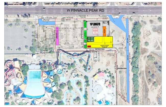
23525 N 63Rd Dr
Phoenix-Mesa-Chandler, AZ
ENCLAVE AT CREEKSIDE LOT 2 AMD MCR 1290-10
201-12-925
MARICOPA
Vacantlandnec
Arizona
R-6
2
C and X Area of minimal flood hazard, usually depicted on FIRMs as above the 500-year flood level.
0.89 AC
2025
Arrowhead
2025
Phoenix
611700
NEARBY LISTINGS FOR SALE OR LEASE
DEMOGRAPHICS near 23525 N 63Rd Dr
1 mile
3 mile
5 mile
2025 Total Population
4,565
77,485
207,088
2030 Population
4,700
80,036
214,294
Pop Growth 2025-2030
+ 2.96%
+ 3.29%
+ 3.48%
Average Age
43
40
40
2025 Total Households
1,595
26,806
75,409
HH Growth 2025-2030
+ 2.88%
+ 3.24%
+ 3.55%
Median Household Inc
$135,657
$132,870
$110,974
Avg Household Size
2.80
2.80
2.70
2025 Avg HH Vehicles
3.00
2.00
2.00
Median Home Value
$710,301
$649,120
$521,958
Median Year Built
1996
1998
1996
Nearby Places
Map Layers
Map Styles
 Street
 Aerial
Layers
 Traffic
 Biking
Places
Listings with unknown addresses are not visible on the map
- Restaurants
- Banks
- Shops
- Fitness
- Groceries
PUBLIC TRANSPORTATION
AIRPORT
Phoenix Sky Harbor International
Drive
Walk
Distance
Phoenix Sky Harbor International
43 min
30.1 mi
Freight Ports
Port of San Diego
Drive
Walk
Distance
Port of San Diego
405 min
362.3 mi
Nearby Properties
Address
Land Use
TOTAL SIZE
Lot Size
Zoning
Address
Land Use
TOTAL SIZE
Lot Size
Zoning
1,360,424 SF
88.31 AC
C-BP
Address
Land Use
TOTAL SIZE
Lot Size
Zoning
53,813 SF
1,286.11 AC
Address
Land Use
TOTAL SIZE
Lot Size
Zoning
812,333 SF
31.75 AC
SR-30
Address
Land Use
TOTAL SIZE
Lot Size
Zoning
239,750 SF
85.34 AC
SR43
Address
Land Use
TOTAL SIZE
Lot Size
Zoning
4,500 SF
13.50 AC
PAD
Address
Land Use
TOTAL SIZE
Lot Size
Zoning
235,399 SF
41.79 AC
M-M
Address
Land Use
TOTAL SIZE
Lot Size
Zoning
291,137 SF
38.49 AC
AG
Address
Land Use
TOTAL SIZE
Lot Size
Zoning
226,169 SF
20.48 AC
Address
Land Use
TOTAL SIZE
Lot Size
Zoning
133,377 SF
17.52 AC
PAD
Address
Land Use
TOTAL SIZE
Lot Size
Zoning
89,875 SF
72.52 AC
R-43AG
Address
Land Use
TOTAL SIZE
Lot Size
Zoning
280,356 SF
12.73 AC
PAD
Address
Land Use
TOTAL SIZE
Lot Size
Zoning
344,908 SF
20.69 AC
C-C
Address
Land Use
TOTAL SIZE
Lot Size
Zoning
126,814 SF
31.56 AC
R17
Address
Land Use
TOTAL SIZE
Lot Size
Zoning
244,979 SF
35.16 AC
C-BP
Address
Land Use
TOTAL SIZE
Lot Size
Zoning
98,628 SF
8.55 AC
R-43AG
Address
Land Use
TOTAL SIZE
Lot Size
Zoning
127,100 SF
3.57 AC
PAD
Address
Land Use
TOTAL SIZE
Lot Size
Zoning
96,016 SF
4.47 AC
PAD
Address
Land Use
TOTAL SIZE
Lot Size
Zoning
187,392 SF
10.36 AC
PAD
Address
Land Use
TOTAL SIZE
Lot Size
Zoning
102,816 SF
35.12 AC
AG
Address
Land Use
TOTAL SIZE
Lot Size
Zoning
96,954 SF
13.47 AC
PAD
Address
Land Use
TOTAL SIZE
Lot Size
Zoning
127,616 SF
27.49 AC
PAD
Address
Land Use
TOTAL SIZE
Lot Size
Zoning
209,546 SF
14.65 AC
M-M
Address
Land Use
TOTAL SIZE
Lot Size
Zoning
88,542 SF
14.50 AC
R-10
Address
Land Use
TOTAL SIZE
Lot Size
Zoning
84,341 SF
14.58 AC
R-43
Address
Land Use
TOTAL SIZE
Lot Size
Zoning
72,097 SF
13.72 AC
R-43AG
Address
Land Use
TOTAL SIZE
Lot Size
Zoning
73,662 SF
13.70 AC
R-6
Address
Land Use
TOTAL SIZE
Lot Size
Zoning
259,036 SF
14.56 AC
M-M
Address
Land Use
TOTAL SIZE
Lot Size
Zoning
78,822 SF
8.14 AC
AG
Address
Land Use
TOTAL SIZE
Lot Size
Zoning
73,694 SF
11.09 AC
R-6
Address
Land Use
TOTAL SIZE
Lot Size
Zoning
183,862 SF
10.37 AC
M-H
The World's #1 Commercial Real Estate Marketplace
Connect with us
© 2026 CoStar Group
The information above has been obtained from sources believed reliable. While we do not doubt its accuracy we have not verified it and make no guarantee, warranty or representation about it. It is your responsibility to independently confirm its accuracy and completeness. Any projections, opinions, assumptions, or estimates used are for example only and do not represent the current or future performance of the property. The value of this transaction to you depends on tax and other factors which should be evaluated by your tax, financial, and legal advisors. You and your advisors should conduct a careful, independent investigation of the property to determine to your satisfaction the suitability of the property for your needs.