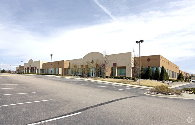
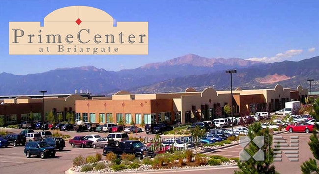
Property Record
2315 Briargate Pkwy, Colorado Springs, CO 80920


NEARBY LISTINGS FOR SALE OR LEASE
Property Detail
2315 Briargate Pkwy
Colorado Springs, CO
Briargate Business Campus Fil No 21
62331-08-051
LOT 1 BRIARGATE BUSINESS CAMPUS FIL NO 21
Officebuilding
El Paso
X
Colorado
08041C0508G
1
2024
12.67 AC
2025
Northeast
007000
Colorado Springs
125,238 SF
DEMOGRAPHICS near 2315 Briargate Pkwy
1 Mile
3 Mile
5 Mile
2024 Total Population
7,615
64,913
166,647
2029 Population
7,962
68,307
174,846
Pop Growth 2024-2029
+ 4.56%
+ 5.23%
+ 4.92%
Average Age
40
38
38
2024 Total Households
2,865
24,131
61,890
HH Growth 2024-2029
+ 5.06%
+ 5.40%
+ 5.09%
Median Household Inc
$109,603
$105,309
$101,032
Avg Household Size
2.60
2.70
2.60
2024 Avg HH Vehicles
2.00
2.00
2.00
Median Home Value
$486,184
$454,664
$455,165
Median Year Built
1998
1995
1996
Nearby Places
Map Layers
Map Styles
 Street
 Aerial
- Restaurants
- Banks
- Shops
- Fitness
- Groceries
PUBLIC TRANSPORTATION
AIRPORT
City of Colorado Springs Municipal
DRIVE
WALK
Distance
City of Colorado Springs Municipal
26 min
15.3 mi
Freight Ports
Tulsa Port Of Catoosa
DRIVE
WALK
Distance
Tulsa Port Of Catoosa
735 min
690.3 mi
SALE & LEASE HISTORY
LISTING DATE
SALE/LEASE

Sep 25, 2016
For Lease
Nearby Properties
Address
Land Use
TOTAL SIZE
Lot Size
Zoning
Address
Land Use
TOTAL SIZE
Lot Size
Zoning
361,165 SF
59.11 AC
PDZ
Address
Land Use
TOTAL SIZE
Lot Size
Zoning
177,966 SF
57.81 AC
PDZ HR
Address
Land Use
TOTAL SIZE
Lot Size
Zoning
261,339 SF
10.42 AC
MX-M CU
Address
Land Use
TOTAL SIZE
Lot Size
Zoning
257,140 SF
30.17 AC
MX-N/CR MX
Address
Land Use
TOTAL SIZE
Lot Size
Zoning
121,820 SF
14.73 AC
BP
Address
Land Use
TOTAL SIZE
Lot Size
Zoning
409,164 SF
19.26 AC
PUD
Address
Land Use
TOTAL SIZE
Lot Size
Zoning
187,841 SF
40.33 AC
A
Address
Land Use
TOTAL SIZE
Lot Size
Zoning
95,337 SF
49.29 AC
BP
Address
Land Use
TOTAL SIZE
Lot Size
Zoning
103,166 SF
8.88 AC
BP
Address
Land Use
TOTAL SIZE
Lot Size
Zoning
562,942 SF
27.13 AC
PDZ
Address
Land Use
TOTAL SIZE
Lot Size
Zoning
82,316 SF
4.08 AC
R-5/CR SS
Address
Land Use
TOTAL SIZE
Lot Size
Zoning
56,290 SF
6.55 AC
A/CR
Address
Land Use
TOTAL SIZE
Lot Size
Zoning
43,033 SF
17 AC
MX-M AO
Address
Land Use
TOTAL SIZE
Lot Size
Zoning
114,474 SF
12.95 AC
BP
Address
Land Use
TOTAL SIZE
Lot Size
Zoning
77,655 SF
8.39 AC
MX-N MX-N/
Address
Land Use
TOTAL SIZE
Lot Size
Zoning
480 SF
11 AC
A UV
Address
Land Use
TOTAL SIZE
Lot Size
Zoning
316,105 SF
19.73 AC
PDZ
Address
Land Use
TOTAL SIZE
Lot Size
Zoning
1,251,233 SF
17.63 AC
BP/CR HR
Address
Land Use
TOTAL SIZE
Lot Size
Zoning
58,774 SF
5 AC
BP
Address
Land Use
TOTAL SIZE
Lot Size
Zoning
41,117 SF
5.04 AC
MX-M
Address
Land Use
TOTAL SIZE
Lot Size
Zoning
64,928 SF
31.47 AC
A
Address
Land Use
TOTAL SIZE
Lot Size
Zoning
391,914 SF
3.13 AC
PDZ
Address
Land Use
TOTAL SIZE
Lot Size
Zoning
35,862 SF
5.95 AC
MX-N
Address
Land Use
TOTAL SIZE
Lot Size
Zoning
211,974 SF
25.15 AC
BP CU
Address
Land Use
TOTAL SIZE
Lot Size
Zoning
76,138 SF
4.84 AC
BP
Address
Land Use
TOTAL SIZE
Lot Size
Zoning
48,673 SF
5.51 AC
R-5 P
Address
Land Use
TOTAL SIZE
Lot Size
Zoning
68,829 SF
6 AC
BP/CR
Address
Land Use
TOTAL SIZE
Lot Size
Zoning
45,141 SF
6.97 AC
R-5/CR
Address
Land Use
TOTAL SIZE
Lot Size
Zoning
50,471 SF
7.28 AC
BP
Address
Land Use
TOTAL SIZE
Lot Size
Zoning
47,313 SF
11.15 AC
MX-N
The World's #1 Commercial Real Estate Marketplace
Connect with us
© 2026 CoStar Group
The information above has been obtained from sources believed reliable. While we do not doubt its accuracy we have not verified it and make no guarantee, warranty or representation about it. It is your responsibility to independently confirm its accuracy and completeness. Any projections, opinions, assumptions, or estimates used are for example only and do not represent the current or future performance of the property. The value of this transaction to you depends on tax and other factors which should be evaluated by your tax, financial, and legal advisors. You and your advisors should conduct a careful, independent investigation of the property to determine to your satisfaction the suitability of the property for your needs.