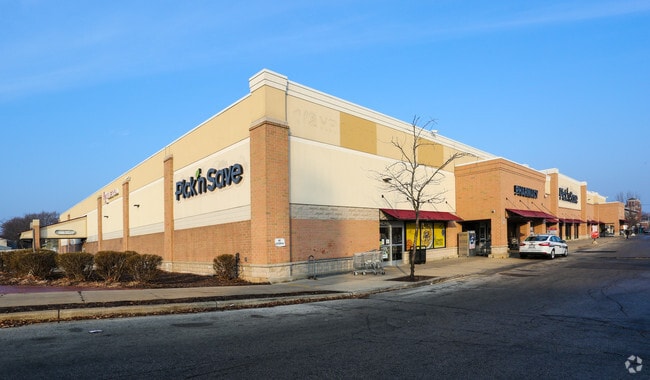
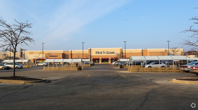
Property Record
2355 N 35Th St, Milwaukee, WI 53210


NEARBY LISTINGS FOR SALE OR LEASE
-
-
-
-
-
-
-
-
-
-
-
1801-1805 N Dr Martin Luther King Jr Dr
Milwaukee, WI 53212
$280,000 - $760,000
1,721 - 6,714 SF
Retail
-
-
View all Milwaukee listings for sale on LoopNet.com
Property Detail
2355 N 35Th St
Milwaukee-Waukesha-West Allis, WI
Stegers
327-1861-000-0
CERTIFIED SURVEY MAP NUMBER 7925 IN SW 1/4 SEC 13-7-21 LOT 1 NID #03,TID #40
Supermarket
Milwaukee
X
Wisconsin
55079C0087E
1
2024
5.69 AC
2024
Milwaukee West
009000
Milwaukee/Madison
63,201 SF
DEMOGRAPHICS near 2355 N 35Th St
1 Mile
3 Mile
5 Mile
2024 Total Population
30,276
219,589
511,719
2029 Population
30,136
217,212
503,033
Pop Growth 2024-2029
(0.46%)
(1.08%)
(1.70%)
Average Age
33
35
36
2024 Total Households
10,251
90,570
213,871
HH Growth 2024-2029
(0.58%)
(1.18%)
(1.71%)
Median Household Inc
$33,743
$40,161
$48,338
Avg Household Size
2.80
2.30
2.30
2024 Avg HH Vehicles
1.00
1.00
1.00
Median Home Value
$91,892
$157,676
$175,735
Median Year Built
1946
1947
1948
Nearby Places
Map Layers
Map Styles
 Street
 Aerial
- Restaurants
- Banks
- Shops
- Fitness
- Groceries
PUBLIC TRANSPORTATION
COMMUTER RAIL
DRIVE
WALK
Distance
10 min
3.5 mi
AIRPORT
General Mitchell International
DRIVE
WALK
Distance
General Mitchell International
20 min
10.1 mi
Nearby Properties
Address
Land Use
TOTAL SIZE
Lot Size
Zoning
Address
Land Use
TOTAL SIZE
Lot Size
Zoning
8.05 AC
TL
Address
Land Use
TOTAL SIZE
Lot Size
Zoning
730,000 SF
6.94 AC
PD
Address
Land Use
TOTAL SIZE
Lot Size
Zoning
3.04 AC
TL
Address
Land Use
TOTAL SIZE
Lot Size
Zoning
607,577 SF
1.67 AC
PD
Address
Land Use
TOTAL SIZE
Lot Size
Zoning
370,160 SF
2.93 AC
C9F(A)
Address
Land Use
TOTAL SIZE
Lot Size
Zoning
380,817 SF
0.82 AC
C9F(A)
Address
Land Use
TOTAL SIZE
Lot Size
Zoning
414,410 SF
2.16 AC
C9F(A)
Address
Land Use
TOTAL SIZE
Lot Size
Zoning
280,000 SF
2.74 AC
RED
Address
Land Use
TOTAL SIZE
Lot Size
Zoning
378,717 SF
0.61 AC
C9D(A)
Address
Land Use
TOTAL SIZE
Lot Size
Zoning
535,904 SF
3.88 AC
C9A(A)
Address
Land Use
TOTAL SIZE
Lot Size
Zoning
491,759 SF
3 AC
C9F(A)
Address
Land Use
TOTAL SIZE
Lot Size
Zoning
300,416 SF
1.24 AC
PD
Address
Land Use
TOTAL SIZE
Lot Size
Zoning
382,921 SF
2.81 AC
PD
Address
Land Use
TOTAL SIZE
Lot Size
Zoning
180,407 SF
0.63 AC
PD
Address
Land Use
TOTAL SIZE
Lot Size
Zoning
534,786 SF
1.81 AC
C9D(A)
Address
Land Use
TOTAL SIZE
Lot Size
Zoning
210,552 SF
2.43 AC
C9D(A)
Address
Land Use
TOTAL SIZE
Lot Size
Zoning
122.53 AC
TL
Address
Land Use
TOTAL SIZE
Lot Size
Zoning
508,168 SF
14.56 AC
C9G
Address
Land Use
TOTAL SIZE
Lot Size
Zoning
262,109 SF
2.24 AC
PD
Address
Land Use
TOTAL SIZE
Lot Size
Zoning
2.92 AC
C9D(A)
Address
Land Use
TOTAL SIZE
Lot Size
Zoning
0.07 AC
RS6
Address
Land Use
TOTAL SIZE
Lot Size
Zoning
0.09 AC
LB2
Address
Land Use
TOTAL SIZE
Lot Size
Zoning
5.85 AC
C9D(A)
Address
Land Use
TOTAL SIZE
Lot Size
Zoning
356,540 SF
1.69 AC
C9D(A)
Address
Land Use
TOTAL SIZE
Lot Size
Zoning
1,709,128 SF
9.32 AC
PD
Address
Land Use
TOTAL SIZE
Lot Size
Zoning
236,218 SF
1.47 AC
C9F(A)
Address
Land Use
TOTAL SIZE
Lot Size
Zoning
15.43 AC
PD
Address
Land Use
TOTAL SIZE
Lot Size
Zoning
247,344 SF
1.44 AC
RED
Address
Land Use
TOTAL SIZE
Lot Size
Zoning
110,000 SF
7.59 AC
TL
Address
Land Use
TOTAL SIZE
Lot Size
Zoning
150,370 SF
2.46 AC
C9G
The World's #1 Commercial Real Estate Marketplace
Connect with us
© 2025 CoStar Group
The information above has been obtained from sources believed reliable. While we do not doubt its accuracy we have not verified it and make no guarantee, warranty or representation about it. It is your responsibility to independently confirm its accuracy and completeness. Any projections, opinions, assumptions, or estimates used are for example only and do not represent the current or future performance of the property. The value of this transaction to you depends on tax and other factors which should be evaluated by your tax, financial, and legal advisors. You and your advisors should conduct a careful, independent investigation of the property to determine to your satisfaction the suitability of the property for your needs.