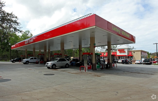
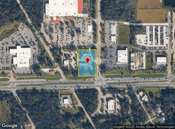
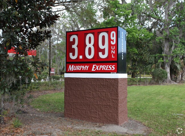
Property Record
2355 State Road 44, New Smyrna Beach, FL 32168
NEARBY LISTINGS FOR SALE OR LEASE
Property Detail
2355 State Road 44
Deltona-Daytona Beach-Ormond Beach, FL
Napier & Hull Grant Mb
7343-06-00-0062
IRREG PARCEL IN LOT 26 BLK 7 & IN LOT 29 BLK 14 NAPIER & HULL GRANT MB 12 PG 152 BEING N OF SR 44 & E OF TIMBERLANE DR MEAS 219.12 FT ON S/L & MEAS 310.53 ON E/L & MEAS 218.28 FT ON N/L & MEAS 315.13 FT ON W/L PER OR 4879 PG 3226-3232 INC PER OR 6432
Storemultistory
Volusia
X
Florida
12127C0540J
26,29
2025
1.57 AC
2025
South Beach Cities
082903
Deltona/Daytona Beach
2,971 SF
DEMOGRAPHICS near 2355 State Road 44
1 Mile
3 Mile
5 Mile
2024 Total Population
3,487
21,871
52,951
2029 Population
3,917
24,514
59,603
Pop Growth 2024-2029
+ 12.33%
+ 12.08%
+ 12.56%
Average Age
45
48
49
2024 Total Households
1,553
10,005
24,468
HH Growth 2024-2029
+ 12.56%
+ 12.22%
+ 12.87%
Median Household Inc
$74,726
$58,783
$63,095
Avg Household Size
2.20
2.10
2.10
2024 Avg HH Vehicles
2.00
2.00
2.00
Median Home Value
$266,168
$260,438
$295,346
Median Year Built
2001
1987
1988
Nearby Places
Map Layers
Map Styles
 Street
 Aerial
- Restaurants
- Banks
- Shops
- Fitness
- Groceries
PUBLIC TRANSPORTATION
AIRPORT
Daytona Beach International
DRIVE
WALK
Distance
Daytona Beach International
23 min
16.1 mi
Orlando Sanford International
DRIVE
WALK
Distance
Orlando Sanford International
43 min
29.9 mi
Freight Ports
Port Canaveral
DRIVE
WALK
Distance
Port Canaveral
69 min
58.6 mi
Nearby Properties
Address
Land Use
TOTAL SIZE
Lot Size
Zoning
Address
Land Use
TOTAL SIZE
Lot Size
Zoning
317,281 SF
21.97 AC
RR
Address
Land Use
TOTAL SIZE
Lot Size
Zoning
360,394 SF
65.63 AC
01R4
Address
Land Use
TOTAL SIZE
Lot Size
Zoning
177,619 SF
6.91 AC
10R2
Address
Land Use
TOTAL SIZE
Lot Size
Zoning
260,126 SF
2 AC
10R3
Address
Land Use
TOTAL SIZE
Lot Size
Zoning
108,577 SF
20 AC
10R2
Address
Land Use
TOTAL SIZE
Lot Size
Zoning
209,027 SF
29.13 AC
10R2A
Address
Land Use
TOTAL SIZE
Lot Size
Zoning
150,044 SF
19.80 AC
R4
Address
Land Use
TOTAL SIZE
Lot Size
Zoning
162,622 SF
20.33 AC
B62
Address
Land Use
TOTAL SIZE
Lot Size
Zoning
23,142 SF
7.98 AC
R
Address
Land Use
TOTAL SIZE
Lot Size
Zoning
91,509 SF
4.06 AC
I1
Address
Land Use
TOTAL SIZE
Lot Size
Zoning
7,345 SF
0.43 AC
MH1
Address
Land Use
TOTAL SIZE
Lot Size
Zoning
91,759 SF
10.15 AC
10B2
Address
Land Use
TOTAL SIZE
Lot Size
Zoning
87,154 SF
1.08 AC
10R5
Address
Land Use
TOTAL SIZE
Lot Size
Zoning
110,926 SF
7.02 AC
Address
Land Use
TOTAL SIZE
Lot Size
Zoning
51,507 SF
10.61 AC
B3C
Address
Land Use
TOTAL SIZE
Lot Size
Zoning
43,852 SF
8.81 AC
RR
Address
Land Use
TOTAL SIZE
Lot Size
Zoning
111,686 SF
10.03 AC
10B5
Address
Land Use
TOTAL SIZE
Lot Size
Zoning
47,434 SF
11.41 AC
10R3
Address
Land Use
TOTAL SIZE
Lot Size
Zoning
74,609 SF
12.67 AC
10B3
Address
Land Use
TOTAL SIZE
Lot Size
Zoning
119,537 SF
12.06 AC
PUD
Address
Land Use
TOTAL SIZE
Lot Size
Zoning
55,587 SF
85.39 AC
R4
Address
Land Use
TOTAL SIZE
Lot Size
Zoning
65.13 AC
Address
Land Use
TOTAL SIZE
Lot Size
Zoning
229,941 SF
0.57 AC
10R2A
Address
Land Use
TOTAL SIZE
Lot Size
Zoning
115,028 SF
16.51 AC
R4
Address
Land Use
TOTAL SIZE
Lot Size
Zoning
44,239 SF
2.31 AC
10B1
Address
Land Use
TOTAL SIZE
Lot Size
Zoning
32,198 SF
1.88 AC
A3C2
Address
Land Use
TOTAL SIZE
Lot Size
Zoning
70,088 SF
0.30 AC
10R5
Address
Land Use
TOTAL SIZE
Lot Size
Zoning
41,310 SF
1.57 AC
10B1
Address
Land Use
TOTAL SIZE
Lot Size
Zoning
73,711 SF
7.06 AC
R2
Address
Land Use
TOTAL SIZE
Lot Size
Zoning
53,157 SF
75.97 AC
I2
The World's #1 Commercial Real Estate Marketplace
Connect with us
© 2025 CoStar Group
The information above has been obtained from sources believed reliable. While we do not doubt its accuracy we have not verified it and make no guarantee, warranty or representation about it. It is your responsibility to independently confirm its accuracy and completeness. Any projections, opinions, assumptions, or estimates used are for example only and do not represent the current or future performance of the property. The value of this transaction to you depends on tax and other factors which should be evaluated by your tax, financial, and legal advisors. You and your advisors should conduct a careful, independent investigation of the property to determine to your satisfaction the suitability of the property for your needs.