Property Record
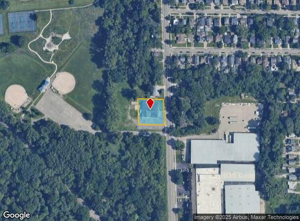
2357 Buchanan Ave Sw, Grand Rapids, MI 49507
NEARBY LISTINGS FOR SALE OR LEASE
Property Detail
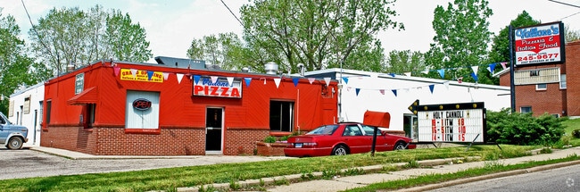
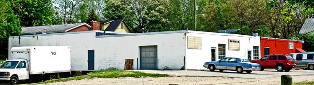
2357 Buchanan Ave Sw
41-17-12-255-056
N 150 FT OF S 183 FT OF W 150 FT OF E 183 FT OF SW 1/4 NE 1/4 * SEC 12 T6N R12W
Restaurantbuilding
Kent
X
Michigan
26081C0416D
0.52 AC
2024
S Grand Rapids/Kentwood
2025
West Michigan
004000
Grand Rapids-Wyoming, MI
8,100 SF
DEMOGRAPHICS near 2357 Buchanan Ave Sw
1 Mile
3 Mile
5 Mile
2024 Total Population
18,502
130,146
291,299
2029 Population
18,440
130,781
292,738
Pop Growth 2024-2029
(0.34%)
+ 0.49%
+ 0.49%
Average Age
33
35
36
2024 Total Households
5,660
48,532
113,521
HH Growth 2024-2029
(0.27%)
+ 0.60%
+ 0.56%
Median Household Inc
$51,053
$56,524
$60,753
Avg Household Size
3.10
2.60
2.40
2024 Avg HH Vehicles
2.00
2.00
2.00
Median Home Value
$134,352
$164,674
$195,365
Median Year Built
1948
1953
1960
Nearby Places
Map Layers
Map Styles
 Street
 Aerial
- Restaurants
- Banks
- Shops
- Fitness
- Groceries
PUBLIC TRANSPORTATION
COMMUTER RAIL
Grand Rapids Vernon J. Ehlers Station (Pere Marquette - Amtrak)
DRIVE
WALK
Distance
Grand Rapids Vernon J. Ehlers Station (Pere Marquette - Amtrak)
6 min
3.5 mi
AIRPORT
Gerald R Ford International
DRIVE
WALK
Distance
Gerald R Ford International
21 min
10.6 mi
Freight Ports
Port Milwaukee
DRIVE
WALK
Distance
Port Milwaukee
305 min
261.1 mi
Nearby Properties
Address
Land Use
TOTAL SIZE
Lot Size
Zoning
Address
Land Use
TOTAL SIZE
Lot Size
Zoning
265,905 SF
1.99 AC
TN-CC
Address
Land Use
TOTAL SIZE
Lot Size
Zoning
649,177 SF
55.67 AC
SD-IT
Address
Land Use
TOTAL SIZE
Lot Size
Zoning
138,122 SF
1.01 AC
TN-CC
Address
Land Use
TOTAL SIZE
Lot Size
Zoning
941,968 SF
38.56 AC
SD-IT
Address
Land Use
TOTAL SIZE
Lot Size
Zoning
398,607 SF
33.51 AC
R4
Address
Land Use
TOTAL SIZE
Lot Size
Zoning
164,591 SF
1.28 AC
TN-CC
Address
Land Use
TOTAL SIZE
Lot Size
Zoning
1,426,319 SF
54.81 AC
SD-IT
Address
Land Use
TOTAL SIZE
Lot Size
Zoning
88,327 SF
2.74 AC
TN-CC
Address
Land Use
TOTAL SIZE
Lot Size
Zoning
87.39 AC
I2
Address
Land Use
TOTAL SIZE
Lot Size
Zoning
269,990 SF
1.28 AC
TN-CC
Address
Land Use
TOTAL SIZE
Lot Size
Zoning
3.31 AC
TN-CC
Address
Land Use
TOTAL SIZE
Lot Size
Zoning
269,990 SF
1.28 AC
TN-CC
Address
Land Use
TOTAL SIZE
Lot Size
Zoning
13.71 AC
MCN-LDR
Address
Land Use
TOTAL SIZE
Lot Size
Zoning
3.31 AC
TN-CC
Address
Land Use
TOTAL SIZE
Lot Size
Zoning
536,296 SF
26.16 AC
SD-IT
Address
Land Use
TOTAL SIZE
Lot Size
Zoning
179,436 SF
24.94 AC
I2
Address
Land Use
TOTAL SIZE
Lot Size
Zoning
348,367 SF
12.15 AC
SD-IT
Address
Land Use
TOTAL SIZE
Lot Size
Zoning
29.13 AC
Address
Land Use
TOTAL SIZE
Lot Size
Zoning
251,562 SF
15.56 AC
MZ
Address
Land Use
TOTAL SIZE
Lot Size
Zoning
31,365 SF
TN-TCC
Address
Land Use
TOTAL SIZE
Lot Size
Zoning
162,228 SF
14.31 AC
R4
Address
Land Use
TOTAL SIZE
Lot Size
Zoning
131,004 SF
0.64 AC
TN-CC
Address
Land Use
TOTAL SIZE
Lot Size
Zoning
89,565 SF
0.16 AC
TN-CC
Address
Land Use
TOTAL SIZE
Lot Size
Zoning
122,570 SF
1.17 AC
TN-TCC
Address
Land Use
TOTAL SIZE
Lot Size
Zoning
123,066 SF
0.30 AC
TN-CC
Address
Land Use
TOTAL SIZE
Lot Size
Zoning
106,284 SF
0.59 AC
TN-CC
Address
Land Use
TOTAL SIZE
Lot Size
Zoning
174,256 SF
10.83 AC
SD-IT
Address
Land Use
TOTAL SIZE
Lot Size
Zoning
Address
Land Use
TOTAL SIZE
Lot Size
Zoning
248,360 SF
7.03 AC
SD-IT
Address
Land Use
TOTAL SIZE
Lot Size
Zoning
54,806 SF
0.55 AC
TN-CC
The World's #1 Commercial Real Estate Marketplace
Connect with us
© 2025 CoStar Group
The information above has been obtained from sources believed reliable. While we do not doubt its accuracy we have not verified it and make no guarantee, warranty or representation about it. It is your responsibility to independently confirm its accuracy and completeness. Any projections, opinions, assumptions, or estimates used are for example only and do not represent the current or future performance of the property. The value of this transaction to you depends on tax and other factors which should be evaluated by your tax, financial, and legal advisors. You and your advisors should conduct a careful, independent investigation of the property to determine to your satisfaction the suitability of the property for your needs.