Property Record
258 Nc Highway 801 N, Advance, NC 27006
NEARBY LISTINGS FOR SALE OR LEASE
-
-
View all Advance listings for lease on LoopNet.com
Property Detail
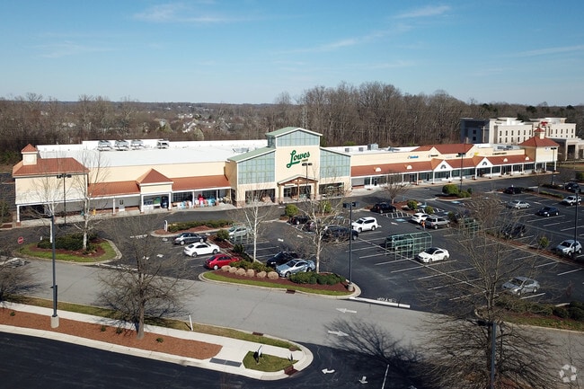
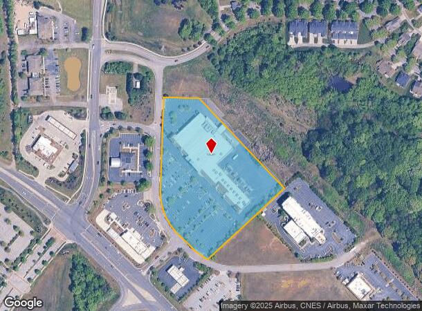
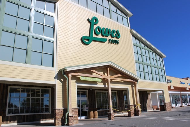
258 Nc Highway 801 N
C8-020-A0-015
6.290 AC HWY 801
Stripcommercialcenter
Davie
X
North Carolina
3710587200K
5.90 AC
2025
Davie County
2025
Greensboro/Winston-Salem
080200
Winston-Salem, NC
59,517 SF
DEMOGRAPHICS near 258 Nc Highway 801 N
1 Mile
3 Mile
5 Mile
2024 Total Population
2,384
16,765
39,966
2029 Population
2,611
17,909
42,184
Pop Growth 2024-2029
+ 9.52%
+ 6.82%
+ 5.55%
Average Age
48
46
44
2024 Total Households
1,065
6,845
16,117
HH Growth 2024-2029
+ 9.20%
+ 6.84%
+ 5.53%
Median Household Inc
$70,948
$95,354
$88,972
Avg Household Size
2.20
2.40
2.40
2024 Avg HH Vehicles
2.00
2.00
2.00
Median Home Value
$245,739
$306,929
$288,855
Median Year Built
1982
1990
1990
Nearby Places
Map Layers
Map Styles
 Street
 Aerial
- Restaurants
- Banks
- Shops
- Fitness
- Groceries
PUBLIC TRANSPORTATION
AIRPORT
Piedmont Triad International
DRIVE
WALK
Distance
Piedmont Triad International
47 min
33.7 mi
Freight Ports
Port of Wilmington
DRIVE
WALK
Distance
Port of Wilmington
285 min
242.4 mi
SALE & LEASE HISTORY
LISTING DATE
SALE/LEASE

Sep 25, 2016
For Lease
Nearby Properties
Address
Land Use
TOTAL SIZE
Lot Size
Zoning
Address
Land Use
TOTAL SIZE
Lot Size
Zoning
132,856 SF
53.61 AC
R20
Address
Land Use
TOTAL SIZE
Lot Size
Zoning
130,696 SF
41.18 AC
PB-S
Address
Land Use
TOTAL SIZE
Lot Size
Zoning
81,594 SF
1,147.49 AC
IP
Address
Land Use
TOTAL SIZE
Lot Size
Zoning
23,926 SF
11.36 AC
Address
Land Use
TOTAL SIZE
Lot Size
Zoning
49,319 SF
24.81 AC
Address
Land Use
TOTAL SIZE
Lot Size
Zoning
1,971 SF
6.24 AC
HB
Address
Land Use
TOTAL SIZE
Lot Size
Zoning
60,296 SF
0.66 AC
PB-S
Address
Land Use
TOTAL SIZE
Lot Size
Zoning
79,498 SF
10.64 AC
HB
Address
Land Use
TOTAL SIZE
Lot Size
Zoning
71,306 SF
10.36 AC
IP-S
Address
Land Use
TOTAL SIZE
Lot Size
Zoning
46,073 SF
11.74 AC
R12
Address
Land Use
TOTAL SIZE
Lot Size
Zoning
119,240 SF
22.72 AC
Address
Land Use
TOTAL SIZE
Lot Size
Zoning
32,656 SF
3.14 AC
IP-S
Address
Land Use
TOTAL SIZE
Lot Size
Zoning
60,709 SF
34.21 AC
C-S
Address
Land Use
TOTAL SIZE
Lot Size
Zoning
59,143 SF
8.49 AC
CS
Address
Land Use
TOTAL SIZE
Lot Size
Zoning
53,105 SF
5.42 AC
IP-S
Address
Land Use
TOTAL SIZE
Lot Size
Zoning
37,658 SF
3.93 AC
RM12-S
Address
Land Use
TOTAL SIZE
Lot Size
Zoning
301.66 AC
RM5-S,RS15
Address
Land Use
TOTAL SIZE
Lot Size
Zoning
50,332 SF
2.45 AC
Address
Land Use
TOTAL SIZE
Lot Size
Zoning
6,192 SF
12.52 AC
R8
Address
Land Use
TOTAL SIZE
Lot Size
Zoning
72,612 SF
5.50 AC
Address
Land Use
TOTAL SIZE
Lot Size
Zoning
51,774 SF
7.02 AC
I2S
Address
Land Use
TOTAL SIZE
Lot Size
Zoning
58,022 SF
7.79 AC
CS
Address
Land Use
TOTAL SIZE
Lot Size
Zoning
20,017 SF
0.64 AC
PB-S
Address
Land Use
TOTAL SIZE
Lot Size
Zoning
36,472 SF
4.88 AC
R8
Address
Land Use
TOTAL SIZE
Lot Size
Zoning
14,820 SF
0.46 AC
HB
Address
Land Use
TOTAL SIZE
Lot Size
Zoning
6,000 SF
1.99 AC
CS
Address
Land Use
TOTAL SIZE
Lot Size
Zoning
21,350 SF
4.52 AC
HB
Address
Land Use
TOTAL SIZE
Lot Size
Zoning
19,338 SF
20.52 AC
Address
Land Use
TOTAL SIZE
Lot Size
Zoning
20,408 SF
222.18 AC
R12
The World's #1 Commercial Real Estate Marketplace
Connect with us
© 2026 CoStar Group
The information above has been obtained from sources believed reliable. While we do not doubt its accuracy we have not verified it and make no guarantee, warranty or representation about it. It is your responsibility to independently confirm its accuracy and completeness. Any projections, opinions, assumptions, or estimates used are for example only and do not represent the current or future performance of the property. The value of this transaction to you depends on tax and other factors which should be evaluated by your tax, financial, and legal advisors. You and your advisors should conduct a careful, independent investigation of the property to determine to your satisfaction the suitability of the property for your needs.