Property Record
236 Perinton Pkwy, Fairport, NY 14450


NEARBY LISTINGS FOR SALE OR LEASE
Property Detail
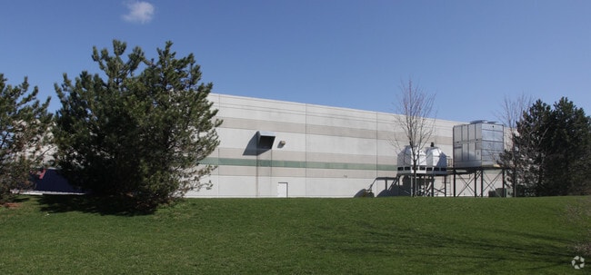
236 Perinton Pkwy
264489 167.01-1-7.1
LOT 9 TWP 12 RNG 4 PERINTON IND ESTATES NR MAP 1995-35
Manufacturinglight
Monroe
X
New York
36055C0384G
7.100
2025
13.05 AC
2024
Southeast
011709
Rochester
81,609 SF
Rochester, NY
DEMOGRAPHICS near 236 Perinton Pkwy
1 Mile
3 Mile
5 Mile
2024 Total Population
2,473
24,849
70,196
2029 Population
2,423
24,486
69,305
Pop Growth 2024-2029
(2.02%)
(1.46%)
(1.27%)
Average Age
42
43
44
2024 Total Households
881
10,134
29,104
HH Growth 2024-2029
(2.16%)
(1.58%)
(1.36%)
Median Household Inc
$146,702
$105,014
$91,558
Avg Household Size
2.80
2.40
2.30
2024 Avg HH Vehicles
2.00
2.00
2.00
Median Home Value
$295,405
$256,232
$240,838
Median Year Built
1989
1980
1978
Nearby Places
Map Layers
Map Styles
 Street
 Aerial
- Restaurants
- Banks
- Shops
- Fitness
- Groceries
PUBLIC TRANSPORTATION
AIRPORT
Frederick Douglass/Greater Rochester International
DRIVE
WALK
Distance
Frederick Douglass/Greater Rochester International
34 min
18.0 mi
Nearby Properties
Address
Land Use
TOTAL SIZE
Lot Size
Zoning
Address
Land Use
TOTAL SIZE
Lot Size
Zoning
900 SF
64.35 AC
RT-2.5
Address
Land Use
TOTAL SIZE
Lot Size
Zoning
295,482 SF
83.23 AC
RES B
Address
Land Use
TOTAL SIZE
Lot Size
Zoning
105,768 SF
51.10 AC
R-B
Address
Land Use
TOTAL SIZE
Lot Size
Zoning
88,859 SF
82.38 AC
RES B
Address
Land Use
TOTAL SIZE
Lot Size
Zoning
5,228 SF
36.68 AC
PDD
Address
Land Use
TOTAL SIZE
Lot Size
Zoning
203,819 SF
21.83 AC
Address
Land Use
TOTAL SIZE
Lot Size
Zoning
196,411 SF
23.40 AC
COMMERCIAL
Address
Land Use
TOTAL SIZE
Lot Size
Zoning
48,582 SF
18.08 AC
APT
Address
Land Use
TOTAL SIZE
Lot Size
Zoning
171,069 SF
15.77 AC
05 - COMME
Address
Land Use
TOTAL SIZE
Lot Size
Zoning
75,677 SF
47.69 AC
RES B
Address
Land Use
TOTAL SIZE
Lot Size
Zoning
85,838 SF
3.70 AC
R-C
Address
Land Use
TOTAL SIZE
Lot Size
Zoning
2.73 AC
Address
Land Use
TOTAL SIZE
Lot Size
Zoning
12,744 SF
246 AC
INDUSTRIAL
Address
Land Use
TOTAL SIZE
Lot Size
Zoning
4,530 SF
13.42 AC
APT
Address
Land Use
TOTAL SIZE
Lot Size
Zoning
25,725 SF
4.02 AC
Address
Land Use
TOTAL SIZE
Lot Size
Zoning
6,000 SF
10.75 AC
APT
Address
Land Use
TOTAL SIZE
Lot Size
Zoning
5,712 SF
4.60 AC
RES A
Address
Land Use
TOTAL SIZE
Lot Size
Zoning
45,772 SF
10.30 AC
COMMERCIAL
Address
Land Use
TOTAL SIZE
Lot Size
Zoning
42,729 SF
1.90 AC
PDD
Address
Land Use
TOTAL SIZE
Lot Size
Zoning
37,722 SF
22.14 AC
INDUSTRIAL
Address
Land Use
TOTAL SIZE
Lot Size
Zoning
25,200 SF
2.93 AC
R-E
Address
Land Use
TOTAL SIZE
Lot Size
Zoning
77,862 SF
21.87 AC
INDUSTRIAL
Address
Land Use
TOTAL SIZE
Lot Size
Zoning
120,587 SF
2.04 AC
L-D
Address
Land Use
TOTAL SIZE
Lot Size
Zoning
53,283 SF
111.98 AC
RT-2.5
Address
Land Use
TOTAL SIZE
Lot Size
Zoning
8,856 SF
9.60 AC
APT
Address
Land Use
TOTAL SIZE
Lot Size
Zoning
30,240 SF
2.91 AC
05 - COMME
Address
Land Use
TOTAL SIZE
Lot Size
Zoning
21,125 SF
7.16 AC
RES B
Address
Land Use
TOTAL SIZE
Lot Size
Zoning
31,509 SF
1.87 AC
CON
Address
Land Use
TOTAL SIZE
Lot Size
Zoning
3,196 SF
4.48 AC
COMMERCIAL
Address
Land Use
TOTAL SIZE
Lot Size
Zoning
82,787 SF
5.10 AC
INDUSTRIAL
The World's #1 Commercial Real Estate Marketplace
Connect with us
© 2026 CoStar Group
The information above has been obtained from sources believed reliable. While we do not doubt its accuracy we have not verified it and make no guarantee, warranty or representation about it. It is your responsibility to independently confirm its accuracy and completeness. Any projections, opinions, assumptions, or estimates used are for example only and do not represent the current or future performance of the property. The value of this transaction to you depends on tax and other factors which should be evaluated by your tax, financial, and legal advisors. You and your advisors should conduct a careful, independent investigation of the property to determine to your satisfaction the suitability of the property for your needs.