Property Record
23594 Interstate 10, Wallisville, TX 77597
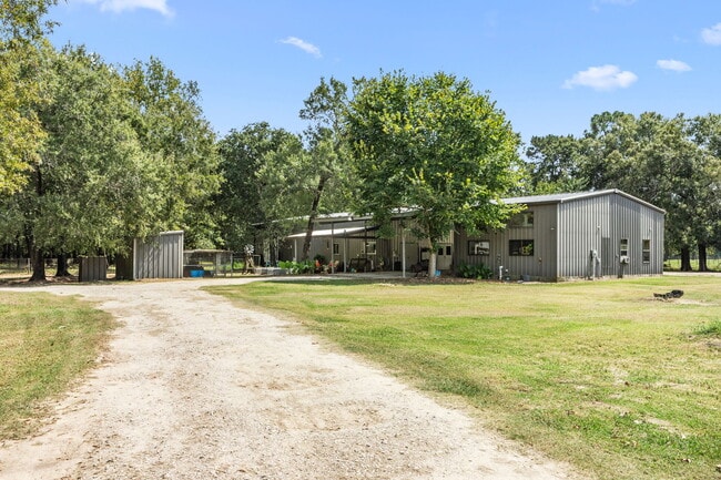
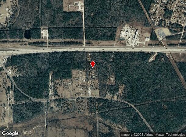
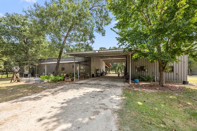
This Property Is For Sale
NEARBY LISTINGS FOR SALE OR LEASE
-
-
View all Wallisville listings for sale on LoopNet.com
Property Detail
23594 Interstate 10
Houston-The Woodlands-Sugar Land, TX
Chambers
88888-00008-00002-120104
Texas
Mobilemanufacturedhomeregardlessoflandownership
East-Southeast Far
X
Houston
48071C0205E
DEMOGRAPHICS near 23594 Interstate 10
1 Mile
3 Mile
5 Mile
2024 Total Population
103
2,419
4,077
2029 Population
116
2,846
4,741
Pop Growth 2024-2029
+ 12.62%
+ 17.65%
+ 16.29%
Average Age
43
42
41
2024 Total Households
41
945
1,558
HH Growth 2024-2029
+ 14.63%
+ 17.78%
+ 16.50%
Median Household Inc
$68,437
$69,155
$70,522
Avg Household Size
2.40
2.60
2.60
2024 Avg HH Vehicles
3.00
2.00
2.00
Median Home Value
$442,857
$317,857
$285,566
Median Year Built
1990
1994
1990
Nearby Places
- Restaurants
- Banks
- Shops
- Fitness
- Groceries
Nearby Properties
Address
Land Use
TOTAL SIZE
Lot Size
Zoning
Address
Land Use
TOTAL SIZE
Lot Size
Zoning
984 SF
91.88 AC
Address
Land Use
TOTAL SIZE
Lot Size
Zoning
2,014 SF
0.50 AC
Address
Land Use
TOTAL SIZE
Lot Size
Zoning
900 SF
20 AC
Address
Land Use
TOTAL SIZE
Lot Size
Zoning
4,941 SF
2.12 AC
Address
Land Use
TOTAL SIZE
Lot Size
Zoning
360 SF
0.25 AC
Address
Land Use
TOTAL SIZE
Lot Size
Zoning
10,473 SF
1.15 AC
Address
Land Use
TOTAL SIZE
Lot Size
Zoning
9,932 SF
15.89 AC
Address
Land Use
TOTAL SIZE
Lot Size
Zoning
3,344 SF
3 AC
Address
Land Use
TOTAL SIZE
Lot Size
Zoning
4,830 SF
1.33 AC
Address
Land Use
TOTAL SIZE
Lot Size
Zoning
5,394 SF
12.50 AC
Address
Land Use
TOTAL SIZE
Lot Size
Zoning
2,369 SF
1.14 AC
Address
Land Use
TOTAL SIZE
Lot Size
Zoning
10,640 SF
0.50 AC
Address
Land Use
TOTAL SIZE
Lot Size
Zoning
468 SF
3 AC
Address
Land Use
TOTAL SIZE
Lot Size
Zoning
2,216 SF
156.09 AC
Address
Land Use
TOTAL SIZE
Lot Size
Zoning
3,821 SF
2.68 AC
Address
Land Use
TOTAL SIZE
Lot Size
Zoning
4,200 SF
6 AC
Address
Land Use
TOTAL SIZE
Lot Size
Zoning
2,724 SF
3.28 AC
Address
Land Use
TOTAL SIZE
Lot Size
Zoning
2,238 SF
1.92 AC
Address
Land Use
TOTAL SIZE
Lot Size
Zoning
7,645 SF
1 AC
Address
Land Use
TOTAL SIZE
Lot Size
Zoning
3,200 SF
1.22 AC
Address
Land Use
TOTAL SIZE
Lot Size
Zoning
5,886 SF
1 AC
Address
Land Use
TOTAL SIZE
Lot Size
Zoning
521 AC
Address
Land Use
TOTAL SIZE
Lot Size
Zoning
9,360 SF
25.75 AC
Address
Land Use
TOTAL SIZE
Lot Size
Zoning
432 SF
3 AC
Address
Land Use
TOTAL SIZE
Lot Size
Zoning
2,888 SF
26.41 AC
Address
Land Use
TOTAL SIZE
Lot Size
Zoning
25.52 AC
Address
Land Use
TOTAL SIZE
Lot Size
Zoning
2.71 AC
Address
Land Use
TOTAL SIZE
Lot Size
Zoning
2,140 SF
1.38 AC
Address
Land Use
TOTAL SIZE
Lot Size
Zoning
2,573 SF
0.26 AC
Address
Land Use
TOTAL SIZE
Lot Size
Zoning
64 SF
2.03 AC
The World's #1 Commercial Real Estate Marketplace
Connect with us
© 2025 CoStar Group
The information above has been obtained from sources believed reliable. While we do not doubt its accuracy we have not verified it and make no guarantee, warranty or representation about it. It is your responsibility to independently confirm its accuracy and completeness. Any projections, opinions, assumptions, or estimates used are for example only and do not represent the current or future performance of the property. The value of this transaction to you depends on tax and other factors which should be evaluated by your tax, financial, and legal advisors. You and your advisors should conduct a careful, independent investigation of the property to determine to your satisfaction the suitability of the property for your needs.