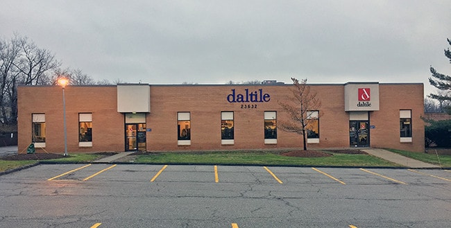
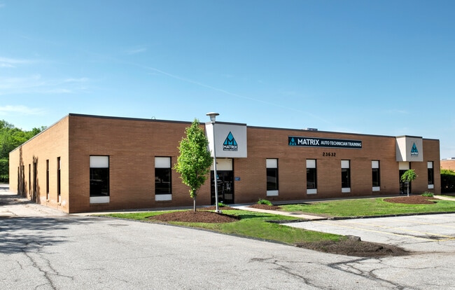
Property Record
23632 Mercantile Rd, Beachwood, OH 44122
Current Lease Availabilities
NEARBY LISTINGS FOR SALE OR LEASE
Property Detail
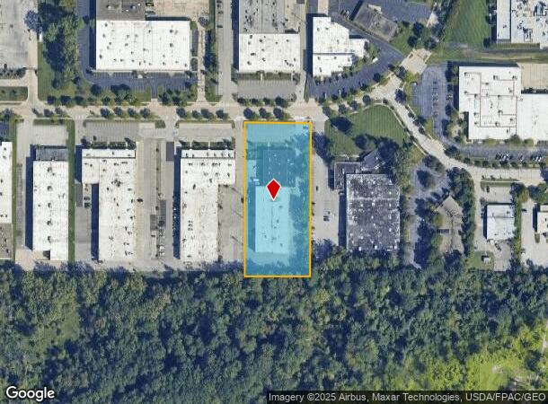
23632 Mercantile Rd
Cleveland-Elyria, OH
Commpkdev
742-24-001
58 COMMPKDEV 0010 ALL
Multitenantindustrial
Cuyahoga
X
Ohio
39035C0209E
10
2024
2.44 AC
2024
East
131105
Cleveland
35,000 SF
DEMOGRAPHICS near 23632 Mercantile Rd
1 Mile
3 Mile
5 Mile
2024 Total Population
2,974
69,940
224,687
2029 Population
2,950
68,083
219,388
Pop Growth 2024-2029
(0.81%)
(2.66%)
(2.36%)
Average Age
44
41
42
2024 Total Households
1,297
28,725
96,321
HH Growth 2024-2029
(1.16%)
(2.86%)
(2.57%)
Median Household Inc
$95,128
$74,540
$60,469
Avg Household Size
2.20
2.30
2.20
2024 Avg HH Vehicles
2.00
2.00
2.00
Median Home Value
$357,291
$253,479
$167,038
Median Year Built
1976
1957
1953
Nearby Places
Map Layers
Map Styles
 Street
 Aerial
- Restaurants
- Banks
- Shops
- Fitness
- Groceries
PUBLIC TRANSPORTATION
AIRPORT
Cleveland-Hopkins International
DRIVE
WALK
Distance
Cleveland-Hopkins International
35 min
21.6 mi
Nearby Properties
Address
Land Use
TOTAL SIZE
Lot Size
Zoning
Address
Land Use
TOTAL SIZE
Lot Size
Zoning
975,742 SF
42.03 AC
U-10
Address
Land Use
TOTAL SIZE
Lot Size
Zoning
964,082 SF
40.67 AC
Address
Land Use
TOTAL SIZE
Lot Size
Zoning
1,066,853 SF
42.18 AC
U-5
Address
Land Use
TOTAL SIZE
Lot Size
Zoning
418,553 SF
40.99 AC
Address
Land Use
TOTAL SIZE
Lot Size
Zoning
737,998 SF
53.07 AC
U-10
Address
Land Use
TOTAL SIZE
Lot Size
Zoning
475,904 SF
8.04 AC
U-7A
Address
Land Use
TOTAL SIZE
Lot Size
Zoning
68.97 AC
C-1
Address
Land Use
TOTAL SIZE
Lot Size
Zoning
682,144 SF
99.58 AC
C-2
Address
Land Use
TOTAL SIZE
Lot Size
Zoning
341,556 SF
17.70 AC
U-4
Address
Land Use
TOTAL SIZE
Lot Size
Zoning
229,833 SF
19.04 AC
U-3
Address
Land Use
TOTAL SIZE
Lot Size
Zoning
729,492 SF
17.67 AC
Address
Land Use
TOTAL SIZE
Lot Size
Zoning
323,733 SF
106.35 AC
MRC2
Address
Land Use
TOTAL SIZE
Lot Size
Zoning
233,767 SF
36.30 AC
U-1A1
Address
Land Use
TOTAL SIZE
Lot Size
Zoning
257,564 SF
2.70 AC
U-4A
Address
Land Use
TOTAL SIZE
Lot Size
Zoning
246,578 SF
28.60 AC
U-5
Address
Land Use
TOTAL SIZE
Lot Size
Zoning
421,649 SF
23.15 AC
U-5
Address
Land Use
TOTAL SIZE
Lot Size
Zoning
333,582 SF
3.67 AC
U-1A1
Address
Land Use
TOTAL SIZE
Lot Size
Zoning
360,712 SF
55.30 AC
INS
Address
Land Use
TOTAL SIZE
Lot Size
Zoning
485,482 SF
9.60 AC
U-8A
Address
Land Use
TOTAL SIZE
Lot Size
Zoning
144,978 SF
31.14 AC
R-3
Address
Land Use
TOTAL SIZE
Lot Size
Zoning
78,838 SF
4.90 AC
U-7A
Address
Land Use
TOTAL SIZE
Lot Size
Zoning
232,078 SF
24.89 AC
U-7
Address
Land Use
TOTAL SIZE
Lot Size
Zoning
294,215 SF
4.70 AC
U-3A
Address
Land Use
TOTAL SIZE
Lot Size
Zoning
346,762 SF
4.57 AC
U-3A
Address
Land Use
TOTAL SIZE
Lot Size
Zoning
119,418 SF
42.99 AC
U-5
Address
Land Use
TOTAL SIZE
Lot Size
Zoning
357,252 SF
10.80 AC
U-8A
Address
Land Use
TOTAL SIZE
Lot Size
Zoning
92,058 SF
31.37 AC
INS
Address
Land Use
TOTAL SIZE
Lot Size
Zoning
143,512 SF
16 AC
Address
Land Use
TOTAL SIZE
Lot Size
Zoning
204,701 SF
10.12 AC
Address
Land Use
TOTAL SIZE
Lot Size
Zoning
4,414 SF
112.92 AC
U-10
The World's #1 Commercial Real Estate Marketplace
Connect with us
© 2026 CoStar Group
The information above has been obtained from sources believed reliable. While we do not doubt its accuracy we have not verified it and make no guarantee, warranty or representation about it. It is your responsibility to independently confirm its accuracy and completeness. Any projections, opinions, assumptions, or estimates used are for example only and do not represent the current or future performance of the property. The value of this transaction to you depends on tax and other factors which should be evaluated by your tax, financial, and legal advisors. You and your advisors should conduct a careful, independent investigation of the property to determine to your satisfaction the suitability of the property for your needs.