Property Record
23640 W 8 Mile Rd, Southfield, MI 48033


NEARBY LISTINGS FOR SALE OR LEASE
Property Detail
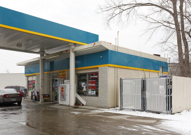
23640 W 8 Mile Rd
Detroit-Warren-Dearborn, MI
Base Line Subdn
24-33-301-036
T1N,R10E,SEC 33 29-5 HART BROS BASE LINE SUBDN E 130 FT OF S 80 FT OF LOT 25, ALSO N 70 FT OF E 42 FT OF LOT 33, ALSO N 70 FT
Supermarket
Oakland
X
Michigan
26163C0060E
25
2024
0.45 AC
2022
Southfield
161800
Detroit
1,276 SF
DEMOGRAPHICS near 23640 W 8 Mile Rd
1 Mile
3 Mile
5 Mile
2024 Total Population
10,383
98,480
284,167
2029 Population
10,088
96,350
277,854
Pop Growth 2024-2029
(2.84%)
(2.16%)
(2.22%)
Average Age
41
40
41
2024 Total Households
4,837
41,088
118,660
HH Growth 2024-2029
(3.06%)
(2.21%)
(2.23%)
Median Household Inc
$39,079
$48,144
$54,640
Avg Household Size
2.10
2.30
2.30
2024 Avg HH Vehicles
1.00
1.00
2.00
Median Home Value
$97,323
$118,227
$152,884
Median Year Built
1957
1956
1957
Nearby Places
Map Layers
Map Styles
 Street
 Aerial
- Restaurants
- Banks
- Shops
- Fitness
- Groceries
PUBLIC TRANSPORTATION
AIRPORT
Detroit Metro Wayne County
DRIVE
WALK
Distance
Detroit Metro Wayne County
38 min
20.8 mi
Windsor International
DRIVE
WALK
Distance
Windsor International
47 min
28.5 mi
Freight Ports
Port of Toledo
DRIVE
WALK
Distance
Port of Toledo
89 min
68.0 mi
Nearby Properties
Address
Land Use
TOTAL SIZE
Lot Size
Zoning
Address
Land Use
TOTAL SIZE
Lot Size
Zoning
2,373,792 SF
17.35 AC
RC
Address
Land Use
TOTAL SIZE
Lot Size
Zoning
882,862 SF
8.22 AC
RC
Address
Land Use
TOTAL SIZE
Lot Size
Zoning
460,062 SF
10.01 AC
RC
Address
Land Use
TOTAL SIZE
Lot Size
Zoning
383,602 SF
36.60 AC
I-1
Address
Land Use
TOTAL SIZE
Lot Size
Zoning
859,104 SF
9.59 AC
RC
Address
Land Use
TOTAL SIZE
Lot Size
Zoning
655,519 SF
9.18 AC
ERO
Address
Land Use
TOTAL SIZE
Lot Size
Zoning
280,500 SF
3.58 AC
RC
Address
Land Use
TOTAL SIZE
Lot Size
Zoning
350,140 SF
27.11 AC
RC
Address
Land Use
TOTAL SIZE
Lot Size
Zoning
301,269 SF
25.47 AC
OS
Address
Land Use
TOTAL SIZE
Lot Size
Zoning
405,020 SF
18.74 AC
RMM
Address
Land Use
TOTAL SIZE
Lot Size
Zoning
325,654 SF
7.45 AC
ERO
Address
Land Use
TOTAL SIZE
Lot Size
Zoning
209,000 SF
11.21 AC
ERO
Address
Land Use
TOTAL SIZE
Lot Size
Zoning
210 SF
20.52 AC
R-2
Address
Land Use
TOTAL SIZE
Lot Size
Zoning
304 SF
6.99 AC
RC
Address
Land Use
TOTAL SIZE
Lot Size
Zoning
307,002 SF
14.61 AC
RC
Address
Land Use
TOTAL SIZE
Lot Size
Zoning
174 SF
14.17 AC
RM
Address
Land Use
TOTAL SIZE
Lot Size
Zoning
202,736 SF
20 AC
PD
Address
Land Use
TOTAL SIZE
Lot Size
Zoning
397,200 SF
14.07 AC
RMU
Address
Land Use
TOTAL SIZE
Lot Size
Zoning
143,700 SF
3.27 AC
PD
Address
Land Use
TOTAL SIZE
Lot Size
Zoning
97,082 SF
67.47 AC
TV-R
Address
Land Use
TOTAL SIZE
Lot Size
Zoning
124,306 SF
5.04 AC
ERO-M
Address
Land Use
TOTAL SIZE
Lot Size
Zoning
110,540 SF
15.30 AC
RC
Address
Land Use
TOTAL SIZE
Lot Size
Zoning
129 SF
15.16 AC
RM
Address
Land Use
TOTAL SIZE
Lot Size
Zoning
158,092 SF
11.75 AC
B-3
Address
Land Use
TOTAL SIZE
Lot Size
Zoning
230,048 SF
11.06 AC
RC
Address
Land Use
TOTAL SIZE
Lot Size
Zoning
204 SF
11.31 AC
RM
Address
Land Use
TOTAL SIZE
Lot Size
Zoning
200 SF
12.69 AC
RM
Address
Land Use
TOTAL SIZE
Lot Size
Zoning
190,000 SF
7.84 AC
ERO-M
Address
Land Use
TOTAL SIZE
Lot Size
Zoning
635,934 SF
31 AC
ERO-M
Address
Land Use
TOTAL SIZE
Lot Size
Zoning
106,867 SF
ERO
The World's #1 Commercial Real Estate Marketplace
Connect with us
© 2025 CoStar Group
The information above has been obtained from sources believed reliable. While we do not doubt its accuracy we have not verified it and make no guarantee, warranty or representation about it. It is your responsibility to independently confirm its accuracy and completeness. Any projections, opinions, assumptions, or estimates used are for example only and do not represent the current or future performance of the property. The value of this transaction to you depends on tax and other factors which should be evaluated by your tax, financial, and legal advisors. You and your advisors should conduct a careful, independent investigation of the property to determine to your satisfaction the suitability of the property for your needs.