Property Record
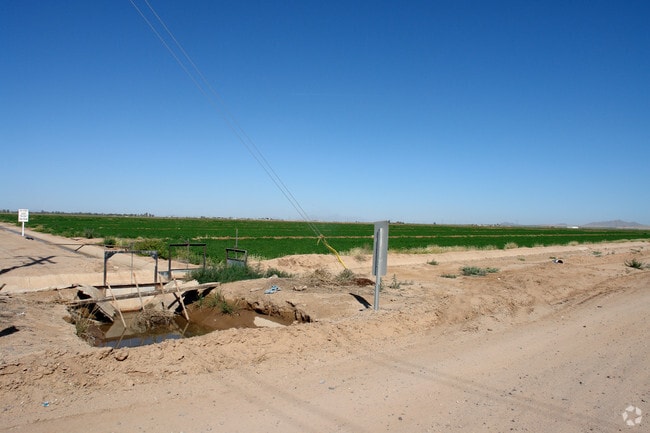
23685 W Guardia Dr, Casa Grande, AZ 85193

NEARBY LISTINGS FOR SALE OR LEASE
Property Detail
23685 W Guardia Dr
Phoenix-Mesa-Scottsdale, AZ
W-192 OF SW SW SW OF SEC 22-6S-5E 2.91 AC
503-44-008A
Pinal
Vacantlandnec
Arizona
2024
156.94 AC
2025
Pinal County
001500
Phoenix
DEMOGRAPHICS near 23685 W Guardia Dr
1 Mile
3 Mile
5 Mile
2024 Total Population
131
2,594
31,110
2029 Population
161
3,227
39,304
Pop Growth 2024-2029
+ 22.90%
+ 24.40%
+ 26.34%
Average Age
39
42
39
2024 Total Households
44
936
11,172
HH Growth 2024-2029
+ 22.73%
+ 23.72%
+ 25.88%
Median Household Inc
$61,875
$56,016
$53,478
Avg Household Size
2.80
2.70
2.70
2024 Avg HH Vehicles
2.00
2.00
2.00
Median Home Value
$96,874
$88,700
$180,216
Median Year Built
1987
1986
1991
Nearby Places
Map Layers
Map Styles
 Street
 Aerial
- Restaurants
- Banks
- Shops
- Fitness
- Groceries
PUBLIC TRANSPORTATION
AIRPORT
Phoenix-Mesa Gateway
DRIVE
WALK
Distance
Phoenix-Mesa Gateway
68 min
45.3 mi
SALE & LEASE HISTORY
LISTING DATE
SALE/LEASE

Aug 16, 2017
For Sale
Nearby Properties
Address
Land Use
TOTAL SIZE
Lot Size
Zoning
Address
Land Use
TOTAL SIZE
Lot Size
Zoning
3,431,931 SF
47.73 AC
Address
Land Use
TOTAL SIZE
Lot Size
Zoning
615,446 SF
88.25 AC
Address
Land Use
TOTAL SIZE
Lot Size
Zoning
525,773 SF
27.24 AC
UNDESIGNAT
Address
Land Use
TOTAL SIZE
Lot Size
Zoning
223,443 SF
176.81 AC
Address
Land Use
TOTAL SIZE
Lot Size
Zoning
286,759 SF
37.76 AC
UNDESIGNAT
Address
Land Use
TOTAL SIZE
Lot Size
Zoning
123,963 SF
15.43 AC
UNDESIGNAT
Address
Land Use
TOTAL SIZE
Lot Size
Zoning
172,746 SF
14.70 AC
UNDESIGNAT
Address
Land Use
TOTAL SIZE
Lot Size
Zoning
264,993 SF
26.48 AC
Address
Land Use
TOTAL SIZE
Lot Size
Zoning
100,149 SF
10.59 AC
Address
Land Use
TOTAL SIZE
Lot Size
Zoning
395,597 SF
13.81 AC
Address
Land Use
TOTAL SIZE
Lot Size
Zoning
33.70 AC
Address
Land Use
TOTAL SIZE
Lot Size
Zoning
32 AC
UNDESIGNAT
Address
Land Use
TOTAL SIZE
Lot Size
Zoning
840 SF
80 AC
Address
Land Use
TOTAL SIZE
Lot Size
Zoning
160 AC
GR
Address
Land Use
TOTAL SIZE
Lot Size
Zoning
711 SF
67.24 AC
UNDESIGNAT
Address
Land Use
TOTAL SIZE
Lot Size
Zoning
127,626 SF
19.13 AC
UNDESIGNAT
Address
Land Use
TOTAL SIZE
Lot Size
Zoning
55,982 SF
19.25 AC
Address
Land Use
TOTAL SIZE
Lot Size
Zoning
303,129 SF
4.03 AC
UNDESIGNAT
Address
Land Use
TOTAL SIZE
Lot Size
Zoning
87,203 SF
13.23 AC
UNDESIGNAT
Address
Land Use
TOTAL SIZE
Lot Size
Zoning
25,092 SF
19.52 AC
Address
Land Use
TOTAL SIZE
Lot Size
Zoning
89,480 SF
7.52 AC
UNDESIGNAT
Address
Land Use
TOTAL SIZE
Lot Size
Zoning
15,475 SF
10.66 AC
Address
Land Use
TOTAL SIZE
Lot Size
Zoning
57,022 SF
6.87 AC
Address
Land Use
TOTAL SIZE
Lot Size
Zoning
107,374 SF
10.45 AC
Address
Land Use
TOTAL SIZE
Lot Size
Zoning
57,568 SF
12.47 AC
UNDESIGNAT
Address
Land Use
TOTAL SIZE
Lot Size
Zoning
71,537 SF
19.11 AC
Address
Land Use
TOTAL SIZE
Lot Size
Zoning
83,274 SF
4.05 AC
Address
Land Use
TOTAL SIZE
Lot Size
Zoning
29,989 SF
10.66 AC
UNDESIGNAT
The World's #1 Commercial Real Estate Marketplace
Connect with us
© 2026 CoStar Group
The information above has been obtained from sources believed reliable. While we do not doubt its accuracy we have not verified it and make no guarantee, warranty or representation about it. It is your responsibility to independently confirm its accuracy and completeness. Any projections, opinions, assumptions, or estimates used are for example only and do not represent the current or future performance of the property. The value of this transaction to you depends on tax and other factors which should be evaluated by your tax, financial, and legal advisors. You and your advisors should conduct a careful, independent investigation of the property to determine to your satisfaction the suitability of the property for your needs.