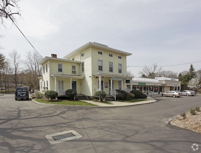
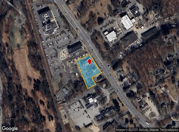
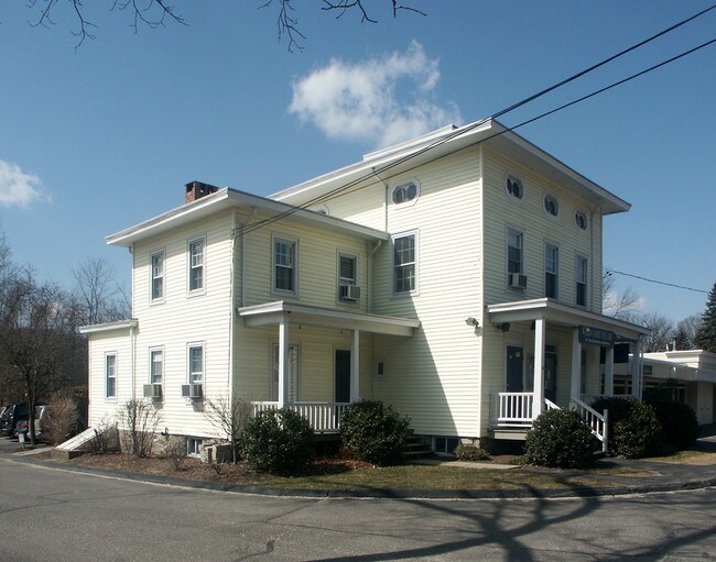
Property Record
237 Danbury Rd, Wilton, CT 06897
NEARBY LISTINGS FOR SALE OR LEASE
Property Detail
237 Danbury Rd
Commercialnec
Fairfield
X
Connecticut
09001C0383F
1.07 AC
2025
Wilton
2025
Westchester/So Connecticut
045200
Bridgeport-Stamford-Norwalk, CT
2,948 SF
WILT-000072-000003
DEMOGRAPHICS near 237 Danbury Rd
1 Mile
3 Mile
5 Mile
2024 Total Population
3,073
23,695
89,970
2029 Population
3,107
23,759
90,193
Pop Growth 2024-2029
+ 1.11%
+ 0.27%
+ 0.25%
Average Age
42
41
41
2024 Total Households
1,161
8,451
32,913
HH Growth 2024-2029
+ 1.12%
+ 0.31%
+ 0.21%
Median Household Inc
$177,284
$196,088
$156,840
Avg Household Size
2.60
2.70
2.70
2024 Avg HH Vehicles
2.00
2.00
2.00
Median Home Value
$695,995
$766,107
$759,462
Median Year Built
1981
1970
1967
Nearby Places
Map Layers
Map Styles
 Street
 Aerial
- Restaurants
- Banks
- Shops
- Fitness
- Groceries
PUBLIC TRANSPORTATION
COMMUTER RAIL
Wilton Station (New Haven Line - Metro-North Commuter Railroad Company (Metro-North))
DRIVE
WALK
Distance
Wilton Station (New Haven Line - Metro-North Commuter Railroad Company (Metro-North))
1 min
11 min
0.6 mi
Cannondale Station (New Haven Line - Metro-North Commuter Railroad Company (Metro-North))
DRIVE
WALK
Distance
Cannondale Station (New Haven Line - Metro-North Commuter Railroad Company (Metro-North))
3 min
2.2 mi
AIRPORT
Westchester County
DRIVE
WALK
Distance
Westchester County
36 min
24.8 mi
Tweed/New Haven
DRIVE
WALK
Distance
Tweed/New Haven
55 min
36.4 mi
Freight Ports
Port of New Haven
DRIVE
WALK
Distance
Port of New Haven
50 min
33.6 mi
Nearby Properties
Address
Land Use
TOTAL SIZE
Lot Size
Zoning
Address
Land Use
TOTAL SIZE
Lot Size
Zoning
28.64 AC
DE-10
Address
Land Use
TOTAL SIZE
Lot Size
Zoning
82.14 AC
R-2
Address
Land Use
TOTAL SIZE
Lot Size
Zoning
292,852 SF
3.38 AC
EO
Address
Land Use
TOTAL SIZE
Lot Size
Zoning
254,126 SF
3.33 AC
EO
Address
Land Use
TOTAL SIZE
Lot Size
Zoning
109.27 AC
R-2
Address
Land Use
TOTAL SIZE
Lot Size
Zoning
254,126 SF
3.06 AC
EO
Address
Land Use
TOTAL SIZE
Lot Size
Zoning
196,084 SF
4.34 AC
DE-5
Address
Land Use
TOTAL SIZE
Lot Size
Zoning
260,868 SF
C
Address
Land Use
TOTAL SIZE
Lot Size
Zoning
21.34 AC
B2
Address
Land Use
TOTAL SIZE
Lot Size
Zoning
24.67 AC
DE-10
Address
Land Use
TOTAL SIZE
Lot Size
Zoning
111,713 SF
C
Address
Land Use
TOTAL SIZE
Lot Size
Zoning
12.32 AC
CRA-1
Address
Land Use
TOTAL SIZE
Lot Size
Zoning
34.16 AC
R-2
Address
Land Use
TOTAL SIZE
Lot Size
Zoning
160,264 SF
C
Address
Land Use
TOTAL SIZE
Lot Size
Zoning
248,782 SF
3.52 AC
EO
Address
Land Use
TOTAL SIZE
Lot Size
Zoning
10.64 AC
HODD
Address
Land Use
TOTAL SIZE
Lot Size
Zoning
249,779 SF
3.09 AC
EO
Address
Land Use
TOTAL SIZE
Lot Size
Zoning
214,890 SF
2.91 AC
EO
Address
Land Use
TOTAL SIZE
Lot Size
Zoning
199,630 SF
1.94 AC
EO
Address
Land Use
TOTAL SIZE
Lot Size
Zoning
32.55 AC
DE-10
Address
Land Use
TOTAL SIZE
Lot Size
Zoning
33.70 AC
R-2
Address
Land Use
TOTAL SIZE
Lot Size
Zoning
219,944 SF
2 AC
EO
Address
Land Use
TOTAL SIZE
Lot Size
Zoning
206,490 SF
1 AC
DE-5
Address
Land Use
TOTAL SIZE
Lot Size
Zoning
11.14 AC
B2
Address
Land Use
TOTAL SIZE
Lot Size
Zoning
11 AC
DE-5
Address
Land Use
TOTAL SIZE
Lot Size
Zoning
206,774 SF
3.57 AC
EO
Address
Land Use
TOTAL SIZE
Lot Size
Zoning
134.24 AC
A3
Address
Land Use
TOTAL SIZE
Lot Size
Zoning
7.61 AC
WC
Address
Land Use
TOTAL SIZE
Lot Size
Zoning
8.92 AC
R-2
Address
Land Use
TOTAL SIZE
Lot Size
Zoning
77,212 SF
DE-5
The World's #1 Commercial Real Estate Marketplace
Connect with us
© 2025 CoStar Group
The information above has been obtained from sources believed reliable. While we do not doubt its accuracy we have not verified it and make no guarantee, warranty or representation about it. It is your responsibility to independently confirm its accuracy and completeness. Any projections, opinions, assumptions, or estimates used are for example only and do not represent the current or future performance of the property. The value of this transaction to you depends on tax and other factors which should be evaluated by your tax, financial, and legal advisors. You and your advisors should conduct a careful, independent investigation of the property to determine to your satisfaction the suitability of the property for your needs.