Property Record
237 E Cripe St, South Bend, IN 46637
Save to a Folder
{{folder.Name}}
{{folder.ListingIds.length}} Properties
{{folder.ListingIds.length}} Property
Create a New Folder
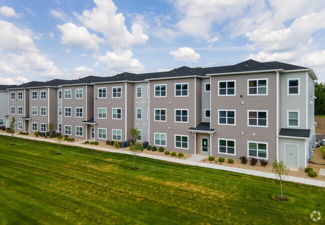
Property Detail
237 E Cripe St
South Bend-Mishawaka, IN-MI
107.57 X 141 N SIDE CRIPE ST BEG 722.85 E OF SE COR LOT 7 D S CRIPES 1ST 25-38-2E
71-03-25-326-040.000-007
St Joseph
Commercialacreage
Indiana
B and X Area of moderate flood hazard, usually the area between the limits of the 100-year and 500-year floods.
7
2024
0.35 AC
2025
North Side
011203
South Bend/Mishawaka
1,818 SF
NEARBY LISTINGS FOR SALE OR LEASE
DEMOGRAPHICS near 237 E Cripe St
1 mile
3 mile
5 mile
2025 Total Population
14,548
81,611
174,125
2030 Population
15,730
84,255
176,966
Pop Growth 2025-2030
+ 8.12%
+ 3.24%
+ 1.63%
Average Age
30
37
38
2025 Total Households
3,877
31,875
68,493
HH Growth 2025-2030
+ 15.73%
+ 3.76%
+ 1.77%
Median Household Inc
$60,029
$61,809
$59,702
Avg Household Size
1.90
2.20
2.30
2025 Avg HH Vehicles
1.00
2.00
2.00
Median Home Value
$167,942
$189,640
$173,775
Median Year Built
2010
1971
1964
Nearby Places
Map Layers
Map Styles
 Street
 Aerial
Layers
 Traffic
 Biking
Places
Listings with unknown addresses are not visible on the map
- Restaurants
- Banks
- Shops
- Fitness
- Groceries
PUBLIC TRANSPORTATION
COMMUTER RAIL
South Bend Amtrak Station (Capitol Limited - Amtrak, Lake Shore Limited - Amtrak)
Drive
Walk
Distance
South Bend Amtrak Station (Capitol Limited - Amtrak, Lake Shore Limited - Amtrak)
11 min
4.6 mi
South Bend Airport Station (South Shore Line - Northern Indiana Commuter Transportation District (South Shore Line))
Drive
Walk
Distance
South Bend Airport Station (South Shore Line - Northern Indiana Commuter Transportation District (South Shore Line))
13 min
5.8 mi
AIRPORT
South Bend International
Drive
Walk
Distance
South Bend International
22 min
8.0 mi
Freight Ports
Port Milwaukee
Drive
Walk
Distance
Port Milwaukee
215 min
178.6 mi
Nearby Properties
Address
Land Use
TOTAL SIZE
Lot Size
Zoning
Address
Land Use
TOTAL SIZE
Lot Size
Zoning
1,089,534 SF
436.76 AC
Address
Land Use
TOTAL SIZE
Lot Size
Zoning
139,888 SF
12.42 AC
Address
Land Use
TOTAL SIZE
Lot Size
Zoning
82,660 SF
48.07 AC
Address
Land Use
TOTAL SIZE
Lot Size
Zoning
219,803 SF
59.79 AC
Address
Land Use
TOTAL SIZE
Lot Size
Zoning
39,988 SF
21.28 AC
Address
Land Use
TOTAL SIZE
Lot Size
Zoning
61,220 SF
19.80 AC
Address
Land Use
TOTAL SIZE
Lot Size
Zoning
162,985 SF
10.54 AC
Address
Land Use
TOTAL SIZE
Lot Size
Zoning
41,528 SF
6.07 AC
Address
Land Use
TOTAL SIZE
Lot Size
Zoning
41,917 SF
0.93 AC
Address
Land Use
TOTAL SIZE
Lot Size
Zoning
263,706 SF
4.60 AC
Address
Land Use
TOTAL SIZE
Lot Size
Zoning
102,124 SF
75.34 AC
Address
Land Use
TOTAL SIZE
Lot Size
Zoning
10,000 SF
2.57 AC
Address
Land Use
TOTAL SIZE
Lot Size
Zoning
18,213 SF
0.79 AC
Address
Land Use
TOTAL SIZE
Lot Size
Zoning
21,468 SF
1.66 AC
Address
Land Use
TOTAL SIZE
Lot Size
Zoning
55,106 SF
Address
Land Use
TOTAL SIZE
Lot Size
Zoning
416,191 SF
39.10 AC
Address
Land Use
TOTAL SIZE
Lot Size
Zoning
120,801 SF
30.51 AC
Address
Land Use
TOTAL SIZE
Lot Size
Zoning
42,485 SF
1.68 AC
Address
Land Use
TOTAL SIZE
Lot Size
Zoning
57,170 SF
0.84 AC
Address
Land Use
TOTAL SIZE
Lot Size
Zoning
38,938 SF
114.29 AC
Address
Land Use
TOTAL SIZE
Lot Size
Zoning
50,603 SF
3.14 AC
Address
Land Use
TOTAL SIZE
Lot Size
Zoning
113,265 SF
2.33 AC
Address
Land Use
TOTAL SIZE
Lot Size
Zoning
292,085 SF
30.05 AC
Address
Land Use
TOTAL SIZE
Lot Size
Zoning
50,916 SF
11.52 AC
Address
Land Use
TOTAL SIZE
Lot Size
Zoning
385,405 SF
49.31 AC
Address
Land Use
TOTAL SIZE
Lot Size
Zoning
1,617 SF
2.22 AC
Address
Land Use
TOTAL SIZE
Lot Size
Zoning
7,138 SF
28.07 AC
Address
Land Use
TOTAL SIZE
Lot Size
Zoning
38,431 SF
1.58 AC
Address
Land Use
TOTAL SIZE
Lot Size
Zoning
16,538 SF
40 AC
Address
Land Use
TOTAL SIZE
Lot Size
Zoning
13,328 SF
96.72 AC
The World's #1 Commercial Real Estate Marketplace
Connect with us
© 2026 CoStar Group
The information above has been obtained from sources believed reliable. While we do not doubt its accuracy we have not verified it and make no guarantee, warranty or representation about it. It is your responsibility to independently confirm its accuracy and completeness. Any projections, opinions, assumptions, or estimates used are for example only and do not represent the current or future performance of the property. The value of this transaction to you depends on tax and other factors which should be evaluated by your tax, financial, and legal advisors. You and your advisors should conduct a careful, independent investigation of the property to determine to your satisfaction the suitability of the property for your needs.