Property Record
237 Ledyard St, Hartford, CT 06114


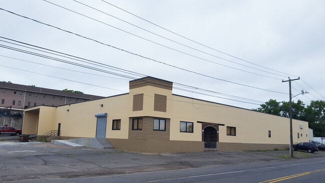
Property Detail
237 Ledyard St
HTFD-000275-000688-000090
Capitol
Commercialbuilding
Connecticut
ID-1
90
2024
1.41 AC
2025
Hartford
502500
Hartford
25,561 SF
Hartford-West Hartford-East Hartford, CT
NEARBY LISTINGS FOR SALE OR LEASE
DEMOGRAPHICS near 237 Ledyard St
1 mile
3 mile
5 mile
2025 Total Population
22,663
134,247
277,222
2030 Population
22,791
136,479
281,561
Pop Growth 2025-2030
+ 0.56%
+ 1.66%
+ 1.57%
Average Age
36
38
39
2025 Total Households
8,085
55,518
112,217
HH Growth 2025-2030
+ 0.59%
+ 1.88%
+ 1.70%
Median Household Inc
$41,597
$52,412
$69,484
Avg Household Size
2.60
2.30
2.30
2025 Avg HH Vehicles
1.00
1.00
1.00
Median Home Value
$238,251
$249,894
$289,449
Median Year Built
1948
1953
1956
Nearby Places
Map Layers
Map Styles
 Street
 Aerial
Layers
 Traffic
 Biking
Places
Listings with unknown addresses are not visible on the map
- Restaurants
- Banks
- Shops
- Fitness
- Groceries
PUBLIC TRANSPORTATION
AIRPORT
Bradley International
Drive
Walk
Distance
Bradley International
24 min
17.3 mi
SALE & LEASE HISTORY
LISTING DATE
SALE/LEASE

Sep 23, 2016
For Sale
Sep 18, 2024
For Lease
Mar 29, 2017
For Sale
Mar 15, 2022
For Sale
Jun 25, 2025
For Lease
Jun 10, 2018
For Sale
Jul 27, 2018
For Lease
Feb 07, 2017
For Sale
Aug 14, 2017
For Sale
Aug 07, 2017
For Sale
Nearby Properties
Address
Land Use
TOTAL SIZE
Lot Size
Zoning
Address
Land Use
TOTAL SIZE
Lot Size
Zoning
147,644 SF
0.19 AC
CAMP
Address
Land Use
TOTAL SIZE
Lot Size
Zoning
173,601 SF
1.56 AC
DT-1
Address
Land Use
TOTAL SIZE
Lot Size
Zoning
516,804 SF
32.98 AC
CAMP
Address
Land Use
TOTAL SIZE
Lot Size
Zoning
482,566 SF
0.65 AC
DT-2
Address
Land Use
TOTAL SIZE
Lot Size
Zoning
15.73 AC
CAMP
Address
Land Use
TOTAL SIZE
Lot Size
Zoning
4.13 AC
DT-1
Address
Land Use
TOTAL SIZE
Lot Size
Zoning
1.45 AC
CAMP
Address
Land Use
TOTAL SIZE
Lot Size
Zoning
213,017 SF
6.21 AC
DT-3
Address
Land Use
TOTAL SIZE
Lot Size
Zoning
149.23 AC
DDD1
Address
Land Use
TOTAL SIZE
Lot Size
Zoning
2.90 AC
DT-2
Address
Land Use
TOTAL SIZE
Lot Size
Zoning
112.42 AC
DDD1
Address
Land Use
TOTAL SIZE
Lot Size
Zoning
69.42 AC
CT R
Address
Land Use
TOTAL SIZE
Lot Size
Zoning
8.89 AC
MX-2
Address
Land Use
TOTAL SIZE
Lot Size
Zoning
29.35 AC
CAMP
Address
Land Use
TOTAL SIZE
Lot Size
Zoning
2,500 SF
74.98 AC
I-2
Address
Land Use
TOTAL SIZE
Lot Size
Zoning
1,125,149 SF
1.14 AC
DT-1
Address
Land Use
TOTAL SIZE
Lot Size
Zoning
205,719 SF
12.15 AC
MX-2
Address
Land Use
TOTAL SIZE
Lot Size
Zoning
28.02 AC
CAMP
Address
Land Use
TOTAL SIZE
Lot Size
Zoning
9.92 AC
DDD1
Address
Land Use
TOTAL SIZE
Lot Size
Zoning
416,762 SF
20 AC
CAMP
Address
Land Use
TOTAL SIZE
Lot Size
Zoning
14.56 AC
SDD/BG
Address
Land Use
TOTAL SIZE
Lot Size
Zoning
20.41 AC
MX-2
Address
Land Use
TOTAL SIZE
Lot Size
Zoning
235,476 SF
198.32 AC
CT R
Address
Land Use
TOTAL SIZE
Lot Size
Zoning
197,704 SF
1.82 AC
CAMP
Address
Land Use
TOTAL SIZE
Lot Size
Zoning
109,276 SF
11 AC
DDD1
Address
Land Use
TOTAL SIZE
Lot Size
Zoning
40,632 SF
1.10 AC
NX-1
Address
Land Use
TOTAL SIZE
Lot Size
Zoning
4.76 AC
MX-2
Address
Land Use
TOTAL SIZE
Lot Size
Zoning
6.63 AC
DT-1
Address
Land Use
TOTAL SIZE
Lot Size
Zoning
2.13 AC
DT-1
Address
Land Use
TOTAL SIZE
Lot Size
Zoning
4.50 AC
DT-1
The World's #1 Commercial Real Estate Marketplace
Connect with us
© 2026 CoStar Group
The information above has been obtained from sources believed reliable. While we do not doubt its accuracy we have not verified it and make no guarantee, warranty or representation about it. It is your responsibility to independently confirm its accuracy and completeness. Any projections, opinions, assumptions, or estimates used are for example only and do not represent the current or future performance of the property. The value of this transaction to you depends on tax and other factors which should be evaluated by your tax, financial, and legal advisors. You and your advisors should conduct a careful, independent investigation of the property to determine to your satisfaction the suitability of the property for your needs.