Property Record
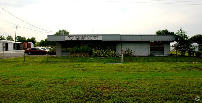
2375 Highway 37 S, Mulberry, FL 33860


NEARBY LISTINGS FOR SALE OR LEASE
Property Detail
2375 Highway 37 S
23-30-13-000000-034030
Kingsford Heights
Lightindustrial
EG NW COR OF SEC RUN E 85.8 FT TO E R/W LINE OF SR 37 S ALONG SAID E R/W LINE 1741.13 FT TO POB CONT S ALONG SAID E R/W LINE 200 FT E 219.02 FT TO WLY R/W LINE OF RR R/W NLY ALONG SAID W R/W LINE 200.14 FT W 211.62 FT TO POB & COMM NW COR OF SEC RUN
X
Polk
12105C0675G
Florida
2024
6.47 AC
2025
Polk County
014905
Tampa/St Petersburg
36,048 SF
Lakeland-Winter Haven, FL
DEMOGRAPHICS near 2375 Highway 37 S
1 Mile
3 Mile
5 Mile
2024 Total Population
422
5,501
26,949
2029 Population
500
6,621
32,056
Pop Growth 2024-2029
+ 18.48%
+ 20.36%
+ 18.95%
Average Age
37
41
38
2024 Total Households
143
2,169
9,762
HH Growth 2024-2029
+ 18.18%
+ 20.29%
+ 18.89%
Median Household Inc
$78,333
$47,350
$63,328
Avg Household Size
2.90
2.50
2.70
2024 Avg HH Vehicles
3.00
2.00
2.00
Median Home Value
$174,444
$111,200
$215,934
Median Year Built
1994
1991
1994
Nearby Places
Map Layers
Map Styles
 Street
 Aerial
- Restaurants
- Banks
- Shops
- Fitness
- Groceries
PUBLIC TRANSPORTATION
AIRPORT
Tampa International
DRIVE
WALK
Distance
Tampa International
61 min
40.8 mi
Freight Ports
Port of Tampa Bay
DRIVE
WALK
Distance
Port of Tampa Bay
51 min
33.8 mi
Nearby Properties
Address
Land Use
TOTAL SIZE
Lot Size
Zoning
Address
Land Use
TOTAL SIZE
Lot Size
Zoning
166,313 SF
63.97 AC
Address
Land Use
TOTAL SIZE
Lot Size
Zoning
174,251 SF
26.66 AC
Address
Land Use
TOTAL SIZE
Lot Size
Zoning
116,961 SF
5.01 AC
I1
Address
Land Use
TOTAL SIZE
Lot Size
Zoning
81,706 SF
20.35 AC
Address
Land Use
TOTAL SIZE
Lot Size
Zoning
172,931 SF
20.09 AC
C4
Address
Land Use
TOTAL SIZE
Lot Size
Zoning
103,698 SF
10.86 AC
GI
Address
Land Use
TOTAL SIZE
Lot Size
Zoning
56,689 SF
9.30 AC
Address
Land Use
TOTAL SIZE
Lot Size
Zoning
41,093 SF
1.58 AC
C1
Address
Land Use
TOTAL SIZE
Lot Size
Zoning
73,084 SF
25.38 AC
Address
Land Use
TOTAL SIZE
Lot Size
Zoning
59,860 SF
10.48 AC
GI
Address
Land Use
TOTAL SIZE
Lot Size
Zoning
68,151 SF
18.63 AC
Address
Land Use
TOTAL SIZE
Lot Size
Zoning
93,186 SF
2.67 AC
I1
Address
Land Use
TOTAL SIZE
Lot Size
Zoning
12,452 SF
2.49 AC
C1
Address
Land Use
TOTAL SIZE
Lot Size
Zoning
28,852 SF
5.19 AC
C2
Address
Land Use
TOTAL SIZE
Lot Size
Zoning
86,674 SF
26.57 AC
RC
Address
Land Use
TOTAL SIZE
Lot Size
Zoning
29,902 SF
2.93 AC
Address
Land Use
TOTAL SIZE
Lot Size
Zoning
103,151 SF
20.86 AC
Address
Land Use
TOTAL SIZE
Lot Size
Zoning
581.94 AC
Address
Land Use
TOTAL SIZE
Lot Size
Zoning
37,474 SF
13.22 AC
Address
Land Use
TOTAL SIZE
Lot Size
Zoning
62,613 SF
10.02 AC
GI
Address
Land Use
TOTAL SIZE
Lot Size
Zoning
86,860 SF
3.02 AC
GI
Address
Land Use
TOTAL SIZE
Lot Size
Zoning
46,605 SF
30.93 AC
XX
Address
Land Use
TOTAL SIZE
Lot Size
Zoning
15,500 SF
2.25 AC
Address
Land Use
TOTAL SIZE
Lot Size
Zoning
56,940 SF
110.04 AC
Address
Land Use
TOTAL SIZE
Lot Size
Zoning
16,944 SF
11.66 AC
Address
Land Use
TOTAL SIZE
Lot Size
Zoning
103,412 SF
65.26 AC
Address
Land Use
TOTAL SIZE
Lot Size
Zoning
29,941 SF
5.06 AC
Address
Land Use
TOTAL SIZE
Lot Size
Zoning
13,325 SF
9.94 AC
RC
Address
Land Use
TOTAL SIZE
Lot Size
Zoning
25,500 SF
1.50 AC
GI
Address
Land Use
TOTAL SIZE
Lot Size
Zoning
39,000 SF
3.73 AC
C4
The World's #1 Commercial Real Estate Marketplace
Connect with us
© 2025 CoStar Group
The information above has been obtained from sources believed reliable. While we do not doubt its accuracy we have not verified it and make no guarantee, warranty or representation about it. It is your responsibility to independently confirm its accuracy and completeness. Any projections, opinions, assumptions, or estimates used are for example only and do not represent the current or future performance of the property. The value of this transaction to you depends on tax and other factors which should be evaluated by your tax, financial, and legal advisors. You and your advisors should conduct a careful, independent investigation of the property to determine to your satisfaction the suitability of the property for your needs.