Property Record
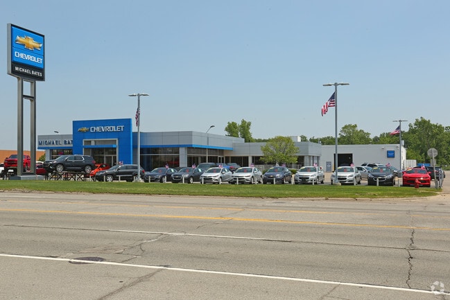
23755 Allen Rd, Woodhaven, MI 48183


NEARBY LISTINGS FOR SALE OR LEASE
Property Detail
23755 Allen Rd
59-071-99-0007-004
23C1B1B2 T4S PT OF NW 1/4 SEC 23 T4S R10E BEG S0DEG 31M 10S E 1439.15FT AND N89DEG 43M 50S E 87FT FROM NW COR SEC 23 TH N89DEG 43M 50S E 500FT TH S0DEG 31M 10S E 550FT TH S89DEG 43M 50S W 500FT TH N0DEG 31M 10S W 550FT POB 6.31AC
Vehiclerentalsvehiclesales
Wayne
X
Michigan
26163C0413E
0007
2025
6.31 AC
2025
Downriver South
982102
Detroit
37,666 SF
Detroit-Warren-Dearborn, MI
DEMOGRAPHICS near 23755 Allen Rd
1 Mile
3 Mile
5 Mile
2024 Total Population
4,739
51,079
119,589
2029 Population
4,539
48,992
114,791
Pop Growth 2024-2029
(4.22%)
(4.09%)
(4.01%)
Average Age
44
43
43
2024 Total Households
2,073
21,506
49,661
HH Growth 2024-2029
(4.29%)
(4.11%)
(4.05%)
Median Household Inc
$76,753
$74,368
$73,858
Avg Household Size
2.20
2.30
2.40
2024 Avg HH Vehicles
2.00
2.00
2.00
Median Home Value
$171,849
$203,037
$200,729
Median Year Built
1966
1975
1973
Nearby Places
Map Layers
Map Styles
 Street
 Aerial
- Restaurants
- Banks
- Shops
- Fitness
- Groceries
PUBLIC TRANSPORTATION
AIRPORT
Detroit Metro Wayne County
DRIVE
WALK
Distance
Detroit Metro Wayne County
26 min
14.1 mi
Windsor International
DRIVE
WALK
Distance
Windsor International
46 min
28.5 mi
Freight Ports
DRIVE
WALK
Distance
56 min
43.0 mi
Nearby Properties
Address
Land Use
TOTAL SIZE
Lot Size
Zoning
Address
Land Use
TOTAL SIZE
Lot Size
Zoning
3,189,689 SF
228.88 AC
Address
Land Use
TOTAL SIZE
Lot Size
Zoning
2,651,867 SF
137.23 AC
I-3
Address
Land Use
TOTAL SIZE
Lot Size
Zoning
1,981,391 SF
166.35 AC
I-2
Address
Land Use
TOTAL SIZE
Lot Size
Zoning
2,193,696 SF
182.23 AC
Address
Land Use
TOTAL SIZE
Lot Size
Zoning
155,600 SF
83.84 AC
R1
Address
Land Use
TOTAL SIZE
Lot Size
Zoning
235,489 SF
23.47 AC
Address
Land Use
TOTAL SIZE
Lot Size
Zoning
177,054 SF
11.88 AC
PUD
Address
Land Use
TOTAL SIZE
Lot Size
Zoning
729,040 SF
45.85 AC
I-2
Address
Land Use
TOTAL SIZE
Lot Size
Zoning
150,224 SF
15.45 AC
RM-1
Address
Land Use
TOTAL SIZE
Lot Size
Zoning
247,238 SF
21.39 AC
I-1
Address
Land Use
TOTAL SIZE
Lot Size
Zoning
1,021,918 SF
163.58 AC
Address
Land Use
TOTAL SIZE
Lot Size
Zoning
35.50 AC
RM-1
Address
Land Use
TOTAL SIZE
Lot Size
Zoning
172,998 SF
17.91 AC
RM-1
Address
Land Use
TOTAL SIZE
Lot Size
Zoning
112,726 SF
21.10 AC
TC
Address
Land Use
TOTAL SIZE
Lot Size
Zoning
3,280 SF
99.72 AC
Address
Land Use
TOTAL SIZE
Lot Size
Zoning
122,430 SF
22.24 AC
Address
Land Use
TOTAL SIZE
Lot Size
Zoning
209,221 SF
21.80 AC
Address
Land Use
TOTAL SIZE
Lot Size
Zoning
211,389 SF
41.38 AC
Address
Land Use
TOTAL SIZE
Lot Size
Zoning
42.98 AC
Address
Land Use
TOTAL SIZE
Lot Size
Zoning
203,114 SF
14.50 AC
R-M MUL
Address
Land Use
TOTAL SIZE
Lot Size
Zoning
178,682 SF
19.23 AC
Address
Land Use
TOTAL SIZE
Lot Size
Zoning
33,600 SF
100.03 AC
Address
Land Use
TOTAL SIZE
Lot Size
Zoning
92,397 SF
12.63 AC
PUD
Address
Land Use
TOTAL SIZE
Lot Size
Zoning
125,828 SF
8.17 AC
B-2 COM
Address
Land Use
TOTAL SIZE
Lot Size
Zoning
143,496 SF
3.73 AC
RM-2
Address
Land Use
TOTAL SIZE
Lot Size
Zoning
255,456 SF
7.74 AC
I-1
Address
Land Use
TOTAL SIZE
Lot Size
Zoning
61,784 SF
6.78 AC
Address
Land Use
TOTAL SIZE
Lot Size
Zoning
141,861 SF
13 AC
RM-1
Address
Land Use
TOTAL SIZE
Lot Size
Zoning
167,004 SF
19.04 AC
RM-1
Address
Land Use
TOTAL SIZE
Lot Size
Zoning
169,192 SF
11.90 AC
R1
The World's #1 Commercial Real Estate Marketplace
Connect with us
© 2026 CoStar Group
The information above has been obtained from sources believed reliable. While we do not doubt its accuracy we have not verified it and make no guarantee, warranty or representation about it. It is your responsibility to independently confirm its accuracy and completeness. Any projections, opinions, assumptions, or estimates used are for example only and do not represent the current or future performance of the property. The value of this transaction to you depends on tax and other factors which should be evaluated by your tax, financial, and legal advisors. You and your advisors should conduct a careful, independent investigation of the property to determine to your satisfaction the suitability of the property for your needs.