Property Record
2376 Route 6, Slate Hill, NY 10973

NEARBY LISTINGS FOR SALE OR LEASE
Property Detail
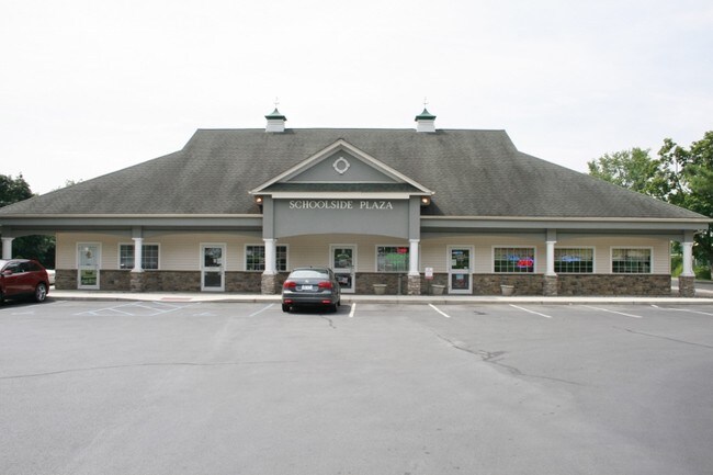
2376 Route 6
New York-Jersey City-White Plains, NY-NJ
Dombal & Schoolside Pizzeria
335600-022-000-0001-079.120-0000
LOT 1 DOMBAL & SCHOOLSIDE PIZZERIA SUB MAP 243-04 FILED 4/9/04
Commercialnec
Orange
X
New York
36071C0245E
79.12
2024
5.30 AC
2024
Monroe
011801
Northern New Jersey
7,536 SF
DEMOGRAPHICS near 2376 Route 6
1 Mile
3 Mile
5 Mile
2024 Total Population
604
5,853
21,063
2029 Population
608
5,915
21,469
Pop Growth 2024-2029
+ 0.66%
+ 1.06%
+ 1.93%
Average Age
40
40
40
2024 Total Households
205
1,981
7,711
HH Growth 2024-2029
+ 0.98%
+ 1.11%
+ 2.15%
Median Household Inc
$95,499
$116,139
$97,679
Avg Household Size
2.90
2.90
2.70
2024 Avg HH Vehicles
2.00
2.00
2.00
Median Home Value
$317,391
$354,323
$332,318
Median Year Built
1977
1982
1987
Nearby Places
Map Layers
Map Styles
 Street
 Aerial
- Restaurants
- Banks
- Shops
- Fitness
- Groceries
PUBLIC TRANSPORTATION
AIRPORT
New York Stewart International
DRIVE
WALK
Distance
New York Stewart International
37 min
26.9 mi
Freight Ports
Port Newark Container Terminal
DRIVE
WALK
Distance
Port Newark Container Terminal
101 min
75.5 mi
SALE & LEASE HISTORY
LISTING DATE
SALE/LEASE

Aug 16, 2017
For Lease
Nearby Properties
Address
Land Use
TOTAL SIZE
Lot Size
Zoning
Address
Land Use
TOTAL SIZE
Lot Size
Zoning
129.70 AC
AR
Address
Land Use
TOTAL SIZE
Lot Size
Zoning
2,576 SF
146.70 AC
AR
Address
Land Use
TOTAL SIZE
Lot Size
Zoning
4 AC
TC2
Address
Land Use
TOTAL SIZE
Lot Size
Zoning
60,321 SF
10.70 AC
TC2
Address
Land Use
TOTAL SIZE
Lot Size
Zoning
62.90 AC
AR
Address
Land Use
TOTAL SIZE
Lot Size
Zoning
104,070 SF
10 AC
MC 1
Address
Land Use
TOTAL SIZE
Lot Size
Zoning
25,357 SF
13.40 AC
AR
Address
Land Use
TOTAL SIZE
Lot Size
Zoning
18,180 SF
209.70 AC
BT
Address
Land Use
TOTAL SIZE
Lot Size
Zoning
23.60 AC
AR
Address
Land Use
TOTAL SIZE
Lot Size
Zoning
44.30 AC
AR
Address
Land Use
TOTAL SIZE
Lot Size
Zoning
7,922 SF
162.90 AC
AR
Address
Land Use
TOTAL SIZE
Lot Size
Zoning
4,464 SF
2.50 AC
TC2
Address
Land Use
TOTAL SIZE
Lot Size
Zoning
13,632 SF
12.70 AC
TC2
Address
Land Use
TOTAL SIZE
Lot Size
Zoning
105.80 AC
SR
Address
Land Use
TOTAL SIZE
Lot Size
Zoning
24,534 SF
14.60 AC
SR
Address
Land Use
TOTAL SIZE
Lot Size
Zoning
16,080 SF
7.30 AC
TC-1
Address
Land Use
TOTAL SIZE
Lot Size
Zoning
7,242 SF
133.30 AC
TC2
Address
Land Use
TOTAL SIZE
Lot Size
Zoning
43.80 AC
AR
Address
Land Use
TOTAL SIZE
Lot Size
Zoning
11,700 SF
2.70 AC
TC-1
Address
Land Use
TOTAL SIZE
Lot Size
Zoning
19.40 AC
AR
Address
Land Use
TOTAL SIZE
Lot Size
Zoning
3,369 SF
1 AC
TC-1
Address
Land Use
TOTAL SIZE
Lot Size
Zoning
9,752 SF
64.30 AC
TC2
Address
Land Use
TOTAL SIZE
Lot Size
Zoning
3,520 SF
0.67 AC
TC1
Address
Land Use
TOTAL SIZE
Lot Size
Zoning
12,258 SF
3 AC
H
Address
Land Use
TOTAL SIZE
Lot Size
Zoning
1,632 SF
91 AC
AR
Address
Land Use
TOTAL SIZE
Lot Size
Zoning
54.40 AC
BT
Address
Land Use
TOTAL SIZE
Lot Size
Zoning
2,116 SF
60.30 AC
AR
Address
Land Use
TOTAL SIZE
Lot Size
Zoning
34 AC
TC2
Address
Land Use
TOTAL SIZE
Lot Size
Zoning
15,480 SF
10.60 AC
TC2
The World's #1 Commercial Real Estate Marketplace
Connect with us
© 2026 CoStar Group
The information above has been obtained from sources believed reliable. While we do not doubt its accuracy we have not verified it and make no guarantee, warranty or representation about it. It is your responsibility to independently confirm its accuracy and completeness. Any projections, opinions, assumptions, or estimates used are for example only and do not represent the current or future performance of the property. The value of this transaction to you depends on tax and other factors which should be evaluated by your tax, financial, and legal advisors. You and your advisors should conduct a careful, independent investigation of the property to determine to your satisfaction the suitability of the property for your needs.