Property Record
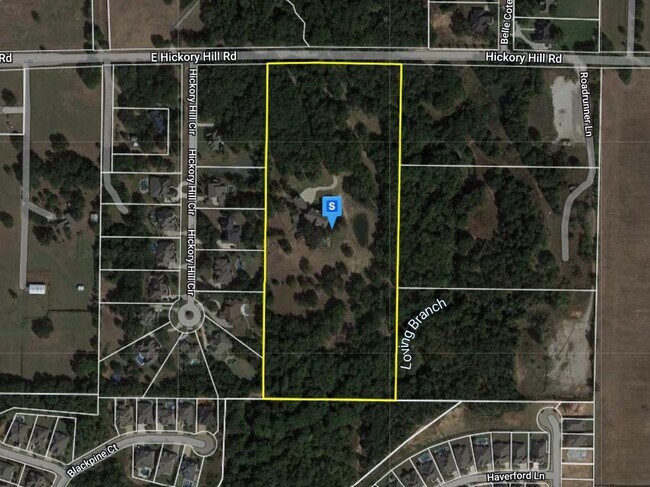
2378 E Hickory Hill Rd, Argyle, TX 76226


Property Detail
2378 E Hickory Hill Rd
Dallas-Fort Worth-Arlington, TX
Fagan Addition
R648055
FAGAN ADDITION BLK A LOT 1
Agriculturalland
Denton
AE
Texas
48121C0530G
1
2024
16 AC
2025
Lewisville
021755
Dallas/Ft Worth
7,911 SF
NEARBY LISTINGS FOR SALE OR LEASE
DEMOGRAPHICS near 2378 E Hickory Hill Rd
1 mile
3 mile
5 mile
2024 Total Population
4,348
41,750
130,153
2029 Population
5,241
49,937
156,337
Pop Growth 2024-2029
+ 20.54%
+ 19.61%
+ 20.12%
Average Age
38
39
40
2024 Total Households
1,381
13,571
44,647
HH Growth 2024-2029
+ 21.07%
+ 20.21%
+ 20.70%
Median Household Inc
$159,302
$135,556
$125,460
Avg Household Size
3.20
3.00
2.90
2024 Avg HH Vehicles
2.00
2.00
2.00
Median Home Value
$484,758
$414,177
$388,059
Median Year Built
2010
2004
2001
Nearby Places
Map Layers
Map Styles
 Street
 Aerial
Transit
 Traffic
 Biking
Places
Listings with unknown addresses are not visible on the map
- Restaurants
- Banks
- Shops
- Fitness
- Groceries
PUBLIC TRANSPORTATION
COMMUTER RAIL
Drive
Walk
Distance
15 min
6.7 mi
Drive
Walk
Distance
18 min
9.1 mi
AIRPORT
Dallas-Fort Worth International
Drive
Walk
Distance
Dallas-Fort Worth International
35 min
19.4 mi
Dallas Love Field
Drive
Walk
Distance
Dallas Love Field
48 min
33.3 mi
Nearby Properties
Address
Land Use
TOTAL SIZE
Lot Size
Zoning
Address
Land Use
TOTAL SIZE
Lot Size
Zoning
386,056 SF
81.56 AC
Address
Land Use
TOTAL SIZE
Lot Size
Zoning
208,582 SF
8.58 AC
Address
Land Use
TOTAL SIZE
Lot Size
Zoning
87,600 SF
12.12 AC
Address
Land Use
TOTAL SIZE
Lot Size
Zoning
202,197 SF
39.88 AC
Address
Land Use
TOTAL SIZE
Lot Size
Zoning
264,138 SF
38.41 AC
Address
Land Use
TOTAL SIZE
Lot Size
Zoning
157,100 SF
10.44 AC
Address
Land Use
TOTAL SIZE
Lot Size
Zoning
80,849 SF
4.05 AC
Address
Land Use
TOTAL SIZE
Lot Size
Zoning
123,322 SF
10.85 AC
Address
Land Use
TOTAL SIZE
Lot Size
Zoning
34,592 SF
49.57 AC
Address
Land Use
TOTAL SIZE
Lot Size
Zoning
76,074 SF
12.08 AC
Address
Land Use
TOTAL SIZE
Lot Size
Zoning
72,184 SF
11.39 AC
Address
Land Use
TOTAL SIZE
Lot Size
Zoning
84,377 SF
2.96 AC
Address
Land Use
TOTAL SIZE
Lot Size
Zoning
76,522 SF
7.32 AC
Address
Land Use
TOTAL SIZE
Lot Size
Zoning
26,465 SF
7.18 AC
Address
Land Use
TOTAL SIZE
Lot Size
Zoning
28,000 SF
3.06 AC
Address
Land Use
TOTAL SIZE
Lot Size
Zoning
61,126 SF
59.83 AC
Address
Land Use
TOTAL SIZE
Lot Size
Zoning
28,477 SF
3.68 AC
Address
Land Use
TOTAL SIZE
Lot Size
Zoning
17,601 SF
5 AC
Address
Land Use
TOTAL SIZE
Lot Size
Zoning
83,242 SF
10.49 AC
Address
Land Use
TOTAL SIZE
Lot Size
Zoning
7,655 SF
82.64 AC
Address
Land Use
TOTAL SIZE
Lot Size
Zoning
25,138 SF
25.51 AC
Address
Land Use
TOTAL SIZE
Lot Size
Zoning
32,656 SF
2.75 AC
Address
Land Use
TOTAL SIZE
Lot Size
Zoning
69,000 SF
5.23 AC
Address
Land Use
TOTAL SIZE
Lot Size
Zoning
78,180 SF
5 AC
Address
Land Use
TOTAL SIZE
Lot Size
Zoning
4,140 SF
11.50 AC
Address
Land Use
TOTAL SIZE
Lot Size
Zoning
25,830 SF
27 AC
Address
Land Use
TOTAL SIZE
Lot Size
Zoning
6,644 SF
4.91 AC
Address
Land Use
TOTAL SIZE
Lot Size
Zoning
43,150 SF
4.92 AC
Address
Land Use
TOTAL SIZE
Lot Size
Zoning
12,541 SF
10.90 AC
Address
Land Use
TOTAL SIZE
Lot Size
Zoning
18,873 SF
3.38 AC
The World's #1 Commercial Real Estate Marketplace
Connect with us
© 2026 CoStar Group
The information above has been obtained from sources believed reliable. While we do not doubt its accuracy we have not verified it and make no guarantee, warranty or representation about it. It is your responsibility to independently confirm its accuracy and completeness. Any projections, opinions, assumptions, or estimates used are for example only and do not represent the current or future performance of the property. The value of this transaction to you depends on tax and other factors which should be evaluated by your tax, financial, and legal advisors. You and your advisors should conduct a careful, independent investigation of the property to determine to your satisfaction the suitability of the property for your needs.