Property Record
238 Belvidere Rd, Perryville, MD 21903


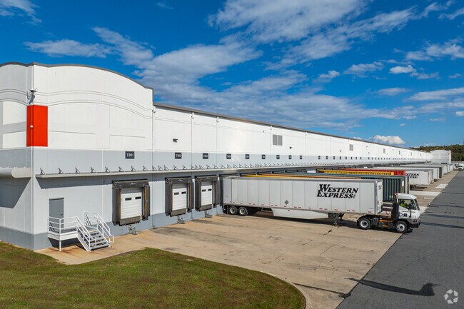
Property Detail
238 Belvidere Rd
05-124077
70.664 ACRES 238 BELVIDERE ROAD S OF BELVIDERE
Warehouse
Cecil
M2
Maryland
B and X Area of moderate flood hazard, usually the area between the limits of the 100-year and 500-year floods.
70.66 AC
2025
Cecil County
2025
Baltimore
030908
Philadelphia-Camden-Wilmington, PA-NJ-DE-MD
1,005,768 SF
NEARBY LISTINGS FOR SALE OR LEASE
DEMOGRAPHICS near 238 Belvidere Rd
1 mile
3 mile
5 mile
2025 Total Population
9
7,967
29,920
2030 Population
9
8,227
30,832
Pop Growth 2025-2030
0.00%
+ 3.26%
+ 3.05%
Average Age
33
40
41
2025 Total Households
3
3,143
11,722
HH Growth 2025-2030
+ 33.33%
+ 3.40%
+ 3.15%
Median Household Inc
$112,500
$102,421
$88,948
Avg Household Size
2.50
2.50
2.50
2025 Avg HH Vehicles
2.00
2.00
2.00
Median Home Value
$299,999
$322,744
$310,432
Median Year Built
2005
1995
1989
Nearby Places
Map Layers
Map Styles
 Street
 Aerial
Layers
 Traffic
 Biking
Places
Listings with unknown addresses are not visible on the map
- Restaurants
- Banks
- Shops
- Fitness
- Groceries
PUBLIC TRANSPORTATION
COMMUTER RAIL
Drive
Walk
Distance
9 min
4.4 mi
Freight Ports
Port Newark Container Terminal
Drive
Walk
Distance
Port Newark Container Terminal
19 min
9.6 mi
Nearby Properties
Address
Land Use
TOTAL SIZE
Lot Size
Zoning
Address
Land Use
TOTAL SIZE
Lot Size
Zoning
1,142,416 SF
95.61 AC
M2
Address
Land Use
TOTAL SIZE
Lot Size
Zoning
1,080,040 SF
127.58 AC
MEA
Address
Land Use
TOTAL SIZE
Lot Size
Zoning
521,850 SF
113.72 AC
MEA
Address
Land Use
TOTAL SIZE
Lot Size
Zoning
593,162 SF
84.15 AC
M2
Address
Land Use
TOTAL SIZE
Lot Size
Zoning
2,397 SF
72.03 AC
M2
Address
Land Use
TOTAL SIZE
Lot Size
Zoning
14,288 SF
67.19 AC
MEA
Address
Land Use
TOTAL SIZE
Lot Size
Zoning
592,800 SF
55.37 AC
M2
Address
Land Use
TOTAL SIZE
Lot Size
Zoning
89,346 SF
21.86 AC
RM
Address
Land Use
TOTAL SIZE
Lot Size
Zoning
502,200 SF
50.87 AC
M2
Address
Land Use
TOTAL SIZE
Lot Size
Zoning
360,458 SF
25.78 AC
M2
Address
Land Use
TOTAL SIZE
Lot Size
Zoning
200,100 SF
53.73 AC
Address
Land Use
TOTAL SIZE
Lot Size
Zoning
31,344 SF
5.70 AC
RM
Address
Land Use
TOTAL SIZE
Lot Size
Zoning
140,316 SF
36.71 AC
RM
Address
Land Use
TOTAL SIZE
Lot Size
Zoning
150,000 SF
7.61 AC
M2
Address
Land Use
TOTAL SIZE
Lot Size
Zoning
32,000 SF
193.70 AC
M1
Address
Land Use
TOTAL SIZE
Lot Size
Zoning
92,200 SF
14.32 AC
SPLIT
Address
Land Use
TOTAL SIZE
Lot Size
Zoning
44,138 SF
20.30 AC
Address
Land Use
TOTAL SIZE
Lot Size
Zoning
3.37 AC
OS
Address
Land Use
TOTAL SIZE
Lot Size
Zoning
9,440 SF
790.55 AC
MEA
Address
Land Use
TOTAL SIZE
Lot Size
Zoning
24,000 SF
2.24 AC
C2
Address
Land Use
TOTAL SIZE
Lot Size
Zoning
24,000 SF
2.16 AC
C2
Address
Land Use
TOTAL SIZE
Lot Size
Zoning
44,160 SF
5.04 AC
M2
Address
Land Use
TOTAL SIZE
Lot Size
Zoning
71,490 SF
16.62 AC
M2
Address
Land Use
TOTAL SIZE
Lot Size
Zoning
149.61 AC
M2
Address
Land Use
TOTAL SIZE
Lot Size
Zoning
11,840 SF
13.53 AC
M2
Address
Land Use
TOTAL SIZE
Lot Size
Zoning
7,488 SF
1.42 AC
C2
Address
Land Use
TOTAL SIZE
Lot Size
Zoning
1,239 AC
MEA
Address
Land Use
TOTAL SIZE
Lot Size
Zoning
92,200 SF
57.54 AC
M2
Address
Land Use
TOTAL SIZE
Lot Size
Zoning
1,232 SF
51.76 AC
SPLIT
The World's #1 Commercial Real Estate Marketplace
Connect with us
© 2026 CoStar Group
The information above has been obtained from sources believed reliable. While we do not doubt its accuracy we have not verified it and make no guarantee, warranty or representation about it. It is your responsibility to independently confirm its accuracy and completeness. Any projections, opinions, assumptions, or estimates used are for example only and do not represent the current or future performance of the property. The value of this transaction to you depends on tax and other factors which should be evaluated by your tax, financial, and legal advisors. You and your advisors should conduct a careful, independent investigation of the property to determine to your satisfaction the suitability of the property for your needs.