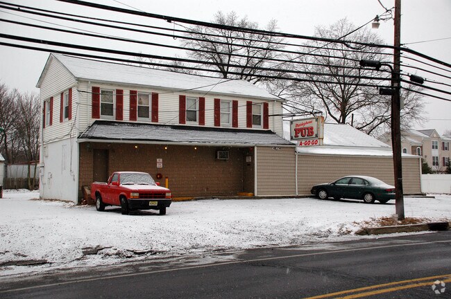
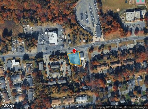
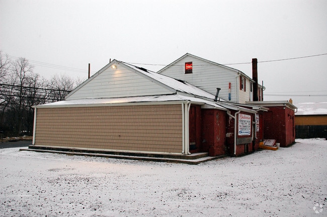
Property Record
238 Highway 34, Matawan, NJ 07747
NEARBY LISTINGS FOR SALE OR LEASE
Property Detail
238 Highway 34
15-10252-25-00038
.504AC
Bartavern
Middlesex
X
New Jersey
34023C0167F
38
2024
0.50 AC
2025
Brunswick
007805
Northern New Jersey
7,904 SF
Lakewood-New Brunswick, NJ
DEMOGRAPHICS near 238 Highway 34
1 Mile
3 Mile
5 Mile
2024 Total Population
1,839
44,297
137,365
2029 Population
1,865
44,177
136,711
Pop Growth 2024-2029
+ 1.41%
(0.27%)
(0.48%)
Average Age
42
44
43
2024 Total Households
696
15,930
48,192
HH Growth 2024-2029
+ 1.29%
(0.31%)
(0.54%)
Median Household Inc
$149,056
$114,521
$120,361
Avg Household Size
2.60
2.70
2.80
2024 Avg HH Vehicles
2.00
2.00
2.00
Median Home Value
$628,788
$472,890
$486,581
Median Year Built
2006
1981
1980
Nearby Places
Map Layers
Map Styles
 Street
 Aerial
- Restaurants
- Banks
- Shops
- Fitness
- Groceries
PUBLIC TRANSPORTATION
COMMUTER RAIL
Aberdeen Matawan (North Jersey Coast Line - NJ Transit Commuter Rail (NJ Transit))
DRIVE
WALK
Distance
Aberdeen Matawan (North Jersey Coast Line - NJ Transit Commuter Rail (NJ Transit))
6 min
3.9 mi
South Amboy (North Jersey Coast Line - NJ Transit Commuter Rail (NJ Transit))
DRIVE
WALK
Distance
South Amboy (North Jersey Coast Line - NJ Transit Commuter Rail (NJ Transit))
11 min
5.6 mi
AIRPORT
Newark Liberty International
DRIVE
WALK
Distance
Newark Liberty International
39 min
25.8 mi
Trenton Mercer
DRIVE
WALK
Distance
Trenton Mercer
63 min
38.1 mi
John F Kennedy International
DRIVE
WALK
Distance
John F Kennedy International
73 min
47.7 mi
Freight Ports
New York Container Terminal
DRIVE
WALK
Distance
New York Container Terminal
32 min
21.1 mi
Nearby Properties
Address
Land Use
TOTAL SIZE
Lot Size
Zoning
Address
Land Use
TOTAL SIZE
Lot Size
Zoning
0.28 AC
CBD
Address
Land Use
TOTAL SIZE
Lot Size
Zoning
Address
Land Use
TOTAL SIZE
Lot Size
Zoning
Address
Land Use
TOTAL SIZE
Lot Size
Zoning
3.98 AC
MUD
Address
Land Use
TOTAL SIZE
Lot Size
Zoning
10.58 AC
APTH
Address
Land Use
TOTAL SIZE
Lot Size
Zoning
7,902 SF
47.49 AC
TCD
Address
Land Use
TOTAL SIZE
Lot Size
Zoning
7,904 SF
60 AC
AF
Address
Land Use
TOTAL SIZE
Lot Size
Zoning
9.12 AC
APTH
Address
Land Use
TOTAL SIZE
Lot Size
Zoning
7,902 SF
62.41 AC
R20
Address
Land Use
TOTAL SIZE
Lot Size
Zoning
7,904 SF
39.92 AC
TCD
Address
Land Use
TOTAL SIZE
Lot Size
Zoning
8.99 AC
MF0
Address
Land Use
TOTAL SIZE
Lot Size
Zoning
31.22 AC
G1
Address
Land Use
TOTAL SIZE
Lot Size
Zoning
109,643 SF
1.87 AC
SB
Address
Land Use
TOTAL SIZE
Lot Size
Zoning
1.58 AC
Address
Land Use
TOTAL SIZE
Lot Size
Zoning
287,915 SF
31.10 AC
I
Address
Land Use
TOTAL SIZE
Lot Size
Zoning
6.80 AC
RM
Address
Land Use
TOTAL SIZE
Lot Size
Zoning
7,904 SF
38.30 AC
AF
Address
Land Use
TOTAL SIZE
Lot Size
Zoning
Address
Land Use
TOTAL SIZE
Lot Size
Zoning
7,905 SF
26.55 AC
CC
Address
Land Use
TOTAL SIZE
Lot Size
Zoning
Address
Land Use
TOTAL SIZE
Lot Size
Zoning
7,904 SF
30 AC
AF
Address
Land Use
TOTAL SIZE
Lot Size
Zoning
7,905 SF
22.82 AC
CC
Address
Land Use
TOTAL SIZE
Lot Size
Zoning
7,801 SF
39.88 AC
AF
Address
Land Use
TOTAL SIZE
Lot Size
Zoning
7,801 SF
30.77 AC
AF
Address
Land Use
TOTAL SIZE
Lot Size
Zoning
7,801 SF
33.28 AC
AF
Address
Land Use
TOTAL SIZE
Lot Size
Zoning
7,904 SF
14.66 AC
R15
Address
Land Use
TOTAL SIZE
Lot Size
Zoning
136,925 SF
6.66 AC
R100
Address
Land Use
TOTAL SIZE
Lot Size
Zoning
15.92 AC
R20
Address
Land Use
TOTAL SIZE
Lot Size
Zoning
6.40 AC
RM
Address
Land Use
TOTAL SIZE
Lot Size
Zoning
7,904 SF
69.62 AC
AF
The World's #1 Commercial Real Estate Marketplace
Connect with us
© 2026 CoStar Group
The information above has been obtained from sources believed reliable. While we do not doubt its accuracy we have not verified it and make no guarantee, warranty or representation about it. It is your responsibility to independently confirm its accuracy and completeness. Any projections, opinions, assumptions, or estimates used are for example only and do not represent the current or future performance of the property. The value of this transaction to you depends on tax and other factors which should be evaluated by your tax, financial, and legal advisors. You and your advisors should conduct a careful, independent investigation of the property to determine to your satisfaction the suitability of the property for your needs.