No Photo
Property Record
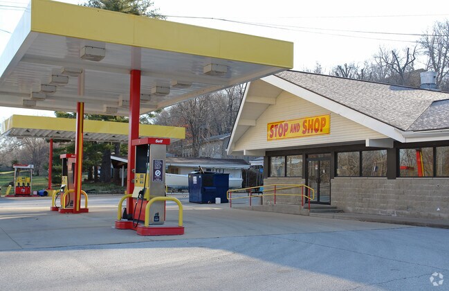
238 S State Ave, Hampton, IL 61256


NEARBY LISTINGS FOR SALE OR LEASE
-
-
View all Hampton listings for sale on LoopNet.com
Property Detail
238 S State Ave
Davenport-Moline-Rock Island, IA-IL
E F Arcularius Add Hampton
09-17-300-002
SUPVR ASST MAP LOT 311 SHEET 39
Commercialnec
Rock Island
X
Illinois
19163C0391H
311
2024
0.70 AC
2024
Outlying Rock Island Cnty
020400
Davenport/Moline/Rock Island
3,762 SF
DEMOGRAPHICS near 238 S State Ave
1 Mile
3 Mile
5 Mile
2024 Total Population
2,580
20,313
80,799
2029 Population
2,509
20,059
79,652
Pop Growth 2024-2029
(2.75%)
(1.25%)
(1.42%)
Average Age
43
41
41
2024 Total Households
678
7,509
32,814
HH Growth 2024-2029
(3.24%)
(1.36%)
(1.53%)
Median Household Inc
$69,973
$70,099
$73,169
Avg Household Size
2.40
2.50
2.40
2024 Avg HH Vehicles
2.00
2.00
2.00
Median Home Value
$185,462
$194,605
$194,315
Median Year Built
1971
1969
1973
Nearby Places
Map Layers
Map Styles
 Street
 Aerial
- Restaurants
- Banks
- Shops
- Fitness
- Groceries
PUBLIC TRANSPORTATION
AIRPORT
Quad Cities International
DRIVE
WALK
Distance
Quad Cities International
20 min
11.7 mi
Freight Ports
Port Milwaukee
DRIVE
WALK
Distance
Port Milwaukee
227 min
200.4 mi
SALE & LEASE HISTORY
LISTING DATE
SALE/LEASE

Sep 22, 2017
For Sale
Nearby Properties
Address
Land Use
TOTAL SIZE
Lot Size
Zoning
Address
Land Use
TOTAL SIZE
Lot Size
Zoning
9,000 SF
408.98 AC
Address
Land Use
TOTAL SIZE
Lot Size
Zoning
5,296 SF
67.13 AC
Address
Land Use
TOTAL SIZE
Lot Size
Zoning
64,661 SF
147.01 AC
Address
Land Use
TOTAL SIZE
Lot Size
Zoning
250,504 SF
25.67 AC
Address
Land Use
TOTAL SIZE
Lot Size
Zoning
3,384,969 SF
128 AC
EM
Address
Land Use
TOTAL SIZE
Lot Size
Zoning
80,933 SF
28.80 AC
Address
Land Use
TOTAL SIZE
Lot Size
Zoning
122,298 SF
65.13 AC
EM
Address
Land Use
TOTAL SIZE
Lot Size
Zoning
164,260 SF
13.81 AC
Address
Land Use
TOTAL SIZE
Lot Size
Zoning
197,382 SF
14.06 AC
EM
Address
Land Use
TOTAL SIZE
Lot Size
Zoning
75,000 SF
4.93 AC
Address
Land Use
TOTAL SIZE
Lot Size
Zoning
13,200 SF
15.82 AC
Address
Land Use
TOTAL SIZE
Lot Size
Zoning
112,000 SF
16.50 AC
EM
Address
Land Use
TOTAL SIZE
Lot Size
Zoning
3,360 SF
35.63 AC
Address
Land Use
TOTAL SIZE
Lot Size
Zoning
72,435 SF
31.43 AC
Address
Land Use
TOTAL SIZE
Lot Size
Zoning
138,436 SF
3.74 AC
Address
Land Use
TOTAL SIZE
Lot Size
Zoning
14,497 SF
151.81 AC
R1
Address
Land Use
TOTAL SIZE
Lot Size
Zoning
600 SF
25.17 AC
Address
Land Use
TOTAL SIZE
Lot Size
Zoning
80,000 SF
5.47 AC
Address
Land Use
TOTAL SIZE
Lot Size
Zoning
50,000 SF
2.04 AC
Address
Land Use
TOTAL SIZE
Lot Size
Zoning
253.10 AC
SIL
Address
Land Use
TOTAL SIZE
Lot Size
Zoning
60,400 SF
4.29 AC
Address
Land Use
TOTAL SIZE
Lot Size
Zoning
Address
Land Use
TOTAL SIZE
Lot Size
Zoning
6,820 SF
6.96 AC
Address
Land Use
TOTAL SIZE
Lot Size
Zoning
18.46 AC
EM
Address
Land Use
TOTAL SIZE
Lot Size
Zoning
103,360 SF
14.66 AC
EM
Address
Land Use
TOTAL SIZE
Lot Size
Zoning
73,981 SF
6.10 AC
Address
Land Use
TOTAL SIZE
Lot Size
Zoning
3,500 SF
11.07 AC
Address
Land Use
TOTAL SIZE
Lot Size
Zoning
8,000 SF
10.02 AC
Address
Land Use
TOTAL SIZE
Lot Size
Zoning
433,640 SF
32.30 AC
EM
The World's #1 Commercial Real Estate Marketplace
Connect with us
© 2026 CoStar Group
The information above has been obtained from sources believed reliable. While we do not doubt its accuracy we have not verified it and make no guarantee, warranty or representation about it. It is your responsibility to independently confirm its accuracy and completeness. Any projections, opinions, assumptions, or estimates used are for example only and do not represent the current or future performance of the property. The value of this transaction to you depends on tax and other factors which should be evaluated by your tax, financial, and legal advisors. You and your advisors should conduct a careful, independent investigation of the property to determine to your satisfaction the suitability of the property for your needs.