Property Record
23823 Ventura Blvd, Calabasas, CA 91302
NEARBY LISTINGS FOR SALE OR LEASE
Property Detail
23823 Ventura Blvd
Los Angeles-Long Beach-Glendale, CA
Undivided One-Nineteenth 1/19 Interest I
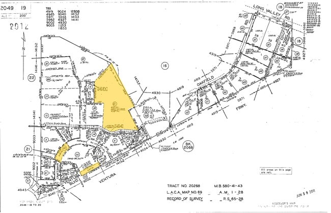
2049-019-061
*TR=RECORD OF SURVEY AS PER BK 65 PG 28 OF R S*LOT COM AT MOST S COR OF LAND DESC IN PAR 1, DOC NO 514, 6-11-52 TO HOWARD A KREBS ET AL TH S 27 51'06 E 42SEE ASSESSOR MAPBOOK FOR MISSING PORTIONTH N 62 08'54 E TO BEG POR OF LOT 45
Industrialgeneral
Los Angeles
D
California
06111C1020E
45
2024
6.69 AC
2025
Calabasas/Westlake Vill
800206
Los Angeles
31,306 SF
DEMOGRAPHICS near 23823 Ventura Blvd
1 Mile
3 Mile
5 Mile
2024 Total Population
6,658
82,630
196,757
2029 Population
6,450
80,480
191,895
Pop Growth 2024-2029
(3.12%)
(2.60%)
(2.47%)
Average Age
45
43
42
2024 Total Households
2,409
31,214
72,995
HH Growth 2024-2029
(3.40%)
(2.70%)
(2.51%)
Median Household Inc
$166,398
$122,558
$105,217
Avg Household Size
2.70
2.60
2.60
2024 Avg HH Vehicles
2.00
2.00
2.00
Median Home Value
$1,094,693
$993,333
$914,992
Median Year Built
1971
1970
1974
Nearby Places
- Restaurants
- Banks
- Shops
- Fitness
- Groceries
PUBLIC TRANSPORTATION
AIRPORT
Bob Hope
DRIVE
WALK
Distance
Bob Hope
31 min
21.3 mi
Los Angeles International
DRIVE
WALK
Distance
Los Angeles International
40 min
29.4 mi
Freight Ports
The Port of Hueneme
DRIVE
WALK
Distance
The Port of Hueneme
50 min
36.4 mi
Nearby Properties
Address
Land Use
TOTAL SIZE
Lot Size
Zoning
Address
Land Use
TOTAL SIZE
Lot Size
Zoning
365,572 SF
8.95 AC
LAR3
Address
Land Use
TOTAL SIZE
Lot Size
Zoning
583,153 SF
4.22 AC
LACR
Address
Land Use
TOTAL SIZE
Lot Size
Zoning
334,174 SF
3.84 AC
LAWC
Address
Land Use
TOTAL SIZE
Lot Size
Zoning
475,019 SF
1.31 AC
LAWC
Address
Land Use
TOTAL SIZE
Lot Size
Zoning
353,830 SF
12.77 AC
LAR4
Address
Land Use
TOTAL SIZE
Lot Size
Zoning
221,414 SF
6.42 AC
LAP
Address
Land Use
TOTAL SIZE
Lot Size
Zoning
329,741 SF
20.14 AC
LCC3DP*
Address
Land Use
TOTAL SIZE
Lot Size
Zoning
307,704 SF
7.74 AC
LAR4
Address
Land Use
TOTAL SIZE
Lot Size
Zoning
602,329 SF
13.08 AC
LAWC
Address
Land Use
TOTAL SIZE
Lot Size
Zoning
219,622 SF
1.91 AC
LAWC
Address
Land Use
TOTAL SIZE
Lot Size
Zoning
357,324 SF
5 AC
LAA1
Address
Land Use
TOTAL SIZE
Lot Size
Zoning
387,660 SF
11.99 AC
LAR3
Address
Land Use
TOTAL SIZE
Lot Size
Zoning
107,395 SF
4.98 AC
CPD
Address
Land Use
TOTAL SIZE
Lot Size
Zoning
162,406 SF
10.60 AC
LAC2
Address
Land Use
TOTAL SIZE
Lot Size
Zoning
98,122 SF
7.34 AC
LAC2
Address
Land Use
TOTAL SIZE
Lot Size
Zoning
427,375 SF
7.61 AC
LAWC
Address
Land Use
TOTAL SIZE
Lot Size
Zoning
165,362 SF
4.08 AC
LCCM
Address
Land Use
TOTAL SIZE
Lot Size
Zoning
208,633 SF
4.62 AC
LAC4
Address
Land Use
TOTAL SIZE
Lot Size
Zoning
106,614 SF
0.78 AC
LAR3
Address
Land Use
TOTAL SIZE
Lot Size
Zoning
106,712 SF
11.55 AC
CSCM
Address
Land Use
TOTAL SIZE
Lot Size
Zoning
490,166 SF
9.65 AC
LAWC
Address
Land Use
TOTAL SIZE
Lot Size
Zoning
234,704 SF
6.26 AC
LAWC
Address
Land Use
TOTAL SIZE
Lot Size
Zoning
280,491 SF
4.74 AC
CSCM
Address
Land Use
TOTAL SIZE
Lot Size
Zoning
173,245 SF
6.16 AC
LCC2*
Address
Land Use
TOTAL SIZE
Lot Size
Zoning
257,344 SF
4.09 AC
CSCM
Address
Land Use
TOTAL SIZE
Lot Size
Zoning
249,703 SF
12.68 AC
LAC2
Address
Land Use
TOTAL SIZE
Lot Size
Zoning
167,007 SF
2.85 AC
LAR4
Address
Land Use
TOTAL SIZE
Lot Size
Zoning
92,367 SF
4.16 AC
CSCR-SC*
Address
Land Use
TOTAL SIZE
Lot Size
Zoning
91,706 SF
1.25 AC
LCC3
The World's #1 Commercial Real Estate Marketplace
Connect with us
© 2025 CoStar Group
The information above has been obtained from sources believed reliable. While we do not doubt its accuracy we have not verified it and make no guarantee, warranty or representation about it. It is your responsibility to independently confirm its accuracy and completeness. Any projections, opinions, assumptions, or estimates used are for example only and do not represent the current or future performance of the property. The value of this transaction to you depends on tax and other factors which should be evaluated by your tax, financial, and legal advisors. You and your advisors should conduct a careful, independent investigation of the property to determine to your satisfaction the suitability of the property for your needs.