Property Record
2383 Highway 41, Charleston, SC 29492
NEARBY LISTINGS FOR SALE OR LEASE
-
-
View all Charleston listings for sale on LoopNet.com
Property Detail
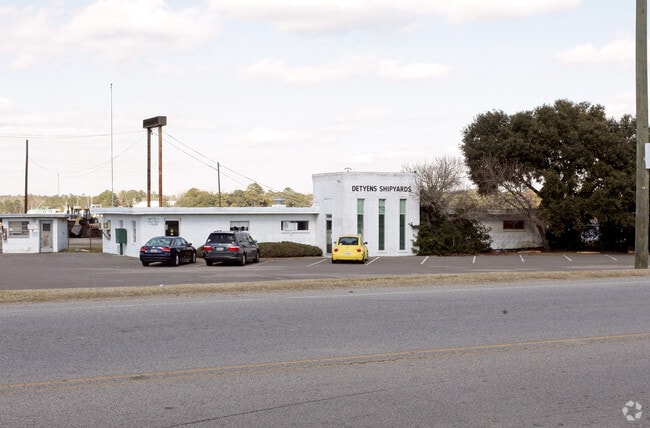
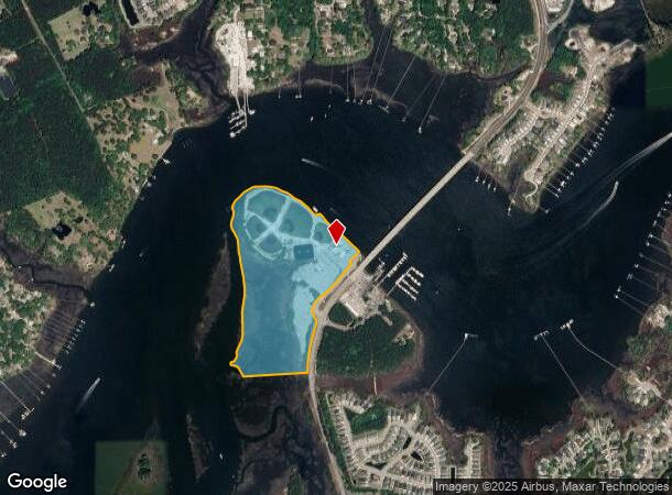
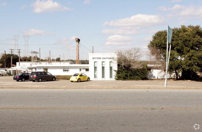
2383 Highway 41
269-00-00-034
East Cainhoy Commercial Values
Recreationcenter
ASSESSMENT DISTRICT: 918METAL BUILDING (14' HEIGHT)PARCEL I
AE
Berkeley
45019C0340K
South Carolina
2025
48.82 AC
2025
East Islands/Mt Pleasant
020406
Charleston/N Charleston
17,200 SF
Charleston-North Charleston, SC
DEMOGRAPHICS near 2383 Highway 41
1 Mile
3 Mile
5 Mile
2024 Total Population
2,478
21,452
41,751
2029 Population
2,803
23,621
45,711
Pop Growth 2024-2029
+ 13.12%
+ 10.11%
+ 9.48%
Average Age
40
41
41
2024 Total Households
905
7,800
15,405
HH Growth 2024-2029
+ 13.37%
+ 10.31%
+ 9.66%
Median Household Inc
$123,067
$113,516
$111,215
Avg Household Size
2.70
2.70
2.70
2024 Avg HH Vehicles
2.00
2.00
2.00
Median Home Value
$474,999
$492,255
$498,351
Median Year Built
2006
2006
2006
Nearby Places
Map Layers
Map Styles
 Street
 Aerial
- Restaurants
- Banks
- Shops
- Fitness
- Groceries
PUBLIC TRANSPORTATION
AIRPORT
Charleston AFB/International
DRIVE
WALK
Distance
Charleston AFB/International
35 min
20.7 mi
Freight Ports
Wando Welch Terminal
DRIVE
WALK
Distance
Wando Welch Terminal
20 min
10.4 mi
Nearby Properties
Address
Land Use
TOTAL SIZE
Lot Size
Zoning
Address
Land Use
TOTAL SIZE
Lot Size
Zoning
349,670 SF
21.61 AC
CHARLESTON
Address
Land Use
TOTAL SIZE
Lot Size
Zoning
79,408 SF
3.11 AC
CHARLESTON
Address
Land Use
TOTAL SIZE
Lot Size
Zoning
48,057 SF
8.50 AC
CHARLESTON
Address
Land Use
TOTAL SIZE
Lot Size
Zoning
3,929 SF
2.35 AC
CHARLESTON
Address
Land Use
TOTAL SIZE
Lot Size
Zoning
92,361 SF
5.87 AC
BERKELEY C
Address
Land Use
TOTAL SIZE
Lot Size
Zoning
6,000 SF
4.35 AC
CHARLESTON
Address
Land Use
TOTAL SIZE
Lot Size
Zoning
1,680 SF
6.97 AC
BERKELEY C
Address
Land Use
TOTAL SIZE
Lot Size
Zoning
160.87 AC
CHARLESTON
Address
Land Use
TOTAL SIZE
Lot Size
Zoning
4,250 SF
1.70 AC
CHARLESTON
Address
Land Use
TOTAL SIZE
Lot Size
Zoning
8,440 SF
2.68 AC
CHARLESTON
Address
Land Use
TOTAL SIZE
Lot Size
Zoning
3,834 SF
2.07 AC
CHARLESTON
Address
Land Use
TOTAL SIZE
Lot Size
Zoning
10,140 SF
3.32 AC
BERKELEY C
Address
Land Use
TOTAL SIZE
Lot Size
Zoning
6,205 SF
3.08 AC
BERKELEY C
Address
Land Use
TOTAL SIZE
Lot Size
Zoning
40,200 SF
5 AC
BERKELEY C
Address
Land Use
TOTAL SIZE
Lot Size
Zoning
31,720 SF
6.18 AC
BERKELEY C
Address
Land Use
TOTAL SIZE
Lot Size
Zoning
107.27 AC
CHARLESTON
Address
Land Use
TOTAL SIZE
Lot Size
Zoning
5,516 SF
CHARLESTON
Address
Land Use
TOTAL SIZE
Lot Size
Zoning
3.53 AC
CHARLESTON
Address
Land Use
TOTAL SIZE
Lot Size
Zoning
6,696 SF
2.06 AC
CHARLESTON
Address
Land Use
TOTAL SIZE
Lot Size
Zoning
2.87 AC
CHARLESTON
Address
Land Use
TOTAL SIZE
Lot Size
Zoning
2,128 SF
2.63 AC
BERKELEY C
Address
Land Use
TOTAL SIZE
Lot Size
Zoning
6,060 SF
1.57 AC
BERKELEY C
Address
Land Use
TOTAL SIZE
Lot Size
Zoning
6,622 SF
20.06 AC
Address
Land Use
TOTAL SIZE
Lot Size
Zoning
4,980 SF
CHARLESTON
Address
Land Use
TOTAL SIZE
Lot Size
Zoning
4,812 SF
1.45 AC
CHARLESTON
Address
Land Use
TOTAL SIZE
Lot Size
Zoning
4,424 SF
0.65 AC
CHARLESTON
Address
Land Use
TOTAL SIZE
Lot Size
Zoning
9,825 SF
1.21 AC
CHARLESTON
Address
Land Use
TOTAL SIZE
Lot Size
Zoning
43.17 AC
CHARLESTON
Address
Land Use
TOTAL SIZE
Lot Size
Zoning
5,026 SF
2.41 AC
BERKELEY C
The World's #1 Commercial Real Estate Marketplace
Connect with us
© 2026 CoStar Group
The information above has been obtained from sources believed reliable. While we do not doubt its accuracy we have not verified it and make no guarantee, warranty or representation about it. It is your responsibility to independently confirm its accuracy and completeness. Any projections, opinions, assumptions, or estimates used are for example only and do not represent the current or future performance of the property. The value of this transaction to you depends on tax and other factors which should be evaluated by your tax, financial, and legal advisors. You and your advisors should conduct a careful, independent investigation of the property to determine to your satisfaction the suitability of the property for your needs.