Property Record
2383 Stillwell Ave, Brooklyn, NY 11223
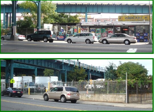

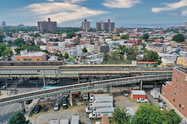
This Property Is For Sale
NEARBY LISTINGS FOR SALE OR LEASE
Property Detail
2383 Stillwell Ave
07160-0042
Kings
Storebuilding
New York
X
42
3604970353F
0.41 AC
2024
South Brooklyn
2025
Long Island (New York)
040000
New York-Jersey City-White Plains, NY-NJ
1,050 SF
DEMOGRAPHICS near 2383 Stillwell Ave
1 mile
3 mile
5 mile
2024 Total Population
90,637
594,663
1,239,730
2029 Population
83,913
553,429
1,154,105
Pop Growth 2024-2029
(7.42%)
(6.93%)
(6.91%)
Average Age
43
41
40
2024 Total Households
33,060
208,136
431,087
HH Growth 2024-2029
(7.83%)
(7.30%)
(7.18%)
Median Household Inc
$55,651
$59,182
$65,944
Avg Household Size
2.60
2.70
2.70
2024 Avg HH Vehicles
1.00
1.00
1.00
Median Home Value
$693,956
$800,197
$783,729
Median Year Built
1956
1948
1948
Nearby Places
Map Layers
Map Styles
 Street
 Aerial
Transit
 Traffic
 Biking
Places
Listings with unknown addresses are not visible on the map
- Restaurants
- Banks
- Shops
- Fitness
- Groceries
Nearby Properties
Address
Land Use
TOTAL SIZE
Lot Size
Zoning
Address
Land Use
TOTAL SIZE
Lot Size
Zoning
1,524,659 SF
170.96 AC
R4
Address
Land Use
TOTAL SIZE
Lot Size
Zoning
1,078,317 SF
10.45 AC
R4
Address
Land Use
TOTAL SIZE
Lot Size
Zoning
5,800 SF
20.10 AC
R6
Address
Land Use
TOTAL SIZE
Lot Size
Zoning
5,800 SF
20.10 AC
R6
Address
Land Use
TOTAL SIZE
Lot Size
Zoning
5,800 SF
20.10 AC
R6
Address
Land Use
TOTAL SIZE
Lot Size
Zoning
5,800 SF
20.10 AC
R6
Address
Land Use
TOTAL SIZE
Lot Size
Zoning
5,800 SF
20.10 AC
R6
Address
Land Use
TOTAL SIZE
Lot Size
Zoning
5,800 SF
20.10 AC
R6
Address
Land Use
TOTAL SIZE
Lot Size
Zoning
5,800 SF
20.10 AC
R6
Address
Land Use
TOTAL SIZE
Lot Size
Zoning
5,800 SF
20.10 AC
R6
Address
Land Use
TOTAL SIZE
Lot Size
Zoning
5,800 SF
20.10 AC
R6
Address
Land Use
TOTAL SIZE
Lot Size
Zoning
12.39 AC
R6
Address
Land Use
TOTAL SIZE
Lot Size
Zoning
965,600 SF
6.65 AC
R5
Address
Land Use
TOTAL SIZE
Lot Size
Zoning
54.78 AC
PARK
Address
Land Use
TOTAL SIZE
Lot Size
Zoning
353,600 SF
55.79 AC
R3-1
Address
Land Use
TOTAL SIZE
Lot Size
Zoning
1,800,000 SF
12.39 AC
R6
Address
Land Use
TOTAL SIZE
Lot Size
Zoning
1,736,700 SF
20.10 AC
R6
Address
Land Use
TOTAL SIZE
Lot Size
Zoning
753,367 SF
5.11 AC
R6
Address
Land Use
TOTAL SIZE
Lot Size
Zoning
623,806 SF
4.68 AC
R6
Address
Land Use
TOTAL SIZE
Lot Size
Zoning
623,806 SF
4.68 AC
R6
Address
Land Use
TOTAL SIZE
Lot Size
Zoning
623,806 SF
4.68 AC
R6
Address
Land Use
TOTAL SIZE
Lot Size
Zoning
623,806 SF
4.68 AC
R6
Address
Land Use
TOTAL SIZE
Lot Size
Zoning
623,806 SF
4.68 AC
R6
Address
Land Use
TOTAL SIZE
Lot Size
Zoning
623,806 SF
4.68 AC
R6
Address
Land Use
TOTAL SIZE
Lot Size
Zoning
623,806 SF
4.68 AC
R6
Address
Land Use
TOTAL SIZE
Lot Size
Zoning
623,806 SF
4.68 AC
R6
Address
Land Use
TOTAL SIZE
Lot Size
Zoning
623,806 SF
4.68 AC
R6
Address
Land Use
TOTAL SIZE
Lot Size
Zoning
623,806 SF
4.68 AC
R6
Address
Land Use
TOTAL SIZE
Lot Size
Zoning
623,806 SF
4.68 AC
R6
Address
Land Use
TOTAL SIZE
Lot Size
Zoning
623,806 SF
4.68 AC
R6
The World's #1 Commercial Real Estate Marketplace
Connect with us
© 2026 CoStar Group
The information above has been obtained from sources believed reliable. While we do not doubt its accuracy we have not verified it and make no guarantee, warranty or representation about it. It is your responsibility to independently confirm its accuracy and completeness. Any projections, opinions, assumptions, or estimates used are for example only and do not represent the current or future performance of the property. The value of this transaction to you depends on tax and other factors which should be evaluated by your tax, financial, and legal advisors. You and your advisors should conduct a careful, independent investigation of the property to determine to your satisfaction the suitability of the property for your needs.