Property Record
23844 Belmont Ridge Rd, Ashburn, VA 20148
NEARBY LISTINGS FOR SALE OR LEASE
Property Detail
23844 Belmont Ridge Rd
Washington-Arlington-Alexandria, DC-VA-MD-WV
Arcola
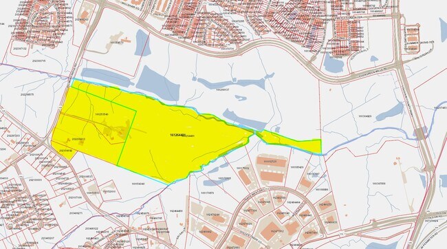
161-25-3540
BRAMBLETON LB 3 PCL A 202203090014299/300P (BG SOUTH LOT 1) 202112200123829 RELEASE, 201805010024235/6P BLA
Vacantlandnec
Loudoun
AE
Virginia
51107C0360E
1
2025
15.36 AC
2025
Route 28 Corridor North
6118012004
Washington, DC
1,696 SF
DEMOGRAPHICS near 23844 Belmont Ridge Rd
1 Mile
3 Mile
5 Mile
2024 Total Population
8,515
74,840
149,605
2029 Population
9,359
81,247
162,084
Pop Growth 2024-2029
+ 9.91%
+ 8.56%
+ 8.34%
Average Age
33
34
34
2024 Total Households
2,604
22,938
45,841
HH Growth 2024-2029
+ 10.02%
+ 8.67%
+ 8.52%
Median Household Inc
$213,137
$189,304
$182,847
Avg Household Size
3.20
3.20
3.20
2024 Avg HH Vehicles
2.00
2.00
2.00
Median Home Value
$774,221
$729,613
$731,665
Median Year Built
2011
2010
2010
Nearby Places
Map Layers
Map Styles
 Street
 Aerial
- Restaurants
- Banks
- Shops
- Fitness
- Groceries
PUBLIC TRANSPORTATION
AIRPORT
Washington Dulles International
DRIVE
WALK
Distance
Washington Dulles International
21 min
10.3 mi
Ronald Reagan Washington Ntl
DRIVE
WALK
Distance
Ronald Reagan Washington Ntl
52 min
33.9 mi
Freight Ports
Port of Baltimore
DRIVE
WALK
Distance
Port of Baltimore
94 min
68.1 mi
Nearby Properties
Address
Land Use
TOTAL SIZE
Lot Size
Zoning
Address
Land Use
TOTAL SIZE
Lot Size
Zoning
415,477 SF
97.76 AC
TR1UBF
Address
Land Use
TOTAL SIZE
Lot Size
Zoning
222,313 SF
36.21 AC
PDOP
Address
Land Use
TOTAL SIZE
Lot Size
Zoning
378,278 SF
112.87 AC
PDGI
Address
Land Use
TOTAL SIZE
Lot Size
Zoning
422,597 SF
85.43 AC
TR3UBF
Address
Land Use
TOTAL SIZE
Lot Size
Zoning
48.30 AC
PDIP
Address
Land Use
TOTAL SIZE
Lot Size
Zoning
59.20 AC
IP
Address
Land Use
TOTAL SIZE
Lot Size
Zoning
181,718 SF
10.23 AC
R16
Address
Land Use
TOTAL SIZE
Lot Size
Zoning
303,168 SF
41.95 AC
PDCCRC
Address
Land Use
TOTAL SIZE
Lot Size
Zoning
259,361 SF
65.01 AC
PDH4
Address
Land Use
TOTAL SIZE
Lot Size
Zoning
264,902 SF
60.25 AC
PDH4
Address
Land Use
TOTAL SIZE
Lot Size
Zoning
54 AC
PDTC
Address
Land Use
TOTAL SIZE
Lot Size
Zoning
39.89 AC
PDGI
Address
Land Use
TOTAL SIZE
Lot Size
Zoning
128,948 SF
11.16 AC
PDH4
Address
Land Use
TOTAL SIZE
Lot Size
Zoning
126,263 SF
9.09 AC
PDH4
Address
Land Use
TOTAL SIZE
Lot Size
Zoning
107,378 SF
16.86 AC
PDH4
Address
Land Use
TOTAL SIZE
Lot Size
Zoning
169,872 SF
33.51 AC
PDH4
Address
Land Use
TOTAL SIZE
Lot Size
Zoning
72.66 AC
PDAAAR
Address
Land Use
TOTAL SIZE
Lot Size
Zoning
108,231 SF
26.10 AC
PDH4
Address
Land Use
TOTAL SIZE
Lot Size
Zoning
108,037 SF
18.49 AC
PDCCSC
Address
Land Use
TOTAL SIZE
Lot Size
Zoning
241,429 SF
9.03 AC
PDH4
Address
Land Use
TOTAL SIZE
Lot Size
Zoning
157,520 SF
29.91 AC
PDH4
Address
Land Use
TOTAL SIZE
Lot Size
Zoning
83,185 SF
10.03 AC
PDH4
Address
Land Use
TOTAL SIZE
Lot Size
Zoning
20,578 SF
256.12 AC
TR3UBF
Address
Land Use
TOTAL SIZE
Lot Size
Zoning
236,800 SF
20.33 AC
PDGI
Address
Land Use
TOTAL SIZE
Lot Size
Zoning
167,044 SF
6.54 AC
R16
Address
Land Use
TOTAL SIZE
Lot Size
Zoning
98,876 SF
83.08 AC
PDGI
Address
Land Use
TOTAL SIZE
Lot Size
Zoning
96,490 SF
19.96 AC
PDH4
The World's #1 Commercial Real Estate Marketplace
Connect with us
© 2026 CoStar Group
The information above has been obtained from sources believed reliable. While we do not doubt its accuracy we have not verified it and make no guarantee, warranty or representation about it. It is your responsibility to independently confirm its accuracy and completeness. Any projections, opinions, assumptions, or estimates used are for example only and do not represent the current or future performance of the property. The value of this transaction to you depends on tax and other factors which should be evaluated by your tax, financial, and legal advisors. You and your advisors should conduct a careful, independent investigation of the property to determine to your satisfaction the suitability of the property for your needs.