Property Record
23845 Erins Run Dr, Sterling, VA 20166

NEARBY LISTINGS FOR SALE OR LEASE
Property Detail
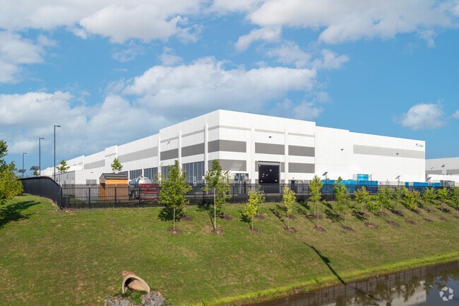
23845 Erins Run Dr
124-29-9328
Prologis Exchange
Notresolvable
PROLOGIS EXCHANGE PARCEL A 202502190007001 AGREE 201810160060240/1P
X
Loudoun
51107C0380E
Virginia
2025
37.53 AC
2025
Rt 28/Dulles North
611901
Washington, DC
327,400 SF
Washington-Arlington-Alexandria, DC-VA-MD-WV
DEMOGRAPHICS near 23845 Erins Run Dr
1 Mile
3 Mile
5 Mile
2024 Total Population
1,098
54,543
176,268
2029 Population
1,188
59,304
188,276
Pop Growth 2024-2029
+ 8.20%
+ 8.73%
+ 6.81%
Average Age
33
34
35
2024 Total Households
344
17,327
56,528
HH Growth 2024-2029
+ 8.43%
+ 8.84%
+ 6.80%
Median Household Inc
$193,749
$182,742
$164,918
Avg Household Size
3.20
3.10
3.10
2024 Avg HH Vehicles
2.00
2.00
2.00
Median Home Value
$652,777
$716,532
$705,803
Median Year Built
2011
2010
2007
Nearby Places
Map Layers
Map Styles
 Street
 Aerial
- Restaurants
- Banks
- Shops
- Fitness
- Groceries
PUBLIC TRANSPORTATION
AIRPORT
Washington Dulles International
DRIVE
WALK
Distance
Washington Dulles International
16 min
7.2 mi
Ronald Reagan Washington Ntl
DRIVE
WALK
Distance
Ronald Reagan Washington Ntl
49 min
33.0 mi
Freight Ports
Port of Baltimore
DRIVE
WALK
Distance
Port of Baltimore
89 min
65.0 mi
SALE & LEASE HISTORY
LISTING DATE
SALE/LEASE

Dec 30, 2016
For Lease
Nearby Properties
Address
Land Use
TOTAL SIZE
Lot Size
Zoning
Address
Land Use
TOTAL SIZE
Lot Size
Zoning
2,700,000 SF
7.51 AC
PDGI
Address
Land Use
TOTAL SIZE
Lot Size
Zoning
525,482 SF
39.73 AC
PDGI
Address
Land Use
TOTAL SIZE
Lot Size
Zoning
669,358 SF
39.88 AC
IP
Address
Land Use
TOTAL SIZE
Lot Size
Zoning
538,565 SF
135.31 AC
PDIP
Address
Land Use
TOTAL SIZE
Lot Size
Zoning
784,204 SF
128.54 AC
GI
Address
Land Use
TOTAL SIZE
Lot Size
Zoning
778,426 SF
48.02 AC
CLI
Address
Land Use
TOTAL SIZE
Lot Size
Zoning
695,321 SF
63.54 AC
PDGI
Address
Land Use
TOTAL SIZE
Lot Size
Zoning
274,000 SF
82.17 AC
PDGI
Address
Land Use
TOTAL SIZE
Lot Size
Zoning
767,464 SF
GI
Address
Land Use
TOTAL SIZE
Lot Size
Zoning
125.80 AC
TRC
Address
Land Use
TOTAL SIZE
Lot Size
Zoning
49.36 AC
IP
Address
Land Use
TOTAL SIZE
Lot Size
Zoning
549,027 SF
21.01 AC
R16
Address
Land Use
TOTAL SIZE
Lot Size
Zoning
326.06 AC
GI
Address
Land Use
TOTAL SIZE
Lot Size
Zoning
222,313 SF
36.21 AC
PDOP
Address
Land Use
TOTAL SIZE
Lot Size
Zoning
378,278 SF
112.87 AC
PDGI
Address
Land Use
TOTAL SIZE
Lot Size
Zoning
48.30 AC
PDIP
Address
Land Use
TOTAL SIZE
Lot Size
Zoning
59.20 AC
IP
Address
Land Use
TOTAL SIZE
Lot Size
Zoning
264,155 SF
10.95 AC
PDTRC
Address
Land Use
TOTAL SIZE
Lot Size
Zoning
230.43 AC
PDGI
Address
Land Use
TOTAL SIZE
Lot Size
Zoning
181,718 SF
10.23 AC
R16
Address
Land Use
TOTAL SIZE
Lot Size
Zoning
303,168 SF
41.95 AC
PDCCRC
Address
Land Use
TOTAL SIZE
Lot Size
Zoning
259,361 SF
65.01 AC
PDH4
Address
Land Use
TOTAL SIZE
Lot Size
Zoning
54 AC
PDTC
Address
Land Use
TOTAL SIZE
Lot Size
Zoning
238,594 SF
50.64 AC
PDGI
Address
Land Use
TOTAL SIZE
Lot Size
Zoning
141.53 AC
PDGI
Address
Land Use
TOTAL SIZE
Lot Size
Zoning
136.07 AC
PDGI
Address
Land Use
TOTAL SIZE
Lot Size
Zoning
1 SF
1.93 AC
GB
Address
Land Use
TOTAL SIZE
Lot Size
Zoning
39.89 AC
PDGI
The World's #1 Commercial Real Estate Marketplace
Connect with us
© 2025 CoStar Group
The information above has been obtained from sources believed reliable. While we do not doubt its accuracy we have not verified it and make no guarantee, warranty or representation about it. It is your responsibility to independently confirm its accuracy and completeness. Any projections, opinions, assumptions, or estimates used are for example only and do not represent the current or future performance of the property. The value of this transaction to you depends on tax and other factors which should be evaluated by your tax, financial, and legal advisors. You and your advisors should conduct a careful, independent investigation of the property to determine to your satisfaction the suitability of the property for your needs.