Property Record
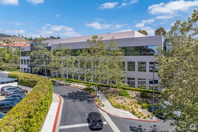
2385 Northside Dr, San Diego, CA 92108


Current Lease Availabilities
NEARBY LISTINGS FOR SALE OR LEASE
Property Detail
2385 Northside Dr
433-280-16
P20501
Storemultistory
PAR 1 TR PM20501
X
San Diego
06073C1617G
California
2024
0.79 AC
2025
Mission Valley
009307
San Diego
91,987 SF
San Diego-Chula Vista-Carlsbad, CA
DEMOGRAPHICS near 2385 Northside Dr
1 mile
3 mile
5 mile
2024 Total Population
15,510
214,917
500,492
2029 Population
15,446
215,014
499,101
Pop Growth 2024-2029
(0.41%)
+ 0.05%
(0.28%)
Average Age
37
37
38
2024 Total Households
7,289
93,733
208,232
HH Growth 2024-2029
(0.49%)
(0.01%)
(0.30%)
Median Household Inc
$95,670
$80,060
$82,629
Avg Household Size
2.10
2.20
2.30
2024 Avg HH Vehicles
2.00
2.00
2.00
Median Home Value
$672,692
$732,497
$751,029
Median Year Built
1989
1976
1973
Nearby Places
Map Layers
Map Styles
 Street
 Aerial
Transit
 Traffic
 Biking
Places
Listings with unknown addresses are not visible on the map
- Restaurants
- Banks
- Shops
- Fitness
- Groceries
PUBLIC TRANSPORTATION
COMMUTER RAIL
Old Town Transit Center (Coaster - San Diego North County Transit District (Coaster/Sprinter/Breeze))
Drive
Walk
Distance
Old Town Transit Center (Coaster - San Diego North County Transit District (Coaster/Sprinter/Breeze))
12 min
6.3 mi
San Diego (Santa Fe Depot) (Coaster - San Diego North County Transit District (Coaster/Sprinter/Breeze))
Drive
Walk
Distance
San Diego (Santa Fe Depot) (Coaster - San Diego North County Transit District (Coaster/Sprinter/Breeze))
13 min
7.7 mi
AIRPORT
San Diego International
Drive
Walk
Distance
San Diego International
14 min
6.8 mi
Freight Ports
Port of San Diego
Drive
Walk
Distance
Port of San Diego
17 min
8.9 mi
Nearby Properties
Address
Land Use
TOTAL SIZE
Lot Size
Zoning
Address
Land Use
TOTAL SIZE
Lot Size
Zoning
30,000 SF
62.51 AC
MVPD-MV-CR
Address
Land Use
TOTAL SIZE
Lot Size
Zoning
4,774 SF
74.75 AC
RM-2-5
Address
Land Use
TOTAL SIZE
Lot Size
Zoning
189,644 SF
20.49 AC
CO-1-2
Address
Land Use
TOTAL SIZE
Lot Size
Zoning
17.88 AC
CO-1-2
Address
Land Use
TOTAL SIZE
Lot Size
Zoning
46.03 AC
IH-2-1
Address
Land Use
TOTAL SIZE
Lot Size
Zoning
2.53 AC
EMX-1
Address
Land Use
TOTAL SIZE
Lot Size
Zoning
4.41 AC
CC-3-8
Address
Land Use
TOTAL SIZE
Lot Size
Zoning
1.51 AC
CC-3-9
Address
Land Use
TOTAL SIZE
Lot Size
Zoning
9.90 AC
RM-3-7
Address
Land Use
TOTAL SIZE
Lot Size
Zoning
18.70 AC
RS-1-7
Address
Land Use
TOTAL SIZE
Lot Size
Zoning
19.25 AC
CC-3-5
Address
Land Use
TOTAL SIZE
Lot Size
Zoning
18.10 AC
RM-2-5
Address
Land Use
TOTAL SIZE
Lot Size
Zoning
5.02 AC
CC-3-8
Address
Land Use
TOTAL SIZE
Lot Size
Zoning
7.48 AC
RM-3-9
Address
Land Use
TOTAL SIZE
Lot Size
Zoning
54,240 SF
8.18 AC
MVPD-MVR-2
Address
Land Use
TOTAL SIZE
Lot Size
Zoning
2.50 AC
MVPD-MV-CO
Address
Land Use
TOTAL SIZE
Lot Size
Zoning
13.45 AC
IL-2-1
Address
Land Use
TOTAL SIZE
Lot Size
Zoning
5.35 AC
MVPD-MV-CR
Address
Land Use
TOTAL SIZE
Lot Size
Zoning
3.97 AC
C
Address
Land Use
TOTAL SIZE
Lot Size
Zoning
7.69 AC
MVPD-MV-M/
Address
Land Use
TOTAL SIZE
Lot Size
Zoning
13.04 AC
RM-2-5
Address
Land Use
TOTAL SIZE
Lot Size
Zoning
7.19 AC
MVPD-MV-M/
Address
Land Use
TOTAL SIZE
Lot Size
Zoning
902,919 SF
45.23 AC
MVPD-MV-CR
Address
Land Use
TOTAL SIZE
Lot Size
Zoning
5.39 AC
CO-1-2
Address
Land Use
TOTAL SIZE
Lot Size
Zoning
2.90 AC
MVPD-MV-CR
Address
Land Use
TOTAL SIZE
Lot Size
Zoning
1.99 AC
EMX-1
Address
Land Use
TOTAL SIZE
Lot Size
Zoning
11.78 AC
CC-1-3
Address
Land Use
TOTAL SIZE
Lot Size
Zoning
5.87 AC
IL-2-1
Address
Land Use
TOTAL SIZE
Lot Size
Zoning
1.81 AC
EMX-1
Address
Land Use
TOTAL SIZE
Lot Size
Zoning
6.68 AC
RM-3-7
The World's #1 Commercial Real Estate Marketplace
Connect with us
© 2026 CoStar Group
The information above has been obtained from sources believed reliable. While we do not doubt its accuracy we have not verified it and make no guarantee, warranty or representation about it. It is your responsibility to independently confirm its accuracy and completeness. Any projections, opinions, assumptions, or estimates used are for example only and do not represent the current or future performance of the property. The value of this transaction to you depends on tax and other factors which should be evaluated by your tax, financial, and legal advisors. You and your advisors should conduct a careful, independent investigation of the property to determine to your satisfaction the suitability of the property for your needs.