Property Record
2386 S Bonnyview Rd, Redding, CA 96001
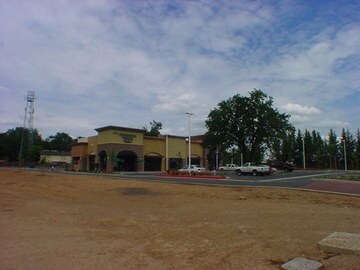

Property Detail
2386 S Bonnyview Rd
048-320-067-000
PORTION PCLS A&B
Storebuilding
SHASTA
B and X Area of moderate flood hazard, usually the area between the limits of the 100-year and 500-year floods.
California
2024
1.01 AC
2025
Other Market Areas
010601
Redding, CA
9,100 SF
NEARBY LISTINGS FOR SALE OR LEASE
DEMOGRAPHICS near 2386 S Bonnyview Rd
1 mile
3 mile
5 mile
2025 Total Population
4,709
32,506
85,622
2030 Population
4,749
32,680
85,927
Pop Growth 2025-2030
+ 0.85%
+ 0.54%
+ 0.36%
Average Age
41
41
41
2025 Total Households
1,811
12,521
33,954
HH Growth 2025-2030
+ 0.83%
+ 0.55%
+ 0.36%
Median Household Inc
$79,101
$79,738
$77,384
Avg Household Size
2.50
2.50
2.40
2025 Avg HH Vehicles
2.00
2.00
2.00
Median Home Value
$350,354
$360,213
$375,941
Median Year Built
1972
1978
1980
Nearby Places
Map Layers
Map Styles
 Street
 Aerial
Layers
 Traffic
 Biking
Places
Listings with unknown addresses are not visible on the map
- Restaurants
- Banks
- Shops
- Fitness
- Groceries
PUBLIC TRANSPORTATION
COMMUTER RAIL
Redding Amtrak (Coast Starlight - Amtrak)
Drive
Walk
Distance
Redding Amtrak (Coast Starlight - Amtrak)
8 min
4.3 mi
AIRPORT
Redding Regional
Drive
Walk
Distance
Redding Regional
11 min
6.7 mi
Freight Ports
Port of Richmond
Drive
Walk
Distance
Port of Richmond
228 min
201.5 mi
SALE & LEASE HISTORY
LISTING DATE
SALE/LEASE

Sep 25, 2016
For Lease
Nearby Properties
Address
Land Use
TOTAL SIZE
Lot Size
Zoning
Address
Land Use
TOTAL SIZE
Lot Size
Zoning
15.20 AC
Address
Land Use
TOTAL SIZE
Lot Size
Zoning
151,773 SF
17.64 AC
Address
Land Use
TOTAL SIZE
Lot Size
Zoning
47,062 SF
4.80 AC
Address
Land Use
TOTAL SIZE
Lot Size
Zoning
81,800 SF
14.81 AC
Address
Land Use
TOTAL SIZE
Lot Size
Zoning
50,251 SF
4.06 AC
Address
Land Use
TOTAL SIZE
Lot Size
Zoning
61,754 SF
1.73 AC
Address
Land Use
TOTAL SIZE
Lot Size
Zoning
92,699 SF
5.91 AC
Address
Land Use
TOTAL SIZE
Lot Size
Zoning
344.24 AC
U
Address
Land Use
TOTAL SIZE
Lot Size
Zoning
11.90 AC
Address
Land Use
TOTAL SIZE
Lot Size
Zoning
16,320 SF
3.76 AC
Address
Land Use
TOTAL SIZE
Lot Size
Zoning
11.80 AC
Address
Land Use
TOTAL SIZE
Lot Size
Zoning
90,832 SF
12.44 AC
C-2
Address
Land Use
TOTAL SIZE
Lot Size
Zoning
65,920 SF
11.34 AC
Address
Land Use
TOTAL SIZE
Lot Size
Zoning
3,178 SF
3.58 AC
Address
Land Use
TOTAL SIZE
Lot Size
Zoning
46,114 SF
2.93 AC
Address
Land Use
TOTAL SIZE
Lot Size
Zoning
2,400 SF
13 AC
Address
Land Use
TOTAL SIZE
Lot Size
Zoning
7.29 AC
Address
Land Use
TOTAL SIZE
Lot Size
Zoning
3.43 AC
Address
Land Use
TOTAL SIZE
Lot Size
Zoning
3.50 AC
M-L
Address
Land Use
TOTAL SIZE
Lot Size
Zoning
4.61 AC
Address
Land Use
TOTAL SIZE
Lot Size
Zoning
31,328 SF
4.50 AC
Address
Land Use
TOTAL SIZE
Lot Size
Zoning
5,005 SF
4.64 AC
Address
Land Use
TOTAL SIZE
Lot Size
Zoning
18,382 SF
5.46 AC
Address
Land Use
TOTAL SIZE
Lot Size
Zoning
3.20 AC
Address
Land Use
TOTAL SIZE
Lot Size
Zoning
2,903 SF
1.54 AC
Address
Land Use
TOTAL SIZE
Lot Size
Zoning
8.31 AC
Address
Land Use
TOTAL SIZE
Lot Size
Zoning
1,175 SF
3.91 AC
Address
Land Use
TOTAL SIZE
Lot Size
Zoning
12,467 SF
2.97 AC
Address
Land Use
TOTAL SIZE
Lot Size
Zoning
12,193 SF
0.28 AC
Address
Land Use
TOTAL SIZE
Lot Size
Zoning
7.56 AC
The World's #1 Commercial Real Estate Marketplace
Connect with us
© 2026 CoStar Group
The information above has been obtained from sources believed reliable. While we do not doubt its accuracy we have not verified it and make no guarantee, warranty or representation about it. It is your responsibility to independently confirm its accuracy and completeness. Any projections, opinions, assumptions, or estimates used are for example only and do not represent the current or future performance of the property. The value of this transaction to you depends on tax and other factors which should be evaluated by your tax, financial, and legal advisors. You and your advisors should conduct a careful, independent investigation of the property to determine to your satisfaction the suitability of the property for your needs.