Property Record
2386 W Spring Dr, Ozark, MO 65721

Property Detail
2386 W Spring Dr
Springfield, MO
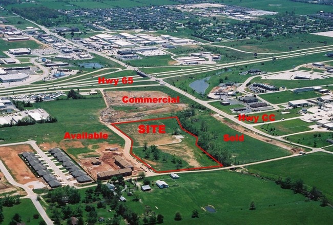
LOT 42A DEERBROOK PH 1 REPLAT OF LOTS 42 & 43
11-0.2-04-001-003-001.000
CHRISTIAN
Commercialnec
Missouri
AE The base floodplain where base flood elevations are provided. AE Zones are now used on new format FIRMs instead of A1-A30 Zones.
42,43
2024
12 AC
2025
East Christian County
020307
Springfield
1,632 SF
NEARBY LISTINGS FOR SALE OR LEASE
DEMOGRAPHICS near 2386 W Spring Dr
1 mile
3 mile
5 mile
2025 Total Population
3,461
26,246
74,246
2030 Population
3,696
27,910
78,055
Pop Growth 2025-2030
+ 6.79%
+ 6.34%
+ 5.13%
Average Age
40
40
40
2025 Total Households
1,408
9,991
29,087
HH Growth 2025-2030
+ 6.82%
+ 6.36%
+ 5.04%
Median Household Inc
$65,692
$90,938
$83,275
Avg Household Size
2.40
2.60
2.50
2025 Avg HH Vehicles
2.00
2.00
2.00
Median Home Value
$394,973
$370,554
$321,922
Median Year Built
2002
2003
1996
Nearby Places
Map Layers
Map Styles
 Street
 Aerial
Transit
 Traffic
 Biking
Places
Listings with unknown addresses are not visible on the map
- Restaurants
- Banks
- Shops
- Fitness
- Groceries
PUBLIC TRANSPORTATION
AIRPORT
Springfield-Branson Ntl
Drive
Walk
Distance
Springfield-Branson Ntl
38 min
26.2 mi
Freight Ports
Tulsa Port of Inola
Drive
Walk
Distance
Tulsa Port of Inola
203 min
180.7 mi
SALE & LEASE HISTORY
LISTING DATE
SALE/LEASE

Sep 24, 2016
For Sale
Jul 17, 2017
For Sale
Nearby Properties
Address
Land Use
TOTAL SIZE
Lot Size
Zoning
Address
Land Use
TOTAL SIZE
Lot Size
Zoning
2,400 SF
41.33 AC
Address
Land Use
TOTAL SIZE
Lot Size
Zoning
8.08 AC
INC
Address
Land Use
TOTAL SIZE
Lot Size
Zoning
13,048 SF
9.29 AC
Address
Land Use
TOTAL SIZE
Lot Size
Zoning
6,000 SF
50.60 AC
Address
Land Use
TOTAL SIZE
Lot Size
Zoning
129,257 SF
32 AC
Address
Land Use
TOTAL SIZE
Lot Size
Zoning
13.11 AC
INC
Address
Land Use
TOTAL SIZE
Lot Size
Zoning
1,836 SF
35.65 AC
Address
Land Use
TOTAL SIZE
Lot Size
Zoning
3,942 SF
40 AC
Address
Land Use
TOTAL SIZE
Lot Size
Zoning
9,474 SF
8.90 AC
Address
Land Use
TOTAL SIZE
Lot Size
Zoning
68,882 SF
39.87 AC
Address
Land Use
TOTAL SIZE
Lot Size
Zoning
3,025 SF
2.20 AC
Address
Land Use
TOTAL SIZE
Lot Size
Zoning
968 SF
18.67 AC
Address
Land Use
TOTAL SIZE
Lot Size
Zoning
54.39 AC
INC
Address
Land Use
TOTAL SIZE
Lot Size
Zoning
11,421 SF
163.10 AC
Address
Land Use
TOTAL SIZE
Lot Size
Zoning
167.92 AC
PAD
Address
Land Use
TOTAL SIZE
Lot Size
Zoning
9,841 SF
7.17 AC
Address
Land Use
TOTAL SIZE
Lot Size
Zoning
3,910 SF
6.33 AC
Address
Land Use
TOTAL SIZE
Lot Size
Zoning
92,462 SF
19.78 AC
Address
Land Use
TOTAL SIZE
Lot Size
Zoning
7,472 SF
4.51 AC
Address
Land Use
TOTAL SIZE
Lot Size
Zoning
5,184 SF
5.30 AC
Address
Land Use
TOTAL SIZE
Lot Size
Zoning
8,933 SF
8.64 AC
Address
Land Use
TOTAL SIZE
Lot Size
Zoning
16.23 AC
INC
Address
Land Use
TOTAL SIZE
Lot Size
Zoning
5,824 SF
6.68 AC
Address
Land Use
TOTAL SIZE
Lot Size
Zoning
3,003 SF
6.46 AC
Address
Land Use
TOTAL SIZE
Lot Size
Zoning
20,765 SF
3 AC
Address
Land Use
TOTAL SIZE
Lot Size
Zoning
9,285 SF
5.49 AC
Address
Land Use
TOTAL SIZE
Lot Size
Zoning
4,545 SF
4.16 AC
Address
Land Use
TOTAL SIZE
Lot Size
Zoning
20,708 SF
31.97 AC
INC
Address
Land Use
TOTAL SIZE
Lot Size
Zoning
25,749 SF
39.26 AC
The World's #1 Commercial Real Estate Marketplace
Connect with us
© 2026 CoStar Group
The information above has been obtained from sources believed reliable. While we do not doubt its accuracy we have not verified it and make no guarantee, warranty or representation about it. It is your responsibility to independently confirm its accuracy and completeness. Any projections, opinions, assumptions, or estimates used are for example only and do not represent the current or future performance of the property. The value of this transaction to you depends on tax and other factors which should be evaluated by your tax, financial, and legal advisors. You and your advisors should conduct a careful, independent investigation of the property to determine to your satisfaction the suitability of the property for your needs.